National Register of Historic Places listings in San Patricio County, Texas
This is a list of the National Register of Historic Places listings in San Patricio County, Texas.
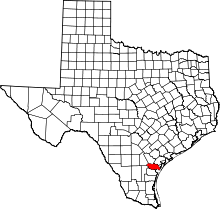
This is intended to be a complete list of properties listed on the National Register of Historic Places in San Patricio County, Texas. There is one property listed on the National Register in the county. This property is also a Recorded Texas Historic Landmark.
This National Park Service list is complete through NPS recent listings posted September 13, 2024.[1]
Current listings
Map all coordinates using OpenStreetMap
Download coordinates as:
- KML
- GPX (all coordinates)
- GPX (primary coordinates)
- GPX (secondary coordinates)
The locations of National Register properties may be seen in a mapping service provided.[2]
| [3] | Name on the Register | Image | Date listed[4] | Location | City or town | Description |
|---|---|---|---|---|---|---|
| 1 | James McGloin Homestead | Upload image | July 14, 1971 (#71000961) | 1 mi (1.6 km). NW of San Patricio on FM 666 27°58′12″N 97°47′34″W / 27.96991°N 97.79276°W / 27.96991; -97.79276 (James McGloin Homestead) | San Patricio | Boundary increase November 15, 1979; Recorded Texas Historic Landmark |
| 2 | San Patricio de Hibernia Monument |  | April 19, 2018 (#100002352) | Main St,, Constitution Sq. 27°57′06″N 97°46′23″W / 27.951793°N 97.772936°W / 27.951793; -97.772936 (San Patricio de Hibernia Monument) | San Patricio | |
| 3 | Sons of San Patricio Monument | 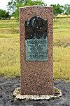 | April 19, 2018 (#100002353) | Cty. Rd. 1441 (21), Old San Patricio Cemetery 27°57′34″N 97°45′43″W / 27.959512°N 97.762055°W / 27.959512; -97.762055 (Sons of San Patricio Monument) | San Patricio | |
| 4 | Taft Public Housing Development (North) |  | August 29, 2018 (#100002848) | 407 through 426 Industrial St. 27°58′57″N 97°23′47″W / 27.982463°N 97.396350°W / 27.982463; -97.396350 (Taft Public Housing Development (North)) | Taft | |
| 5 | Taft Public Housing Development (South) |  | August 29, 2018 (#100002849) | Roughly bounded by Ave. C, Walnut, 2nd & Ash Sts. 27°58′32″N 97°23′57″W / 27.975692°N 97.399303°W / 27.975692; -97.399303 (Taft Public Housing Development (South)) | Taft |
See also
 National Register of Historic Places portal
 Texas portal


- National Register of Historic Places listings in Texas
- Recorded Texas Historic Landmarks in San Patricio County
References
- ^ National Park Service, United States Department of the Interior, "National Register of Historic Places: Weekly List Actions", retrieved September 13, 2024.
- ^ The latitude and longitude information provided in this table was derived originally from the National Register Information System, which has been found to be fairly accurate for about 99% of listings. Some locations in this table may have been corrected to current GPS standards.
- ^ Numbers represent an alphabetical ordering by significant words. Various colorings, defined here, differentiate National Historic Landmarks and historic districts from other NRHP buildings, structures, sites or objects.
- ^ The eight-digit number below each date is the number assigned to each location in the National Register Information System database, which can be viewed by clicking the number.
External links
![]() Media related to National Register of Historic Places in San Patricio County, Texas at Wikimedia Commons
Media related to National Register of Historic Places in San Patricio County, Texas at Wikimedia Commons
- v
- t
- e
Places adjacent to National Register of Historic Places listings in San Patricio County, Texas
| Live Oak County | Bee County and Refugio County | Aransas County |
 | ||
 San Patricio County, Texas San Patricio County, Texas | Gulf of Mexico | |
 | ||
| Jim Wells County | Nueces County |

Municipalities and communities of San Patricio County, Texas, United States | ||
|---|---|---|
County seat: Sinton | ||
| Cities | 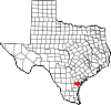 | |
| Towns | ||
| CDPs | ||
| Unincorporated community | ||
| Footnotes | ‡This populated place also has portions in an adjacent county or counties | |
| ||


