Daly Basin
Bioregion in the Northern Territory, Australia
| Daly Basin Northern Territory | |||||||||||||||
|---|---|---|---|---|---|---|---|---|---|---|---|---|---|---|---|
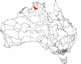 The interim Australian bioregions, with the Daly Basin in red | |||||||||||||||
| Area | 20,922 km2 (8,078.0 sq mi) | ||||||||||||||
| |||||||||||||||
The Daly Basin, an interim Australian bioregion, is located in the Northern Territory,[1][2] comprising an area of 2,092,229 hectares (5,170,010 acres)[3] of central Arnhem Land in the Top End of the Northern Territory.[4]
The bioregion includes gently undulating plains with scattered low plateau remnants and some rocky hills and gorges along its western edge. The dominant vegetation is Darwin woolybutt (Eucalyptus miniata) and stringybark open forests. Land uses include extensive grazing, intensive horticulture, and tourism. There are also areas of Aboriginal land. The major population centre is Katherine.[4]
See also
 Environment portal

- Geography of Australia
References
- ^ Environment Australia. "Revision of the Interim Biogeographic Regionalisation for Australia (IBRA) and Development of Version 5.1 - Summary Report". Department of the Environment and Water Resources, Australian Government. Archived from the original on 5 September 2006. Retrieved 31 January 2007.
{{cite journal}}: Cite journal requires|journal=(help) - ^ IBRA Version 6.1 Archived September 8, 2006, at the Wayback Machine data
- ^ "Interim Biogeographic Regionalisation for Australia (IBRA7) regions and codes". Department of Sustainability, Environment, Water, Population and Communities. Commonwealth of Australia. 2012. Retrieved 13 January 2013.
- ^ a b "Daly Basin bioregion" (PDF). Department of the Environment. Australian Government. Retrieved 1 June 2015.
- v
- t
- e
- Arnhem Coast
- Arnhem Plateau
- Australian Alps
- Avon Wheatbelt
- Ben Lomond
- Brigalow Belt North
- Brigalow Belt South
- Broken Hill Complex
- Burt Plain
- Cape York Peninsula
- Carnarvon
- Central Arnhem
- Central Kimberley
- Central Mackay Coast
- Central Ranges
- Channel Country
- Cobar Peneplain
- Coolgardie
- Coral Sea
- Cumberland Plain
- Daly Basin
- Dampierland
- Darling Riverine Plains
- Darwin Coastal
- Davenport Murchison Ranges
- Desert Uplands
- Einasleigh Uplands
- Esperance Plains
- Eyre Yorke Block
- Finke
- Flinders Lofty Block
- Furneaux
- Gascoyne
- Gawler
- Geraldton Sandplains
- Gibson Desert
- Great Sandy Desert
- Great Victoria Desert
- Gulf Coastal
- Gulf Fall and Uplands
- Gulf Plains
- Hampton
- Indian Tropical Islands
- Jarrah Forest
- Kanmantoo
- King
- Little Sandy Desert
- MacDonnell Ranges
- Mallee
- Mitchell Grass Downs
- Mount Isa Inlier
- Mulga Lands
- Murchison
- Murray Darling Depression
- Nandewar
- Naracoorte Coastal Plain
- New England Tablelands
- Northern Kimberley
- New South Wales North Coast
- New South Wales South Western Slopes
- Nullarbor Plain
- Ord Victoria Plain
- Pacific Subtropical Islands
- Pine Creek
- Pilbara
- Riverina
- Simpson Strzelecki Dunefields
- South East Coastal Plain
- South East Corner
- South Eastern Highlands
- South Eastern Queensland
- Southern Volcanic Plain
- Stony Plains
- Sturt Plateau
- Subantarctic Islands
- Swan Coastal Plain
- Sydney Basin
- Tanami
- Tasmanian Central Highlands
- Tasmanian Northern Midlands
- Tasmanian Northern Slopes
- Tasmanian South East
- Tasmanian Southern Ranges
- Tasmanian West
- Tiwi Cobourg
- Victoria Bonaparte
- Victorian Midlands
- Warren
- Wet Tropics
- Yalgoo
 | This Northern Territory geography article is a stub. You can help Wikipedia by expanding it. |
- v
- t
- e


