King Philip's Hill
United States historic place
King Philip's Hill | |
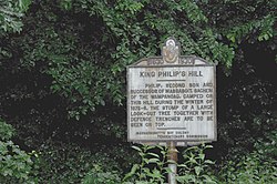 Historic marker describing the hill | |
42°41′2″N 72°28′35″W / 42.68389°N 72.47639°W / 42.68389; -72.47639 | |
| Built | 1675 |
|---|---|
| NRHP reference No. | 81000106[1] |
| Added to NRHP | December 16, 1981 |
King Philip's Hill is a historic site off Old Bernardston Road in Northfield, Massachusetts. In 1675 the Wampanoag chief Metacom, colloquially called "King Philip" by English colonists, is claimed to have held council here during King Philip's War. The hill has evidence of what appears to be trenches and other remnants of fortification from the time, but the exact nature of these is debatable; 19th century area historian George Sheldon believed the trenches to be the work of a colonist.[2]
The site was added to the National Register of Historic Places in 1981.[1] It is now owned by the town, with a trail that loops around and over the hill, with informational signs along the way.[3]
See also
References
- ^ a b "National Register Information System". National Register of Historic Places. National Park Service. April 15, 2008.
- ^ Tougias, Michael; Schultz, Eric (December 1, 2000). King Philip's War. The Countryman Press. ISBN 9781581577013.
- ^ "King Philip's Hill Trail". Town of Northfield. Retrieved July 11, 2018.
- v
- t
- e
- Contributing property
- Keeper of the Register
- Historic district
- History of the National Register of Historic Places
- National Park Service
- Property types

| Barnstable County | |
|---|---|
| Bristol County | |
| Essex County | |
| Hampden County | |
| Middlesex County | |
| Norfolk County | |
| Suffolk County | |
| Worcester County |
 Category
 National Register of Historic Places portal
 United States portal


This article about a National Register of Historic Places listing in Franklin County Massachusetts is a stub. You can help Wikipedia by expanding it. |
- v
- t
- e


