Vĩnh Lợi district
District in Bạc Liêu province, Vietnam
Vĩnh Lợi district Huyện Vĩnh Lợi | |
|---|---|
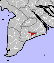 Location in Bạc Liêu province | |
| Country |  Vietnam Vietnam |
| Province | Bạc Liêu province |
| Capital | Châu Hưng |
| Area | |
| • Total | 252 sq mi (652 km2) |
| Population (2003) | |
| • Total | 187,515 |
| Time zone | UTC+7 (Indochina Time) |
Vĩnh Lợi is a rural district (huyện) of Bạc Liêu province in the Mekong Delta region of Vietnam. As of 2003 the district had a population of 187,515.[1] The district covers an area of 652 km2. The district capital lies at Châu Hưng.[1] Vĩnh Lợi district is north of the border with Sóc Trăng province, south of Hòa Bình and Bạc Liêu town, and west of Phước Long district.
Administrative divisions
Vĩnh Lợi district is subdivided into 8 commune-level subdivisions, including Châu Hưng township (district capital), and the rural communes of: Châu Hưng A, Hưng Thành, Hưng Hội, Châu Thới, Vĩnh Hưng, Vĩnh Hưng A and Long Thạnh.
References
- ^ a b "Districts of Vietnam". Statoids. Retrieved March 13, 2009.
- v
- t
- e
Districts of the Mekong Delta

- Cao Lãnh city※
- Hồng Ngự city
- Sa Đéc city
- Cao Lãnh
- Châu Thành
- Hồng Ngự
- Lai Vung
- Lấp Vò
- Tân Hồng
- Tam Nông
- Thanh Bình
- Tháp Mười
- Ngã Bảy city
- Vị Thanh city※
- Long Mỹ town
- Châu Thành
- Châu Thành A
- Long Mỹ
- Phụng Hiệp
- Vị Thủy
- Mỹ Tho city※
- Cai Lậy town
- Gò Công town
- Cái Bè
- Cai Lậy
- Châu Thành
- Chợ Gạo
- Gò Công Đông
- Gò Công Tây
- Tân Phú Đông
- Tân Phước
※ denotes provincial seat.
 | This article about a location in Bạc Liêu province, Vietnam is a stub. You can help Wikipedia by expanding it. |
- v
- t
- e


 Vĩnh_Lợi_District