Qleiat
Village in Keserwan-Jbeil
Qleiat 33°58′21″N 35°42′50″E / 33.972435°N 35.714025°E / 33.972435; 35.714025 | |
|---|---|
| Country |  Lebanon Lebanon |
| Governorate | Keserwan-Jbeil |
| District | Keserwan |
| Area | |
| • Total | 6.46 km2 (2.49 sq mi) |
| Elevation | 1,050 m (3,440 ft) |
| Time zone | UTC+2 (EET) |
| • Summer (DST) | UTC+3 (EEST) |
| Dialing code | +961 |
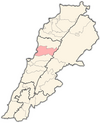
Qleiat (Arabic: قليعات; also spelled Qulaya'at, Qlaiaat, Qliyat, Qleiaat or Kleiat) is a town and municipality in the Keserwan District of the Keserwan-Jbeil Governorate of Lebanon. It is located 28 kilometers north of Beirut. Qleiat's average elevation is 1,050 meters above sea level and its total land area is 646 hectares.[1] Its inhabitants are predominantly Maronite Catholic, with Christians from other denominations in the minority.[2]
References
- v
- t
- e

Capital: Jounieh
- Adma wa Dafneh
- Ain el-Rihaneh
- Aintoura
- Ajaltoun
- Aramoun
- Ashqout
- Azra
- Ballouneh
- Batha
- Bkerké
- Bqaatouta
- Bzoummar
- Chahtoul-Jouret Mhad
- Chnaniir
- Daraoun
- Daraya
- Dlebta
- Faitroun
- Faraya
- Fatqa
- Ghazir
- Ghbaleh
- Ghidras
- Ghineh
- Ghosta
- Harissa-Daraoun
- Herharaya
- Hrajel
- Jdaidet Ghazir
- Jeita
- Jouret Bedran
- Jouret el-Termos
- Kaslik
- Kfar Dibiane
- Kfar Yassine
- Okaibe
- Qattine
- Qleiat
- Maarab
- Mayrouba
- Rayfoun
- Safra
- Sahel Alma
- Sarba
- Sehaileh
- Tabarja
- Yahchouch
- Zouk Mikael
- Zouk Mosbeh
 | This Lebanon location article is a stub. You can help Wikipedia by expanding it. |
- v
- t
- e


