Daraya, Chouf
Village in Mount Lebanon, Lebanon
Daraya داريا | |
|---|---|
Village | |
| 33°38′45″N 35°30′11″E / 33.64583°N 35.50306°E / 33.64583; 35.50306 | |
| Country |  Lebanon Lebanon |
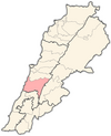
| Governorate | Mount Lebanon |
| District | Chouf |
| Elevation | 2,600 ft (800 m) |
| Time zone | UTC+2 (EET) |
| • Summer (DST) | +3 |
Daraya (Arabic: داريا), also known as Dheira, is a Lebanese village located in Chouf District in Mount Lebanon Governorate.[1] The name is derived from "Dar" which means house or home.
Location
Daraya belongs to the Chouf District; it is linked with the Lebanese coast by Al-Jiyya-Barja, Saydata-Dibbiyeh, and Wadi Zeina-Shheem roads. It is located 12 km away from Beit ed-Dine, 35 km from Baabda and 40 km away from Beirut. Daraya is 600–800 meters above the sea level.
Area and population
Its area is about 481.5 hectares and most of the area consists of hills. Highlands are planted with olives, grapevines and figs, while plains are planted with vegetables. There are also some small woods. The population is about 4132 persons. Nearly half of them have the right to vote.
References
- ^ "Daraiya (Chouf)". Localiban. Localiban. 11 January 2008. Retrieved 9 January 2018.
- v
- t
- e

Capital: Beitedine
- Ain Qani
- Ain W Zain
- Ain Zhalta
- Ainbal
- Ammatour
- Baadarâne
- Baakleen
- Bakaata
- Barja
- Barouk
- Batloun
- Beitedine
- Beykoun
- El Bireh
- Bourjein et Marjiyat
- Boutmeh
- Brih
- Bsaba
- Dahr El Maghara
- Damour
- Daraya
- Deir el Qamar
- Dibbiyeh
- El Foûâra
- Haret Jandal
- Gharife
- Jahlieh
- Jdaideh
- Jieh
- Joun
- Kahlouniye
- Kfarfakoud
- Kfar Nabrakh
- Mazraat el-Chouf
- Mazraat el Daher
- Maasser
- Moukhtara
- Mtolleh
- Na'ameh
- Niha
- Rmeileh
- Serjbel
- Shheem
- Symkanieh
- Zaarourieh
 | This Lebanon location article is a stub. You can help Wikipedia by expanding it. |
- v
- t
- e


