Wambrechies
Commune in Hauts-de-France, France
Wambrechies Wemmersijs | ||
|---|---|---|
Commune | ||
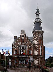 The town hall in Wambrechies | ||
 Coat of arms | ||
Location of Wambrechies  | ||
(2020–2026) Sébastien Brogniart[1] | | |
| Area 1 | 16 km2 (6 sq mi) | |
| Population (2021)[2] | 10,798 | |
| • Density | 670/km2 (1,700/sq mi) | |
| Time zone | UTC+01:00 (CET) | |
| • Summer (DST) | UTC+02:00 (CEST) | |
| INSEE/Postal code | 59636 /59118 | |
| Elevation | 13–26 m (43–85 ft) (avg. 20 m or 66 ft) | |
| 1 French Land Register data, which excludes lakes, ponds, glaciers > 1 km2 (0.386 sq mi or 247 acres) and river estuaries. | ||
Wambrechies (French pronunciation: [wɑ̃bʁəʃi]; West Flemish: Wemmersijs; Picard: Vamberchi) is a commune in the Nord department, in the region Hauts-de-France, in northern France. It is part of the European Metropolis of Lille.[3] It has a population of around 10,600 (2019).
Geography
Wambrechies is situated to the north of Lille, it is bordered by the neighbouring communes of Marquette-lez-Lille (to the southeast), Saint André-lez-Lille (to the south), Quesnoy-sur-Deûle (to the northwest) and Bondues (to the northeast). The Deûle canal runs from north to south through the town.
Heraldry
 | The arms of Wambrechies are blazoned : Or, a cross engrailed gules. (Artres, Bettrechies, Cerfontaine, Denain, Eth, Lesquin, Obies, Quérénaing, Semousies, Wambrechies and Warlaing use the same arms.)
|
Population
Graphs are unavailable due to technical issues. There is more info on Phabricator and on MediaWiki.org. |
| Year | Pop. | ±% p.a. |
|---|---|---|
| 1968 | 5,845 | — |
| 1975 | 7,894 | +4.39% |
| 1982 | 8,152 | +0.46% |
| 1990 | 8,250 | +0.15% |
| 1999 | 8,552 | +0.40% |
| 2007 | 9,875 | +1.81% |
| 2012 | 9,665 | −0.43% |
| 2017 | 10,948 | +2.52% |
| Source: INSEE[4] | ||
Twin towns
Kempen, Germany since 1972.
See also
References
- ^ "Répertoire national des élus: les maires" (in French). data.gouv.fr, Plateforme ouverte des données publiques françaises. 13 September 2022.
- ^ "Populations légales 2021" (in French). The National Institute of Statistics and Economic Studies. 28 December 2023.
- ^ INSEE commune file
- ^ Population en historique depuis 1968, INSEE
Wikimedia Commons has media related to Wambrechies.
- v
- t
- e

- Allennes-les-Marais
- Annœullin
- Anstaing
- Armentières
- Aubers
- Baisieux
- La Bassée
- Bauvin
- Beaucamps-Ligny
- Bois-Grenier
- Bondues
- Bousbecque
- Bouvines
- Capinghem
- Carnin
- La Chapelle-d'Armentières
- Chéreng
- Comines
- Croix
- Deûlémont
- Don
- Emmerin
- Englos
- Ennetières-en-Weppes
- Erquinghem-le-Sec
- Erquinghem-Lys
- Escobecques
- Faches-Thumesnil
- Forest-sur-Marque
- Fournes-en-Weppes
- Frelinghien
- Fretin
- Fromelles
- Gruson
- Hallennes-lez-Haubourdin
- Halluin
- Hantay
- Haubourdin
- Hem
- Herlies
- Houplin-Ancoisne
- Houplines
- Illies
- Lambersart
- Lannoy
- Le Maisnil
- Leers
- Lesquin
- Lezennes
- Lille (includes the associate-communes of Hellemmes and Lomme)
- Linselles
- Lompret
- Loos
- Lys-lez-Lannoy
- La Madeleine
- Marcq-en-Barœul
- Marquette-lez-Lille
- Marquillies
- Mons-en-Barœul
- Mouvaux
- Neuville-en-Ferrain
- Noyelles-lès-Seclin
- Pérenchies
- Péronne-en-Mélantois
- Prémesques
- Provin
- Quesnoy-sur-Deûle
- Radinghem-en-Weppes
- Ronchin
- Roncq
- Roubaix
- Sailly-lez-Lannoy
- Sainghin-en-Mélantois
- Sainghin-en-Weppes
- Saint-André-lez-Lille
- Salomé
- Santes
- Seclin
- Sequedin
- Templemars
- Toufflers
- Tourcoing
- Tressin
- Vendeville
- Verlinghem
- Villeneuve-d'Ascq
- Wambrechies
- Warneton
- Wasquehal
- Wattignies
- Wattrelos
- Wavrin
- Wervicq-Sud
- Wicres
- Willems
Authority control databases | |
|---|---|
| International |
|
| National |
|
| Geographic |
|
 | This Nord geographical article is a stub. You can help Wikipedia by expanding it. |
- v
- t
- e


