Voghjaberd
40°09′59″N 44°38′54″E / 40.16639°N 44.64833°E / 40.16639; 44.64833
Place in Kotayk, Armenia
Voghjaberd Ողջաբերդ | |
|---|---|
 Voghjaberd and the cave settlement | |
  Voghjaberd | |
| Coordinates: 40°09′59″N 44°38′54″E / 40.16639°N 44.64833°E / 40.16639; 44.64833 | |
| Country | Armenia |
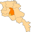
| Marz (Province) | Kotayk |
| Elevation | 1,700 m (5,600 ft) |
| Population (2001) | |
| • Total | 957 |
| Time zone | UTC+4 ( ) |
| • Summer (DST) | UTC+5 ( ) |
Voghjaberd (Armenian: Ողջաբերդ, also Romanized as Vokhchaberd) is a village in the Kotayk Province of Armenia.

See also
- Kotayk Province
References
- Voghjaberd at GEOnet Names Server
- Report of the results of the 2001 Armenian Census, Statistical Committee of Armenia
- v
- t
- e
 Kotayk Province
Capital: Hrazdan
- Abovyan
- Byureghavan
- Charentsavan
- Hrazdan
- Nor Hachn
- Tsaghkadzor
- Yeghvard