Tsihombe (district)
Place in Androy, Madagascar
Tsihombe Tsiombe | |
|---|---|
 Faux Cap | |
| 25°18′S 45°29′E / 25.300°S 45.483°E / -25.300; 45.483 | |
| Country |  Madagascar Madagascar |
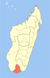
| Region | Androy |
| District | Tsihombe |
| Area | |
| • Total | 3,316 km2 (1,280 sq mi) |
| Elevation | 150 m (490 ft) |
| Population (2020) | |
| • Total | 158,954 |
| • Density | 48/km2 (120/sq mi) |
| Time zone | UTC3 (EAT) |
| Postal code | 621 |
Tsihombe is a municipality and a district of Androy in Madagascar.[2][3] The district has an area of 3,316 km2 (1,280 sq mi), and the estimated population in 2020 was 158,954.[4]
Geography
This district is crossed by the Route nationale 10 and the Manambovo river. Tsihombe is located at 65 km west of Ambovombe and 45 km East of Beloha.[5]
The district of Tsihombe includes the Cape Sainte Marie, the southernmost point of Madagascar. At Cape Sainte Marie there is also a wildlife reserve.
This is the semi-arid region of Madagascar and the population uses to eat cactus fruit and crickets to survive.[6][7][8]
A water-pipeline of 225 km is presently under construction if the tubes will not be embezzled.[9]
Municipalities
References
- ^ Estimated based on DEM data from Shuttle Radar Topography Mission
- ^ REPOBLIKAN’I MADAGASIKARA:Tanindrazana – Fahafahana – Fandrosoana (PDF). MINISTERE DE L’AGRICULTURE, DE L’ELEVAGE ET DE LA PECHE. October 2007. pp. 42–44.
- ^ "Madagascar: Administrative Division". citypopulation. Retrieved 10 June 2018.
- ^ "Madagascar: Administrative Division (Regions and Districts) - Population Statistics, Charts and Map". www.citypopulation.de. Retrieved 2024-01-17.
- ^ DIFFICULTES ALIMENTAIRES DANS LES DISTRICTS DE BELOHA ET DE TSIHOMBE.
- ^ Crickets to the rescue
- ^ Shield-backed katydids in Madagascar with the description of a new genus and three new species (Orthoptera: Ensifera: Tettigoniidae: Tettigoniinae: Arytropteridini)
- ^ Cricket Powder Provides Valuable Nutrients for Vulnerable Populations
- ^ www.presidence.gov.mg
- v
- t
- e
Capital: Ambovombe-Androy
- Ambahita
- Ambatomainty, Androy
- Ambatosola
- Anivorano Mitsinjo
- Anja Nord
- Ankaranabo Nord
- Antsakoamaro
- Bekitro
- Bekily Centre
- Belindo Mahasoa
- Beraketa
- Besakoa
- Beteza
- Bevitiky
- Manakompy
- Maroviro
- Morafeno Bekily
- Tanambao Tsirandrana
- Tanandava
- Tsikolaky
- Vohimanga
- Anjapaly
- Antaritarika
- Faux Cap
- Imongy
- Nikoly
- Marovato
- Tsiombe
- Ampamata
- Ambinany
- Andraivo
- Antanimora Sud
- Andalatanosy
- Befeno
- Imanombo
- Jafaro
- Sihanamaro.[1]
4 districts; 56 communes
 | This Madagascar location article is a stub. You can help Wikipedia by expanding it. |
- v
- t
- e
- ^ antanimora-sud-demande un district


