Toulépleu
Place in Montagnes, Ivory Coast
6°34′N 8°25′W / 6.567°N 8.417°W / 6.567; -8.417 Ivory Coast
 (2014)[1]
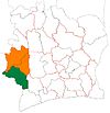
Toulépleu is a town in the far west of Ivory Coast, near the border with Liberia. It is a sub-prefecture and the seat of Toulépleu Department in Cavally Region, Montagnes District. Toulépleu is also a commune.
Notes
- ^ "Côte d'Ivoire". geohive.com. Retrieved 7 December 2015.
- v
- t
- e
Departments and sub-prefectures of Cavally Region, Montagnes DistrictRegional seat: Guiglo
* also a commune
 | This Montagnes District location article is a stub. You can help Wikipedia by expanding it. |
- v
- t
- e


