Southwest, Minneapolis
Community of Minneapolis
Community in Minnesota, United States
Southwest | |
|---|---|
Community | |
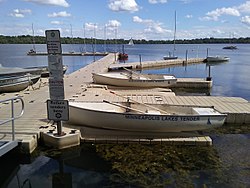 Lake Harriet | |
 Location of Southwest within the U.S. city of Minneapolis | |
| Country | United States |
| State | Minnesota |
| County | Hennepin |
| City | Minneapolis |
| Founded | 1849 |
| Neighborhoods | List
|
| Area [1] | |
| • Total | 8.142 sq mi (21.09 km2) |
| Population (2020)[2] | |
| • Total | 50,658 |
| • Density | 6,200/sq mi (2,400/km2) |
| Time zone | UTC-6 (CST) |
| • Summer (DST) | UTC-5 (CDT) |
| ZIP code | 55408, 55409, 55410, 55416, 55419 |
| Area code | 612 |
| Census | Pop. | Note | %± |
|---|---|---|---|
| 1980 | 52,946 | — | |
| 1990 | 49,590 | −6.3% | |
| 2000 | 47,863 | −3.5% | |
| 2010 | 48,076 | 0.4% | |
| 2020 | 50,658 | 5.4% |
The Southwest community consists of the following neighborhoods: Linden Hills, East Harriet, Kingfield, Fulton, Lynnhurst, Tangletown, Armatage, Kenny, and Windom. This portion of Minneapolis contains many parks and trails along Lake Harriet and Minnehaha Creek.
Parts of the Southwest community are in Minneapolis City Council wards 7, 8, and 11. The community contains all of Ward 13.[3]
References
External links
- Southwest Business Association (SWBA)
- Experience Southwest : Southwest Minneapolis Business Directory (NEHBA sponsored)
- Businesses in Southwest Minneapolis
Wikivoyage has a travel guide for Southwest Minneapolis.
- v
- t
- e
- Harrison
- Hawthorne
- Jordan
- Near North
- Sumner-Glenwood
- Willard-Hay
- 38th Street
- Cedar Avenue
- Central Avenue
- Franklin Avenue East
- East Lake Street
- Lowry Avenue North
- West Broadway
For a more comprehensive list, List of neighborhoods in Minneapolis.
| Authority control databases |
|
|---|
44°55′50″N 93°18′12″W / 44.93056°N 93.30333°W / 44.93056; -93.30333


 Southwest,_Minneapolis