Sherwood Island State Park
State park in Connecticut, United States
41°06′56″N 73°19′42″W / 41.11556°N 73.32833°W / 41.11556; -73.32833[1]
Sherwood Island State Park is a public recreation area on the shore of Long Island Sound in the Greens Farms section of Westport, Connecticut.[3] The state park offers swimming, fishing, and other activities on 238 acres (96 ha) of beach, wetlands, and woodlands. Sherwood Island is numbered as Connecticut's first state park because state purchase of land at the site began in 1914.[3][4][5] The park is managed by the Connecticut Department of Energy and Environmental Protection.
History
In the 1640s, several colonists from the Town of Fairfield, who came to be known as the "Bankside Farmers," settled in the area that included Fox Island, which was later renamed Sherwood Island, administering the island in common.[6][7]
Daniel Sherwood settled on Fox Island in 1787. During the 1800s, his large family farmed the uplands on the west side of the island and operated a gristmill on the Mill Pond. Many farmers shared the Machamux salt marsh. (See also Henry Burr Sherwood.)[8] By the 1860s, the place was known as "Sherwood's Island." Gallup Gap Creek at one time ran north and south on the east side of the park but not far from the center. Some have said that what was known previously as Sherwood's Island was only west of that creek, which was later dammed up to help water flow at the grist mill.[9]
When the Connecticut State Park Commission was formed in 1911, one of its main tasks was to find and develop shore parks along Connecticut's coastline. Field secretary Albert Turner walked the shoreline seeking suitable sites: several hundred acres of undeveloped land with natural scenic beauty, fronting on a good beach, and far enough from cities to ensure freedom from sewage pollution and lack of interference with industrial development. He concluded that Sherwood Island was the only suitable site in Fairfield County.[10]
At that time, the land had many owners. Acting for the state, Westport farmer and public citizen William H. Burr Jr., who led the fight to create the park, bought two small parcels in 1914, including a 5-acre (20,000 m2) strip of beachfront,[4][11] giving Sherwood Island its designation as Connecticut’s first state park, although it took another two decades for the park to be widely used. Various parcels bought by 1915 amounted to 24 acres (97,000 m2) by deed, although a state survey showed they in fact amounted to 30 acres (120,000 m2). The park at this point had 23,350 feet (7,120 m) of shorefront.[10]
In 1923, another 18 acres (73,000 m2) north of the island were acquired for possible use as a parking lot, although they were unconnected to the other 30 acres (120,000 m2). Some access to the park at this time was available through the Town of Westport's Burying Hill Beach. At this point, further development of the park stalled when local landowners, led by local property owner Edward Gair, persuaded a town meeting to oppose further land acquisitions and spending on the park. The state legislature, reluctant to act without local approval, defeated a proposal from the State Parks Commission to spend $500,000 on further park development. Large beachfront properties were acquired by developers. For the next nine years, supporters and opponents in Westport and Fairfield County debated the matter. By 1932, the state leased more land in what became the park (with an option to buy within five years) and opened the park that summer.[10]
On April 29, 1937, with the lease and option to buy nearing expiration, Governor Wilbur L. Cross signed two bills with a total appropriation of $485,000 for the state to buy more land and develop the park. This was a victory for the Connecticut Forestry Association, the Fairfield County Planning Association, and supporters, including William H. Burr, who came to be known as the father of the park.[10]
In the 1950s, the U.S. Army Corps of Engineers constructed jetties and extended the two beaches. In 1959, the state built an art deco styled pavilion/bathhouse.[12] In 2002, a memorial was dedicated to the victims of the September 11, 2001 attacks.
Features
- Geography and geology
The park is bounded on the west by the Sherwood Mill Pond and on the south by Long Island Sound. It is separated from the mainland by creeks and ditches. The park's beaches are 6,000 feet (1,800 m) long, more than a mile.[11] Waves on the beach separate three different colors of sand into separate lines — red (garnet), black (magnetite) and white (quartz) are sorted by the waves because each type has a different density and shape.[13][14]
- September 11 Memorial

Sherwood Island State Park was chosen for Connecticut's September 11 Living Memorial because on a clear day, the New York City skyline is visible from the point.[15] On 9/11, people at the park witnessed the smoke rise over the World Trade Center. The park was authorized, though not activated, to be a staging area for relief efforts. At the dedication on September 5, 2002, the names of 149 deceased victims of the attacks were read aloud; each person was a resident of Connecticut or had close family in the state. Governor John G. Rowland presided over the interfaith ceremony of music, speech, and prayer. The memorial's design incorporates the endurance of granite, the sheltering beauty of trees, and the tranquility of the sea. The 9-foot (2.7 m) polished granite stone monument reads, "The citizens of Connecticut dedicate this living memorial to the thousands of innocent lives lost on September 11, 2001 and to the families who loved them."[15] The memorial is handicapped-accessible.[12]
- Nature center
The Sherwood Island Nature Center is a summer facility that offers close-up experiences with live animals, displays about the environment and local history, and educational programs.[16] The first nature center was set up by Park Supervisor Glenn Dochtermann in an unused first-aid and lifeguard building in the 1990s. Dochterman used the site as a meeting place for guided field trips and furnished the building with local specimens. In 1995, the Friends of Sherwood Island supported the nature center and established a summer internship program. In 2002, the building was deemed structurally unsound and a campaign to construct a new nature center was launched. The total cost of $340,000 for the new building came from $196,000 from the Connecticut Department of Environmental Protection and $144,000 from the Friends of Sherwood Island. The new facility was constructed and opened in 2009.[17]
- Access
The park is accessed from Exit 18 on Interstate 95 and proceeding south onto the Sherwood Island Connector, also known as Connecticut Special Service Road 476,[18] before reaching the park's paved and gravel parking areas.[12]
Activities and amenities
Park activities include saltwater swimming and fishing, picnicking, scuba diving, field sports, bird watching, flying kites and model airplanes, and visiting the nature center.[3] Facilities include a pavilion, bathhouses, concessions, a first aid station, toilets, and drinking fountains.[12]
Gallery
-
 East from the pavilion roof
 -
 Pavilion, from the south
 -
 Distinctive picnic spot, west side
 -
 Beach on west side and "Protected Sand Dune Area"
 -
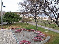
 Some of more than 100 picnic tables northwest of the pavilion


References
- ^ a b "Sherwood Island State Park". Geographic Names Information System. United States Geological Survey, United States Department of the Interior.
- ^ "Appendix A: List of State Parks and Forests" (PDF). State Parks and Forests: Funding. Staff Findings and Recommendations. Connecticut General Assembly. January 23, 2014. p. A-3. Retrieved March 20, 2014.
- ^ a b c "Sherwood Island State Park". State Parks and Forests. Connecticut Department of Energy and Environmental Protection. May 2017. Retrieved September 28, 2017.
- ^ a b Report of the State Park Commission to the Governor 1916. Hartford, Conn.: State of Connecticut. December 11, 1916. p. 19. Retrieved September 28, 2017.
- ^ "State Parks". State Register and Manual 1934. State of Connecticut. 1934. p. 226. Retrieved March 17, 2016.
- ^ Jennings, George Penfield (1933). Greens Farms, Connecticut: The Old West Parish of Fairfield. The Congregational Society of Greenfields. p. 2. Retrieved March 17, 2016.
- ^ "Colonial Green's Farms". Friends of Sherwood Island. Retrieved February 14, 2013.
- ^ "History of the Park". Friends of Sherwood Island. Retrieved February 14, 2013.
- ^ "The Controversial Creeks". Friends of Sherwood Island. Retrieved February 14, 2013.
- ^ a b c d "The 23-Year War". Friends of Sherwood Island. Retrieved February 14, 2013.
- ^ a b Connecticut Impressionist Art Trail sign at east end of pavilion at Sherwood Island State Park, read on November 17, 2007
- ^ a b c d Leary, Joseph (2004). A Shared Landscape: A Guide & History of Connecticut's State Parks & Forests. Hartford, Conn.: Friends of the Connecticut State Parks, Inc. pp. 45–46. ISBN 0974662909.
- ^ "The Geology of Sherwood Island State Park". State Parks and Forests. Connecticut Department of Energy and Environmental Protection. Retrieved March 17, 2016.
- ^ Skehan, James W. (2008). Roadside Geology of Connecticut and Rhode Island. Missoula, Mt.: Mountain Press Publishing. p. 224. ISBN 978-0-8784-2547-1.
- ^ a b "Connecticut's 9-11 Living Memorial". Connecticut Department of Energy and Environmental Protection. Retrieved February 18, 2013.
- ^ "Nature Center". Friends of Sherwood Island. Retrieved May 22, 2014.
- ^ "History of the Nature Center". Friends of Sherwood Island. Retrieved May 22, 2014.
- ^ "Secret Route List". Connecticut Roads. Kurumi. Retrieved April 15, 2014.
Additional sources
- Greens Farms, Connecticut: The Old West Parish of Fairfield, George Penfield Jennings, The Congregational Society of Greens Farms, 1933; reprinted: Modern Books & Crafts, 1971.
- The William H. Burr Jr. Collection (B-112), Fairfield Historical Society, Fairfield, Connecticut.
External links
Wikimedia Commons has media related to Sherwood Island State Park.
- Sherwood Island State Park Connecticut DEEP
- Sherwood Island State Park Map Connecticut DEEP
- Friends of Sherwood Island State Park
- v
- t
- e
- Above All
- Air Line
- Beaver Brook
- Becket Hill State Park Reserve
- Beckley Furnace Industrial Monument
- Bennett's Pond
- Bigelow Hollow
- Black Rock
- Bluff Point
- Bolton Notch
- Brainard Homestead
- Burr Pond
- Camp Columbia
- Campbell Falls
- Chatfield Hollow
- Collis P. Huntington
- Connecticut Valley Railroad
- Dart Island State Park
- Day Pond
- Dennis Hill
- Devil's Hopyard
- Dinosaur
- Eagle Landing
- Farm River
- Farmington Canal
- Fort Griswold Battlefield
- Fort Trumbull
- Gardner Lake
- Gay City
- George Dudley Seymour
- George Waldo
- Gillette Castle
- Haddam Island
- Haddam Meadows
- Haley Farm
- Hammonasset Beach
- Harkness Memorial
- Haystack Mountain
- Higganum Reservoir
- Hop River State Park Trail
- Hopemead
- Hopeville Pond
- Horse Guard
- Housatonic Meadows
- Humaston Brook
- Hurd
- Indian Well
- John A. Minetto
- Kent Falls
- Kettletown
- Killingly Pond
- Lake Waramaug
- Lamentation Mountain
- Larkin State Park Trail
- Lovers Leap
- Macedonia Brook
- Machimoodus
- Mansfield Hollow
- Mashamoquet Brook
- Mianus River
- Millers Pond
- Minnie Island
- Mohawk Mountain
- Mono Pond
- Moosup Valley State Park Trail
- Mooween
- Mount Bushnell
- Mount Riga
- Mount Tom
- Old Furnace
- Osbornedale
- Penwood
- Platt Hill
- Pomeroy
- Putnam Memorial
- Quaddick
- Quinebaug Lake
- Quinnipiac River
- River Highlands
- Rocky Glen
- Rocky Neck
- Ross Pond
- Salt Rock State Campground
- Satan's Kingdom State Recreation Area
- Scantic River
- Selden Neck
- Seth Low Pierrepont
- Sherwood Island
- Silver Sands
- Sleeping Giant
- Southford Falls
- Squantz Pond
- Stillwater Pond
- Stoddard Hill
- Stratton Brook
- Sunnybrook
- Sunrise
- Talcott Mountain
- Tri-Mountain
- Trout Brook Valley
- Wadsworth Falls
- West Rock Ridge
- Wharton Brook
- Whittemore Glen
- Windsor Locks Canal State Park Trail
- Windsor Meadows
- Wooster Mountain
- Algonquin
- American Legion
- Centennial Watershed
- Cockaponset
- Enders
- James L. Goodwin
- Housatonic
- Massacoe
- Mattatuck
- Meshomasic
- Mohawk
- Mohegan
- Nassahegon
- Natchaug
- Nathan Hale
- Naugatuck
- Nehantic
- Nepaug
- Nipmuck
- Nye-Holman
- Pachaug
- Paugnut
- Paugussett
- People's
- Pootatuck
- Quaddick
- Salmon River
- Shenipsit
- Topsmead
- Tunxis
- Wyantenock
- Aldo Leopold WMA
- Assekonk WMA
- Babcock Pond WMA
- Barber Pond WMA
- Barn Island WMA
- Bartlett Brook WMA
- Bear Hill WMA
- Belding WMA
- Bishops Swamp WMA
- Black Pond WMA
- Candlewood Hill WMA
- Cedar Swamp WMA
- Charles E. Wheeler WMA
- Cromwell Meadows WMA
- Durham Meadows WMA
- East River Marsh WMA
- East Swamp WMA
- Eightmile River WMA
- Franklin Swamp WMA
- Goshen WMA
- Great Harbor WMA
- Higganum Meadows WMA
- Housatonic River WMA
- King's Island Coop WMA
- Kollar WMA
- Larson Lot WMA
- Little River Fish and Wildlife Area
- Lord's Cove WMA
- Maromas Coop WMA
- Meadow Brook WMA
- Menunketesuck WMA
- Messerschmidt WMA
- Newgate WMA
- Nod Brook WMA
- Nott Island WMA
- Pease Brook WMA
- Plum Bank WMA
- Quinebaug River WMA
- Quinnipiac River Marsh WMA
- Ragged Rock WMA
- Raymond Brook Marsh WMA
- Robbins Swamp WMA
- Roger Tory Peterson Wildlife Area
- Roraback WMA
- Rose Hill WMA
- Ross Marsh WMA
- Salmon River Cove and Haddam Neck WMA
- Sessions Woods WMA
- Simsbury WMA
- Skiff Mountain Coop WMA
- James V. Spignesi WMA
- Stanley Works WMA
- Suffield WMA
- Talbot WMA
- Tankerhoosen WMA
- Wangunk Meadows WMA
- Wopowog WMA
- Zemko Pond WMA
- Aspetuck Reservoir
- Barkhamsted Reservoir
- Beaver Dam Lake
- Candlewood Lake
- Easton Reservoir
- Far Mill Reservoir
- Hemlock Reservoir
- Hop Brook Lake
- Lake Lillinonah
- Mansfield Hollow Lake
- Means Brook
- Saugatuck Reservoir
- Trap Falls Reservoir
- West Hartford Reservoir
- West Pequonnock Reservoir
- Lake Zoar
- Aspetuck Land Trust
- Aton Forest
- Audubon Center at Bent of the River
- Bartlett Arboretum and Gardens
- Bear Mountain
- Beckley Bog
- Branford Land Trust
- Case Mountain
- Cathedral Pines
- Connecticut Audubon Society Center at Fairfield
- Connecticut College Arboretum
- Devil's Den Preserve
- Earthplace
- Great Mountain Forest
- Higby Mountain
- Highstead Arboretum
- Joshua's Tract Conservation and Historic Trust
- McLean Game Refuge
- New Canaan Nature Center
- Peter's Rock
- Pine Mountain Reserve
- Saltonstall Mountain
- Stamford Museum & Nature Center
- Steep Rock Association
- Weantinoge Heritage Land Trust
- White Memorial Foundation
- Woodcock Nature Center
- Yale-Myers Forest
- American Legion State Forest Trails
- Aspetuck Valley Trail
- Blue-Blazed Trails
- Chatfield Trail
- Hancock Brook Trail
- Housatonic Range Trail
- Lillinonah Trail
- Mattabesett Trail
- Menunkatuck Trail
- Metacomet Trail
- Narragansett Trail
- Natchaug Trail
- Naugatuck Trail
- Nehantic Trail
- Nipmuck Trail
- Paugussett Trail
- Pequot Trail
- Quinnipiac Trail
- Regicides Trail
- Salmon River Trail
- Shenipsit Trail
- Tunxis Trail
- Westwoods Trails
- Whitestone Cliffs Trail
- Zoar Trail
Forest/Parks
- Bear Mountain Reservation
- Beardsley Park
- Burr Farm Protected Open Space
- East Rock Park
- Gurski Farm Protected Open Space
- Happy Landings Protected Open Space
- Lighthouse Point Park
- Lillinonah Woods
- Mill River Park
- Old Bridge Sanctuary
- Pleasure Beach
- Roosevelt Forest
- Salt Meadow Park
- Seaside Park
- Webb Mountain Discovery Zone
- Webb Mountain Park
Authority control databases | |
|---|---|
| International |
|
| National |
|


