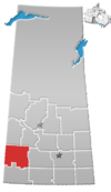
Shackleton, Saskatchewan
Shackleton is a special service area in the Rural Municipality of Miry Creek No. 229, Saskatchewan, Canada. It previously held the status of village until December 31, 2013. The community is located 81 km (50 mi) northwest of the City of Swift Current on Highway 32.
History
Prior to December 31, 2013, Shackleton was incorporated as a village, and was restructured as a social service area under the jurisdiction of the Rural Municipality of Miry Creek No. 229 on that date.[5]
Demographics
In the 2021 Census of Population conducted by Statistics Canada, Shackleton had a population of 5 living in 4 of its 6 total private dwellings, a change of -50% from its 2016 population of 10. With a land area of 0.72 km2 (0.28 sq mi), it had a population density of 6.9/km2 (18.0/sq mi) in 2021.[6]
| 2016 | |
|---|---|
| Population | 10 (0% from 2011) |
| Land area | 0.66 km2 (0.25 sq mi) |
| Population density | 15.1/km2 (39/sq mi) |
| Median age | NA (M: NA, F: NA) |
| Private dwellings | 8 (total) |
| Median household income | $NA |
See also
References
- ^ National Archives, Archivia Net, Post Offices and Postmasters, archived from the original on October 6, 2006
- ^ Government of Saskatchewan, MRD Home, Municipal Directory System, archived from the original on November 21, 2008
- ^ Canadian Textiles Institute. (2005), CTI Determine your provincial constituency, archived from the original on September 11, 2007
- ^ Commissioner of Canada Elections, Chief Electoral Officer of Canada (2005), Elections Canada On-line, archived from the original on April 21, 2007
- ^ "The Saskatchewan Gazette: Part I: Volume 110" (PDF) (PDF). Government of Saskatchewan. January 3, 2014. pp. 21–24. Retrieved April 6, 2014.
- ^ "Population and dwelling counts: Canada and designated places". Statistics Canada. February 9, 2022. Retrieved August 31, 2022.
- ^ "2016 Community Profiles". 2016 Canadian Census. Statistics Canada. August 12, 2021. Retrieved August 1, 2016.
- ^ "2006 Community Profiles". 2006 Canadian Census. Statistics Canada. August 20, 2019.
- ^ "2001 Community Profiles". 2001 Canadian Census. Statistics Canada. July 18, 2021.
- v
- t
- e

communities
| Organized hamlets | |
|---|---|
| Special service areas | |
| Hamlets |
- Abbey Colony
- Aikins
- Beverley
- Cantuar
- Chipperfield
- Cuthbert
- Duncairn
- Dunelm
- Estuary
- Eyre
- Forgan
- Gascoigne
- Glidden
- Greenan
- Gunnworth
- Hak
- High Point
- Horsham
- Hughton
- Inglebright
- Isham
- Java
- Lacadena
- Leinan
- Lemsford
- Lille
- Linacre
- Madison
- Matador
- Mondou
- Nadeauville
- Penkill
- Plato
- Player
- Portreeve
- Rhineland
- Richlea
- Roadene
- Rosengart
- Roseray
- Saltburn
- Sanctuary
- Schantzenfeld
- Schoenfeld
- Schoenwiese
- Shackleton
- Snipe Lake
- Springfeld
- Surprise
- Tuberose
- Tunstall
- Tyner
- Verlo
- Wartime
- Wheatland Colony
- White Bear
- Witley
- Wyatt
50°41′17″N 108°36′02″W / 50.68806°N 108.60056°W / 50.68806; -108.60056
 | This Saskatchewan location article is a stub. You can help Wikipedia by expanding it. |
- v
- t
- e


