Santol, La Union
Municipality in La Union, Philippines
Municipality in Ilocos Region, Philippines

Flag

Seal
Itan Santol

Map of La Union with Santol highlighted
[1]
Members
- Jojo O. Ominga
- Claudio O. Galos Jr.
- Edith R. Millares
- William O. Agtarap
- Olympio O. Millares
- Loreto A. Wailan
- Roxanne M. Dangle
- Tirso A. Ledda
[2]
(2020 census)[3]
16.93
2505
013318000
Tagalog
Kankanaey
Santol, officially the Municipality of Santol (Ilocano: Ili ti Santol; Filipino: Bayan ng Santol), is a 4th class municipality in the province of La Union, Philippines. According to the 2020 census, it has a population of 14,166 people.[3]
History
Santol, a Balaoan northeastern Rancheria, became a township in 1908 under the sub-province Amburayan, Mountain Province. An Igorot named Lakay Camilot was its first municipal president.[5]
In 1920, a new province out of the old Lepanto-Amburayan sub-province was planned to showcase the socio-cultural integration amongst lowlanders, mountaineers and the Bagos. Three towns (San Gabriel, Sudipen and Santol) were proposed for the planned province to be named Harrison, a former American Governor-General who championed filipinization and integration.[5]
However, protest resolutions were filed by the leaders of these municipalities unanimously objecting to their inclusion because of historical, economic, cultural and geographical reasons. As a result, the proposal did not push through.[5]
In 1922, Mountain Province relinquished Santol which became a municipal district of La Union. Santol was elevated into a regular municipality status in 1949 by virtue of Executive Order No. 214 issued by President Elpidio Quirino.[5]
The town of Santol is considered a safe harbor for there had been no distinct destruction of lives or properties during the historic events regarding wars and calamities. Such was true during the Spanish regime and Japanese occupation. Evidence of this is that Barrio Mangan was set aside as the place of the military emergency hospital. It was also here where the center of distribution of food supplies for army personnel was located. Barrio Banbanaba was the site of message center which is directly in touch with all the barrios of Balaoan, Santol, San Gabriel and Sudipen.[5]
Santol Central and Cadanglaan served as the grounds for training volunteers during the days nearing the landing of the Liberation Forces while Sammauting was the hiding place for the guerillas.[5]
There are two accounts as to how Santol derived its name. the first version states that the place was once a favorite hunting ground for people interested in sculpture of religious images. In one of their hunts for material sculpture, they saw a huge tree called Santol. The size of the tree was so remarkable that several images were carved out from a single trunk, thus made it their main material in wood carving.[5]
The second version states that during the Spanish occupation, soldiers passed by the area, but the women did not understand Spanish and presumed the soldiers were asking for the name of the fruits they were carrying. One of the women answered – “Santol, Apo.”. the soldiers also did not understand the dialect and all they remembered was the word Santol, hence, the name of the place.[5]
Geography
Santol is situated in the north-eastern part of the Province of La Union. It is bounded on the north by the Municipality of Sudipen, on the north-east by the upland Municipality of Sugpon in Ilocos Sur, on the south by the Municipality of San Gabriel, and on the west by the Municipality of Balaoan. The town center of Santol is 40 kilometres (25 mi) north of the City of San Fernando, the provincial capital and regional administrative center; 310 kilometres (190 mi) north of Manila and 113 kilometres (70 mi) of the country's summer capital Baguio via the Naguilian Road.
Barangays
Santol is politically subdivided into 11 barangays. [6] Each barangay consists of puroks and some have sitios.
- Corrooy
- Lettac Norte
- Lettac Sur
- Mangaan
- Paagan
- Poblacion
- Puguil
- Ramot
- Sapdaan
- Sasaba
- Tubaday
Climate
| Climate data for Santol, La Union | |||||||||||||
|---|---|---|---|---|---|---|---|---|---|---|---|---|---|
| Month | Jan | Feb | Mar | Apr | May | Jun | Jul | Aug | Sep | Oct | Nov | Dec | Year |
| Mean daily maximum °C (°F) | 30 (86) | 31 (88) | 32 (90) | 33 (91) | 32 (90) | 31 (88) | 30 (86) | 29 (84) | 30 (86) | 31 (88) | 31 (88) | 30 (86) | 31 (88) |
| Mean daily minimum °C (°F) | 21 (70) | 22 (72) | 23 (73) | 25 (77) | 26 (79) | 25 (77) | 25 (77) | 25 (77) | 25 (77) | 24 (75) | 23 (73) | 21 (70) | 24 (75) |
| Average precipitation mm (inches) | 42 (1.7) | 48 (1.9) | 74 (2.9) | 110 (4.3) | 269 (10.6) | 275 (10.8) | 362 (14.3) | 325 (12.8) | 330 (13.0) | 306 (12.0) | 126 (5.0) | 61 (2.4) | 2,328 (91.7) |
| Average rainy days | 11.2 | 12.0 | 17.1 | 21.2 | 27.1 | 26.8 | 28.1 | 27.0 | 26.0 | 24.5 | 17.7 | 12.4 | 251.1 |
| Source: Meteoblue[7] | |||||||||||||
Demographics
| Year | Pop. | ±% p.a. |
|---|---|---|
| 1918 | 3,536 | — |
| 1939 | 4,901 | +1.57% |
| 1948 | 5,060 | +0.36% |
| 1960 | 6,125 | +1.60% |
| 1970 | 7,316 | +1.79% |
| 1975 | 7,686 | +0.99% |
| 1980 | 7,836 | +0.39% |
| 1990 | 9,544 | +1.99% |
| 1995 | 10,209 | +1.27% |
| 2000 | 11,202 | +2.01% |
| 2007 | 11,712 | +0.62% |
| 2010 | 12,007 | +0.91% |
| 2015 | 12,476 | +0.73% |
| 2020 | 14,166 | +2.53% |
| Source: Philippine Statistics Authority[8][9][10][11] | ||
In the 2024 census, the population of Santol, La Union, was 12,166 people,[3] with a density of 150 inhabitants per square kilometre or 390 inhabitants per square mile.
Economy
Poverty incidence of Santol
10 20 30 40 2006 39.70 2009 32.74 2012 20.64 2015 12.57 2018 5.31 2021 16.93 Source: Philippine Statistics Authority[12][13][14][15][16][17][18][19] |
Government
Local government
Santol, belonging to the first congressional district of the province of La Union, is governed by a mayor designated as its local chief executive and by a municipal council as its legislative body in accordance with the Local Government Code. The mayor, vice mayor, and the councilors are elected directly by the people through an election which is being held every three years.
Elected officials
| Position | Name |
|---|---|
| Congressman | Pablo C. Ortega |
| Mayor | Magno A. Wailan |
| Vice-Mayor | Monico O. Oriente Jr. |
| Barangay Officials | Jojo O. Ominga |
| Claudio O. Galos Jr. | |
| Edith R. Millares | |
| William O. Agtarap | |
| Olympio O. Millares | |
| Loreto A. Wailan | |
| Roxanne M. Dangle | |
| Tirso A. Ledda |
Churches
- The Jesus Church - Santol Mission
- The Lady of the Victory Church
- All Christians Pavillion
- The Jesus Church - Sapdaan Santol, La Union
Schools
- Santol Vocational High School "Main"
- Corro-oy integrated School
- Corro-oy National High School
- Liguay National High School
Gallery
-
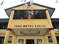 Municipal hall
 -
 Town center
 -
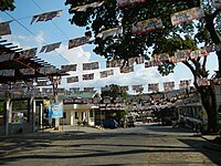 Town center
 -
 Street view and landscape
 -
 Santol Arch


References
- ^ Municipality of Santol | (DILG)
- ^ "2015 Census of Population, Report No. 3 – Population, Land Area, and Population Density" (PDF). Philippine Statistics Authority. Quezon City, Philippines. August 2016. ISSN 0117-1453. Archived (PDF) from the original on May 25, 2021. Retrieved July 16, 2021.
{{cite web}}: CS1 maint: year (link) - ^ a b c Census of Population (2020). "Region I (Ilocos Region)". Total Population by Province, City, Municipality and Barangay. Philippine Statistics Authority. Retrieved 8 July 2021.
- ^ "PSA Releases the 2021 City and Municipal Level Poverty Estimates". Philippine Statistics Authority. 2 April 2024. Retrieved 28 April 2024.
- ^ a b c d e f g h "History". Municipality of Santol. Retrieved 1 September 2024.
 This article incorporates text from this source, which is in the public domain.
 - ^ "Province: La Union". PSGC Interactive. Quezon City, Philippines: Philippine Statistics Authority. Retrieved 12 November 2016.
- ^ "Santol: Average Temperatures and Rainfall". Meteoblue. Retrieved 26 April 2020.
- ^ Census of Population (2015). "Region I (Ilocos Region)". Total Population by Province, City, Municipality and Barangay. Philippine Statistics Authority. Retrieved 20 June 2016.
- ^ Census of Population and Housing (2010). "Region I (Ilocos Region)" (PDF). Total Population by Province, City, Municipality and Barangay. National Statistics Office. Retrieved 29 June 2016.
- ^ Censuses of Population (1903–2007). "Region I (Ilocos Region)". Table 1. Population Enumerated in Various Censuses by Province/Highly Urbanized City: 1903 to 2007. National Statistics Office.
{{cite encyclopedia}}: CS1 maint: numeric names: authors list (link) - ^ "Province of La Union". Municipality Population Data. Local Water Utilities Administration Research Division. Retrieved 17 December 2016.
- ^ "Poverty incidence (PI):". Philippine Statistics Authority. Retrieved December 28, 2020.
- ^ "Estimation of Local Poverty in the Philippines" (PDF). Philippine Statistics Authority. 29 November 2005.
- ^ "2003 City and Municipal Level Poverty Estimates" (PDF). Philippine Statistics Authority. 23 March 2009.
- ^ "City and Municipal Level Poverty Estimates; 2006 and 2009" (PDF). Philippine Statistics Authority. 3 August 2012.
- ^ "2012 Municipal and City Level Poverty Estimates" (PDF). Philippine Statistics Authority. 31 May 2016.
- ^ "Municipal and City Level Small Area Poverty Estimates; 2009, 2012 and 2015". Philippine Statistics Authority. 10 July 2019.
- ^ "PSA Releases the 2018 Municipal and City Level Poverty Estimates". Philippine Statistics Authority. 15 December 2021. Retrieved 22 January 2022.
- ^ "PSA Releases the 2021 City and Municipal Level Poverty Estimates". Philippine Statistics Authority. 2 April 2024. Retrieved 28 April 2024.
- ^ "2019 National and Local Elections" (PDF). Commission on Elections. Retrieved March 6, 2022.
External links
Wikimedia Commons has media related to Santol, La Union.
- Philippine Standard Geographic Code
- Philippine Census Information
- Local Governance Performance Management System


