Sông Cầu
You can help expand this article with text translated from the corresponding article in Vietnamese. (March 2009) Click [show] for important translation instructions.
- View a machine-translated version of the Vietnamese article.
- Machine translation, like DeepL or Google Translate, is a useful starting point for translations, but translators must revise errors as necessary and confirm that the translation is accurate, rather than simply copy-pasting machine-translated text into the English Wikipedia.
- Do not translate text that appears unreliable or low-quality. If possible, verify the text with references provided in the foreign-language article.
- You must provide copyright attribution in the edit summary accompanying your translation by providing an interlanguage link to the source of your translation. A model attribution edit summary is
Content in this edit is translated from the existing Vietnamese Wikipedia article at [[:vi:Thị xã Sông Cầu]]; see its history for attribution. - You may also add the template
{{Translated|vi|Thị xã Sông Cầu}}to the talk page. - For more guidance, see Wikipedia:Translation.
Town in South Central Coast, Vietnam
Sông Cầu Thị xã Sông Cầu | |
|---|---|
Town (Class-4) | |
| Sông Cầu town | |
 Xuân Đài Bay | |
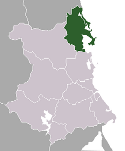 Location of Sông Cầu in Phú Yên Province | |
 | |
| Country |  Vietnam Vietnam |
| Region | South Central Coast |
| Province | Phú Yên |
| Established | 28 August 2009 |
| Local government's offices | Xuân Phú |
| Area | |
| • Town (Class-4) | 188 sq mi (487 km2) |
| • Urban | 12.4266 sq mi (32.1848 km2) |
| Population (2009) | |
| • Town (Class-4) | 105,780 |
| • Density | 541/sq mi (208.7/km2) |
| • Urban | 32,437 |
| • Urban density | 2,610/sq mi (1,007.8/km2) |
| Time zone | UTC+7 (Indochina Time) |
| Website | songcau.phuyen.gov.vn |
Sông Cầu is a town (thị xã) of Phú Yên province in the South Central Coast region of Vietnam.
After the Vietnam War, Sông Cầu was merged into Đồng Xuân District in 1976. The latter was then combined with Tuy An District to become Xuân An District in March 1977, but Xuân An was soon split again into the two previous districts in September 1978. Sông Cầu Township was the seat for those districts. On 27 June 1985, Sông Cầu District was split from Đồng Xuân District.[1] On 28 August 2009, Sông Cầu District was upgraded to town status.[2]
Sông Cầu is subdivided into 4 wards (phường): Xuân Yên, Xuân Phú, Xuân Thành and Xuân Đài, and 10 communes (xã): Xuân Thọ 1, Xuân Thọ 2, Xuân Lâm, Xuân Phương, Xuân Thịnh, Xuân Cảnh, Xuân Hoà, Xuân Bình, Xuân Lộc and Xuân Hải. At the time of establishment (2009) it had a population of 101,521 and covered an area of 489.28 km².[2] The local government's offices are located in Xuân Phú Ward.
References
- ^ (Vietnamese) History of Sông Cầu
- ^ a b (Vietnamese) The foundation of Sông Cầu Town
13°33′N 109°12′E / 13.550°N 109.200°E / 13.550; 109.200
- v
- t
- e
Cities in Vietnam
| Special |
|
|---|---|
| Class-1 |
|
| Class-1 |
|---|
| Class-1 | |
|---|---|
| Class-2 | |
| Class-3 |
|
| ||
|---|---|---|
| Da Nang city |  | |
| Bình Định province | ||
| Bình Thuận province | ||
| Khánh Hòa province |
| |
| Ninh Thuận province | ||
| Phú Yên province | ||
| Quảng Nam province | ||
| Quảng Ngãi province | ||
※ denotes provincial seat. / § Sovereignty over the Hoàng Sa and Trường Sa archipelagoes is disputed as of 22 September 2024. | ||
 | This article about a location in Phú Yên province, Vietnam is a stub. You can help Wikipedia by expanding it. |
- v
- t
- e


 Sông_Cầu