Ribno | |
|---|---|
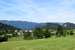 | |
 Ribno Location in Slovenia | |
| Coordinates: 46°21′4.79″N 14°7′24.53″E / 46.3513306°N 14.1234806°E | |
| Country | |
| Traditional Region | Upper Carniola |
| Statistical region | Upper Carniola |
| Municipality | Bled |
| Elevation | 568.5 m (1,865.2 ft) |
| Population (2020) | |
• Total | 612 |
| [1] | |
Ribno (pronounced [ˈɾiːbnɔ]) is a settlement in the Municipality of Bled in the Upper Carniola region of Slovenia.
Geography
[edit]
The territory of Ribno extends from the village center north of the Sava Bohinjka River to the south. Its elevation ranges from a low of 417 meters (1,368 ft) along the river to a high of 1,265 meters (4,150 ft) at Black Peak (Slovene: Črni vrh) on the Jelovica Plateau. The Selca Pasture (Slovene: Selška planina or Selska planina), also known as the Selca–Kupljenik Pasture (Slovene: Selsko-kupljeniška planina), lies at the southernmost point in the settlement, below the southern slope of Black Peak.
Church
[edit]
The parish church in the village is dedicated to Saint James. It was originally a Gothic church with some frescos remaining in the chancel, but it was greatly rebuilt and reconstructed in the late 19th century.[2]
References
[edit]- ^ Statistical Office of the Republic of Slovenia Archived November 18, 2008, at the Wayback Machine
- ^ Bled municipal site
External links
[edit] Media related to Ribno at Wikimedia Commons
- Ribno on Geopedia
| Settlements | Administrative seat: Bled
|  | ||||
|---|---|---|---|---|---|---|
| Landmarks | ||||||
This article about the Municipality of Bled in Slovenia is a stub. You can help Wikipedia by expanding it. |