Petrilje
Village in Jablanica District, Serbia
42°47′27″N 21°33′11″E / 42.79083°N 21.55306°E / 42.79083; 21.55306 Serbia
 (2002)
Petrilje is a village in the municipality of Medveđa, Serbia. According to the 2002 census, the village has a population of 63 people.[1]
History
The village was mentioned in the late middle ages as "Arbanashka Petrila" which translates into "The Albanian Petrila" and indicates an Albanian presence[2][3]
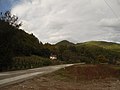
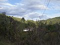
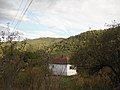
Gallery
-
-
 A lake near the village.
 -
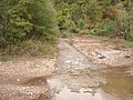 Tularska river.
 -
-
-
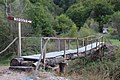 A bridge that leads to the Corov waterfall.
 -
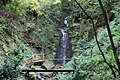
 Corov waterfall.
 -
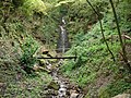
 Corov waterfall.
 -
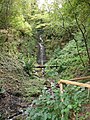
 Corov waterfall.
 -
 Corov waterfall.
 -
 Corov waterfall.
 -
 Corov waterfall.
 -
 Corov waterfall.
 -
 Corov waterfall.
 -
 A Corov's stream.


References
- ^ Popis stanovništva, domaćinstava i Stanova 2002. Knjiga 1: Nacionalna ili etnička pripadnost po naseljima. Republika Srbija, Republički zavod za statistiku Beograd 2003. ISBN 86-84433-00-9
- ^ Selami Pulaha Popullsia Shqiptare e Kosoves Gjate Shekujve p. 13
- ^ ILJAZ REXHA REGISTRATION OF SETTLEMENTS AND ALBANIAN POPULATION OF KOSOVO According to the Ottoman defters records of XV century
42°47′27″N 21°33′11″E / 42.79083°N 21.55306°E / 42.79083; 21.55306
- v
- t
- e
Municipality of Medveđa- Medveđa

- Bogunovac
- Borovac
- Čokotin
- Crni Vrh
- Donji Bučumet
- Donji Gajtan
- Đulekare
- Gazdare
- Gornja Lapaštica
- Gornji Bučumet
- Gornji Gajtan
- Grbavce
- Gubavce
- Gurgutovo
- Kapit
- Lece
- Maćedonce
- Maćedonce (Retkocersko)
- Mala Braina
- Marovac
- Medevce
- Mrkonje
- Negosavlje
- Petrilje
- Poroštica
- Pusto Šilovo
- Ravna Banja
- Retkocer
- Rujkovac
- Sijarina
- Sijarinska Banja
- Sponce
- Srednji Bučumet
- Stara Banja
- Stubla
- Svirce
- Tulare
- Varadin
- Velika Braina
- Vrapce
 | This Jablanica District, Serbia location article is a stub. You can help Wikipedia by expanding it. |
- v
- t
- e


