Oepping
Place in Upper Austria, Austria

Coat of arms
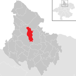
Location in the district
[1]
(2018-01-01)[2]
4151
Oepping is a municipality in the district of Rohrbach in the Austrian state of Upper Austria.
Geography
Oepping lies in the Mühlviertel. About 24 percent of the municipality is forest, and 70 percent is farmland.
References
Wikimedia Commons has media related to Oepping.
- v
- t
- e
Municipalities in the district of Rohrbach
- Aigen-Schlägl
- Altenfelden
- Arnreit
- Atzesberg
- Auberg
- Haslach an der Mühl
- Helfenberg
- Hofkirchen im Mühlkreis
- Hörbich
- Julbach
- Kirchberg ob der Donau
- Klaffer am Hochficht
- Kleinzell im Mühlkreis
- Kollerschlag
- Lembach im Mühlkreis
- Lichtenau im Mühlkreis
- Nebelberg
- Neufelden
- Neustift im Mühlkreis
- Niederkappel
- Niederwaldkirchen
- Oberkappel
- Oepping
- Peilstein im Mühlviertel
- Pfarrkirchen im Mühlkreis
- Putzleinsdorf
- Rohrbach-Berg
- Sankt Johann am Wimberg
- Sankt Martin im Mühlkreis
- Sankt Oswald bei Haslach
- Sankt Peter am Wimberg
- Sankt Stefan-Afiesl
- Sankt Ulrich im Mühlkreis
- Sankt Veit im Mühlkreis
- Sarleinsbach
- Schwarzenberg am Böhmerwald
- Ulrichsberg
Authority control databases | |
|---|---|
| International |
|
| National |
|
 | This Upper Austria location article is a stub. You can help Wikipedia by expanding it. |
- v
- t
- e


