Northgate, North Dakota
Unincorporated community in North Dakota, United States
48°59′27″N 102°15′44″W / 48.99083°N 102.26222°W / 48.99083; -102.2622258737
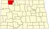
Northgate is an unincorporated community in Burke County, North Dakota, United States. The community is adjacent to the U.S. border with Canada, and it shares its name with the neighboring Canadian settlement of Northgate, Saskatchewan. The community is served by North Dakota Highway 8.[2] Northgate had its own post office until 1985.[3]
The former Port of Entry building was razed in 2014–2015 for unknown reasons. Almost all of Northgate, Saskatchewan, was razed in 2013–2014 to make room for an extension of the Canadian National Railway.
Climate
| Climate data for Northgate 5 ESE, North Dakota, 1991–2020 normals: 1842ft (561m) | |||||||||||||
|---|---|---|---|---|---|---|---|---|---|---|---|---|---|
| Month | Jan | Feb | Mar | Apr | May | Jun | Jul | Aug | Sep | Oct | Nov | Dec | Year |
| Record high °F (°C) | 53 (12) | 53 (12) | 75 (24) | 85 (29) | 91 (33) | 95 (35) | 101 (38) | 103 (39) | 93 (34) | 86 (30) | 74 (23) | 51 (11) | 103 (39) |
| Mean maximum °F (°C) | 41.0 (5.0) | 37.2 (2.9) | 56.6 (13.7) | 74.5 (23.6) | 87.0 (30.6) | 90.1 (32.3) | 94.4 (34.7) | 93.3 (34.1) | 88.8 (31.6) | 73.7 (23.2) | 58.7 (14.8) | 41.5 (5.3) | 92.5 (33.6) |
| Mean daily maximum °F (°C) | 18.1 (−7.7) | 20.9 (−6.2) | 33.2 (0.7) | 51.7 (10.9) | 64.9 (18.3) | 72.7 (22.6) | 78.1 (25.6) | 78.3 (25.7) | 68.5 (20.3) | 52.3 (11.3) | 34.1 (1.2) | 21.3 (−5.9) | 49.5 (9.7) |
| Daily mean °F (°C) | 8.0 (−13.3) | 11.1 (−11.6) | 23.4 (−4.8) | 39.1 (3.9) | 51.6 (10.9) | 60.9 (16.1) | 65.4 (18.6) | 64.3 (17.9) | 54.7 (12.6) | 40.1 (4.5) | 24.3 (−4.3) | 12.1 (−11.1) | 37.9 (3.3) |
| Mean daily minimum °F (°C) | −2.0 (−18.9) | 1.3 (−17.1) | 13.6 (−10.2) | 26.5 (−3.1) | 38.3 (3.5) | 49.1 (9.5) | 52.7 (11.5) | 50.2 (10.1) | 41.0 (5.0) | 28.0 (−2.2) | 14.6 (−9.7) | 3.0 (−16.1) | 26.4 (−3.1) |
| Mean minimum °F (°C) | −29.2 (−34.0) | −25.7 (−32.1) | −14.2 (−25.7) | 7.8 (−13.4) | 23.6 (−4.7) | 38.1 (3.4) | 43.8 (6.6) | 38.7 (3.7) | 27.2 (−2.7) | 13.1 (−10.5) | −8.1 (−22.3) | −23.6 (−30.9) | −31.4 (−35.2) |
| Record low °F (°C) | −39 (−39) | −37 (−38) | −30 (−34) | −9 (−23) | 19 (−7) | 30 (−1) | 38 (3) | 33 (1) | 18 (−8) | 1 (−17) | −26 (−32) | −36 (−38) | −39 (−39) |
| Average precipitation inches (mm) | 0.40 (10) | 0.37 (9.4) | 0.63 (16) | 0.91 (23) | 2.27 (58) | 3.70 (94) | 2.51 (64) | 1.37 (35) | 1.49 (38) | 1.04 (26) | 0.54 (14) | 0.46 (12) | 15.69 (399.4) |
| Source 1: NOAA[4] | |||||||||||||
| Source 2: XMACIS (temp records & monthly max/mins)[5] | |||||||||||||
See also
References
- ^ U.S. Geological Survey Geographic Names Information System: Northgate, North Dakota
- ^ General Highway Map: Burke County, North Dakota (PDF) (Map). North Dakota Department of Transportation. 2015. Retrieved January 13, 2020.
- ^ "Postmaster Finder: Post Offices by County". United States Postal Service. Archived from the original on January 13, 2020. Retrieved January 13, 2020.
- ^ "Northgate 5 ESE, North Dakota 1991-2020 Monthly Normals". Retrieved December 26, 2023.
- ^ "xmACIS". National Oceanic and Atmospheric Administration. Retrieved December 26, 2023.
- v
- t
- e
Municipalities and communities of Burke County, North Dakota, United States
County seat: Bowbells
- Battleview
- Bowbells
- Carter
- Clayton
- Cleary
- Colville
- Dale
- Dimond
- Fay
- Foothills
- Forthun
- Garness
- Harmonious
- Kandiyohi
- Keller
- Lakeview
- Leaf Mountain
- Lucy
- Minnesota
- North Star
- Portal
- Richland
- Roseland
- Short Creek
- Soo
- Thorson
- Vale
- Vanville
- Ward
territory
- North Burke
communities
- Battleview
- Northgate
‡This populated place also has portions in an adjacent county or counties
- North Dakota portal
- United States portal
 | This North Dakota location article is a stub. You can help Wikipedia by expanding it. |
- v
- t
- e


