National Register of Historic Places listings in Sequoia-Kings Canyon National Parks
This is a list of the National Register of Historic Places listings in Sequoia and Kings Canyon National Parks.
This is intended to be a complete list of the properties and districts on the National Register of Historic Places in Sequoia National Park and Kings Canyon National Park, California, United States. The locations of National Register properties and districts for which the latitude and longitude coordinates are included below, may be seen in a Google map.[1]
There are 23 properties and districts listed on the National Register in the park.
This National Park Service list is complete through NPS recent listings posted September 13, 2024.[2]
Map all coordinates using OpenStreetMap
Download coordinates as:
- KML
- GPX (all coordinates)
- GPX (primary coordinates)
- GPX (secondary coordinates)
Current listings
| [3] | Name on the Register | Image | Date listed[4] | Location | City or town | Description |
|---|---|---|---|---|---|---|
| 1 | Ash Mountain Entrance Sign |  | April 27, 1978 (#78000367) | N of Three Rivers in Sequoia National Park 36°29′15″N 118°50′09″W / 36.4875°N 118.835833°W / 36.4875; -118.835833 (Ash Mountain Entrance Sign) | Three Rivers | |
| 2 | Barton-Lackey Cabin |  | March 30, 1978 (#78000290) | Kings Canyon National Park 36°42′46″N 118°34′59″W / 36.712778°N 118.583056°W / 36.712778; -118.583056 (Barton-Lackey Cabin) | Cedar Grove | |
| 3 | Bearpaw Meadow High Sierra Camp |  | April 21, 2016 (#16000192) | Sequoia National Park 36°33′55″N 118°37′17″W / 36.56527°N 118.62138°W / 36.56527; -118.62138 (Bearpaw Meadow High Sierra Camp) | Three Rivers | |
| 4 | Cabin Creek Ranger Residence and Dormitory |  | April 27, 1978 (#78000368) | SE of Wilsonia on Generals Highway in Sequoia National Park 36°38′56″N 118°48′49″W / 36.648889°N 118.813611°W / 36.648889; -118.813611 (Cabin Creek Ranger Residence and Dormitory) | Wilsonia | |
| 5 | Cattle Cabin |  | September 15, 1977 (#77000150) | NE of Three Rivers on Sequoia National Park 36°34′18″N 118°45′11″W / 36.571667°N 118.753056°W / 36.571667; -118.753056 (Cattle Cabin) | Three Rivers | |
| 6 | Gamlin Cabin | 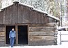 | March 8, 1977 (#77000123) | NW of Wilsonia 36°44′56″N 118°58′13″W / 36.748889°N 118.970278°W / 36.748889; -118.970278 (Gamlin Cabin) | Wilsonia | |
| 7 | Generals' Highway Stone Bridges |  | September 13, 1978 (#78000284) | N of Mineral King in Sequoia National Park 36°36′27″N 118°44′46″W / 36.6075°N 118.746111°W / 36.6075; -118.746111 (Generals' Highway Stone Bridges) | Mineral King | |
| 8 | Giant Forest Lodge Historic District |  | May 5, 1978 (#78000287) | NE of Three Rivers in Sequoia National Park 36°33′56″N 118°45′58″W / 36.565556°N 118.766111°W / 36.565556; -118.766111 (Giant Forest Lodge Historic District) | Three Rivers | |
| 9 | Giant Forest Village-Camp Kaweah Historic District |  | May 22, 1978 (#78000311) | N of Three Rivers in Sequoia National Park 36°33′52″N 118°46′24″W / 36.564444°N 118.773333°W / 36.564444; -118.773333 (Giant Forest Village-Camp Kaweah Historic District) | Three Rivers | |
| 10 | Groenfeldt Site | Upload image | March 30, 1978 (#78000288) | Address Restricted | Three Rivers | |
| 11 | Hockett Meadow Ranger Station |  | April 27, 1978 (#78000369) | S of Silver City in Sequoia National Park 36°22′37″N 118°39′19″W / 36.376944°N 118.655278°W / 36.376944; -118.655278 (Hockett Meadow Ranger Station) | Silver City | |
| 12 | Hospital Rock |  | August 29, 1977 (#77000122) | Address Restricted | Three Rivers | |
| 13 | Knapp Cabin |  | December 20, 1978 (#78000291) | W of Cedar Grove in Kings Canyon National Park 36°47′02″N 118°38′09″W / 36.783889°N 118.635833°W / 36.783889; -118.635833 (Knapp Cabin) | Cedar Grove | |
| 14 | Mineral King Road Cultural Landscape |  | October 24, 2003 (#03001063) | Mineral King Rd, Sequoia National Park 36°26′49″N 118°40′50″W / 36.446873°N 118.680531°W / 36.446873; -118.680531 (Mineral King Road Cultural Landscape) | Mineral King | |
| 15 | Moro Rock Stairway |  | December 29, 1978 (#78000283) | N of Three Rivers in Sequoia National Park 36°32′39″N 118°45′51″W / 36.544167°N 118.764167°W / 36.544167; -118.764167 (Moro Rock Stairway) | Three Rivers | |
| 16 | John Muir Memorial Shelter |  | August 15, 1978 (#16000576) | CA 180, Grant Grove Village in Kings Canyon National Park 37°06′43″N 118°40′15″W / 37.111995°N 118.670948°W / 37.111995; -118.670948 (John Muir Memorial Shelter) | Grant Grove | |
| 17 | Pear Lake Ski Hut |  | May 5, 1978 (#78000285) | N of Mineral King on Sequoia National Park 36°36′29″N 118°40′15″W / 36.608056°N 118.670833°W / 36.608056; -118.670833 (Pear Lake Ski Hut) | Mineral King | |
| 18 | Quinn Ranger Station |  | April 13, 1977 (#77000118) | S on Mineral King on Sequoia National Park 36°19′29″N 118°34′33″W / 36.324722°N 118.575833°W / 36.324722; -118.575833 (Quinn Ranger Station) | Mineral King | |
| 19 | Redwood Meadow Ranger Station |  | April 13, 1978 (#78000289) | NE of Three Rivers in Sequoia National Park 36°31′46″N 118°38′07″W / 36.529444°N 118.635278°W / 36.529444; -118.635278 (Redwood Meadow Ranger Station) | Three Rivers | |
| 20 | Shorty Lovelace Historic District |  | January 31, 1978 (#78000293) | E of Pinehurst on Kings Canyon National Park 36°44′26″N 118°31′03″W / 36.740556°N 118.5175°W / 36.740556; -118.5175 (Shorty Lovelace Historic District) | Pinehurst | |
| 21 | Smithsonian Institution Shelter |  | March 8, 1977 (#77000119) | W of Lone Pine in Sequoia National Park 36°34′49″N 118°17′32″W / 36.580278°N 118.292222°W / 36.580278; -118.292222 (Smithsonian Institution Shelter) | Lone Pine | |
| 22 | Squatter's Cabin |  | March 8, 1977 (#77000116) | NE of Three Rivers 36°33′31″N 118°45′09″W / 36.558611°N 118.7525°W / 36.558611; -118.7525 (Squatter's Cabin) | Three Rivers | |
| 23 | Tharp's Log |  | March 8, 1977 (#77000117) | NE of Three Rivers 36°33′40″N 118°44′29″W / 36.561111°N 118.741389°W / 36.561111; -118.741389 (Tharp's Log) | Three Rivers |
See also
- National Register of Historic Places listings in Fresno County, California
- National Register of Historic Places listings in Tulare County, California
- National Register of Historic Places listings in California
Wikimedia Commons has media related to National Register of Historic Places in Sequoia-Kings Canyon National Park.
References
- ^ The latitude and longitude information provided in this table was derived originally from the National Register Information System, which has been found to be fairly accurate for about 99% of listings. Some locations in this table may have been corrected to current GPS standards.
- ^ National Park Service, United States Department of the Interior, "National Register of Historic Places: Weekly List Actions", retrieved September 13, 2024.
- ^ Numbers represent an alphabetical ordering by significant words. Various colorings, defined here, differentiate National Historic Landmarks and historic districts from other NRHP buildings, structures, sites or objects.
- ^ The eight-digit number below each date is the number assigned to each location in the National Register Information System database, which can be viewed by clicking the number.
- v
- t
- e
- Ash Mountain Entrance Sign
- Barton-Lackey Cabin
- Bearpaw Meadow High Sierra Camp
- Cabin Creek Ranger Residence and Dormitory
- Cattle Cabin
- Gamlin Cabin
- Groenfeldt Site
- Hockett Meadow Ranger Station
- Hospital Rock
- Knapp Cabin
- Moro Rock Stairway
- John Muir Memorial Shelter
- Pear Lake Ski Hut
- Quinn Ranger Station
- Redwood Meadow Ranger Station
- Smithsonian Institution Shelter
- Squatter's Cabin
- Tharp's Log
See also: National Register of Historic Places listings in Sequoia-Kings Canyon National Parks


| ||
|---|---|---|
| Mountains |
|  |
| Giant sequoias |
| |
| Historic places | ||
| Other attractions |
| |
| People | ||
| Nearby places | ||
| ||
| |
|---|---|
| Topics | |
| Lists by state |
|
| Lists by insular areas | |
| Lists by associated state | |
| Other areas | |
| Related | |
| |


