Masoarivo, Antsalova
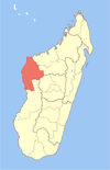
Place in Melaky, Madagascar
19°2′S 44°20′E / 19.033°S 44.333°E / -19.033; 44.333 Madagascar
[1]
[2]
(2001)[3]
406
Masoarivo is a rural municipality in western Madagascar. It belongs to the district of Antsalova, which is a part of the region of Melaky. The population of the commune was estimated to be approximately 8,000 in 2001 commune census.[3]
Masoarivo is served by a local airport and riverine harbour. Primary and junior level secondary education are available in town. The majority 54% of the population of the commune are farmers, while an additional 23% receives their livelihood from raising livestock. The most important crop is rice, while other important products are maize, cassava and bananas. Services provide employment for 3% of the population. Additionally fishing employs 20% of the population.[3]
Geography
This municipality borders to Trangahy in the West, to Antsalova in the North, and to the Mozambique Channel in the West. It is located at 120 km from Antsalova.[4]
It has a small harbour.
The National Road No.8 crosses the municipality, though it is practicable only in the dry season.
Protected areas
- Tsimembo-Manambolomaty protected area is partly situated in this municipality.
References
- ^ cepf.net
- ^ Estimated based on DEM data from Shuttle Radar Topography Mission
- ^ a b c "ILO census data". Cornell University. 2002. Retrieved 2008-03-04.
- ^ Worldbank.org
- v
- t
- e
Capital: Maintirano
- Antsalova
- Bekopaka
- Bemaraha Atsinanana
- Masoarivo
- Soahany
- Trangahy
- Ambolodia Sud
- Ampako
- Ankasakasa Tsibiray
- Antsirasira
- Bekodoka
- Besalampy
- Mahabe
- Marovoay Sud
- Soanenga
5 districts; 40 communes
19°2′S 44°20′E / 19.033°S 44.333°E / -19.033; 44.333
 | This Melaky location article is a stub. You can help Wikipedia by expanding it. |
- v
- t
- e


