Manara, Lebanon
Place in Beqaa, Lebanon
Manara المناره Hammara | |
|---|---|
 Alzaher house, Almanara, 1965 | |
| 33°38′53″N 35°53′10″E / 33.64806°N 35.88611°E / 33.64806; 35.88611 | |
| Country | Lebanon |
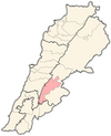
| Governorate | Beqaa |
| District | West Beqaa |
Manara, also known as Hammara, is a municipality in the West Beqaa district of the Beqaa Governorate in eastern Lebanon. It is located approximately 65 kilometers (40 mi) east of the capital Beirut. Its average elevation is 1,160 meters (3,810 ft) above sea level and its jurisdiction covers 1,413 hectares.[1] Its inhabitants are Sunni Muslims.[2]
References
- v
- t
- e
 Western Beqaa District, Beqaa Governorate
Capital: Joub Jannine
- Aammiq
- Aana
- Ain Zebdeh
- Aitanite
- Baaloul
- Bab Mareaa
- Baidar ech Chamout
- Dakoue
- Ghazzeh
- Haouch El Harimeh
- Kamid al lawz
- Kefraya
- Khiara
- Lala
- Libbaya
- Machghara
- Manara
- Marj
- Meidoun
- Qaraoun
- Qelaya
- Saghbine
- Sawiri
- Sohmor
- Sultan Yacoub
- Tell Zenoub
- Yohmor
- Zilaya
 | This Lebanon location article is a stub. You can help Wikipedia by expanding it. |
- v
- t
- e


