Los Comandos Airport
Airport

MSLD
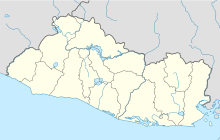
Location of the airport in El Salvador
| Direction | Length | Surface | |
|---|---|---|---|
| m | ft | ||
| 01/19 | 985 | 3,232 | Asphalt |
Source: Google Maps[1] GCM[2]
Los Comandos Airport (ICAO: MSLD) is an airstrip serving the town of San Francisco Gotera in Morazán Department, El Salvador.
The runway is 3 kilometres (1.9 mi) north of the town. There is rising terrain to the north.
The Soto Cano VORTAC (Ident: ESC) is located 48.9 nautical miles (90.6 km) northeast of Los Comandos. The Toncontin VOR-DME (Ident: TNT) is located 54.3 nautical miles (100.6 km) east-northeast of the airstrip.[3][4]
See also
 El Salvador portal
 Aviation portal
- Transport in El Salvador
- List of airports in El Salvador


References
External links
- OurAirports - Los Comandos
- OpenStreetMap - Los Comandos
- HERE Maps - Los Comandos
- FallingRain - Los Comandos
- v
- t
- e
- El Salvador portal
- Barrillas
- Cangrejera
- Ceiba Doblada
- Corral de Mulas
- Corral de Mulas San Juan
- El Jocotillo
- El Platanar
- El Tamarindo
- El Zapote
- Espiritu Santo
- Jiquilisco Casas Nuevas
- Jiquilisco La Carrera
- La Cabaña
- La Chepona
- La Unión
- San Francisco Gotera
- San Miguel El Papalon
- San Miguel La Aramuaca
- San Salvador Ilopango
- San Salvador Óscar Romero
- Santa Rosa de Lima
- Usulután
 | This article about a Central American airport is a stub. You can help Wikipedia by expanding it. |
- v
- t
- e
 | This El Salvador location article is a stub. You can help Wikipedia by expanding it. |
- v
- t
- e


