List of volcanoes in New Zealand
This is a partial list of active, dormant, and extinct volcanoes in New Zealand.
Kermadec Arc and Havre Trough
| Name | Elevation | Location | Last eruption | |
|---|---|---|---|---|
| metres | feet | Coordinates | ||
| Brothers Seamount | -1350 | -4400 | 34°52′30″S 179°04′30″E / 34.875°S 179.075°E / -34.875; 179.075 (Brothers) | - |
| Clark Seamount | -860 | -2800 | 36°26′46″S 177°50′20″E / 36.446°S 177.839°E / -36.446; 177.839 (Clark) | - |
| Cole Seamount[1] | -1100 | -3600 | 33°24′36″S 179°52′16″E / 33.410°S 179.871°E / -33.410; 179.871 | - |
| Cotton Seamount[2] | -950 | -3100 | 35°03′S 178°59′E / 35.05°S 178.99°E / -35.05; 178.99 (Cotton) | - |
| Curtis Island | 137 | 449 | 30°32′26.97″S 178°33′25.69″W / 30.5408250°S 178.5571361°W / -30.5408250; -178.5571361 (Curtis Island) | - |
| Gamble Seamount[3] | -226 | -741 | 27°12′25″S 177°25′55″W / 27.207°S 177.432°W / -27.207; -177.432 | - |
| Giggenbach Seamount[4] | -65 | -210 | 30°02′10″S 178°42′43″E / 30.036°S 178.712°E / -30.036; 178.712 (Giggenbach) | - |
| Havre Seamount | -730 | -2360 | 31°07′13″S 179°58′07″W / 31.12028°S 179.96861°W / -31.12028; -179.96861 | 2012 |
| Hinepuia Seamounts[5] | - | - | 26°20′35″S 177°19′01″W / 26.343°S 177.317°W / -26.343; -177.317 | - |
| Hinetāpeka Seamount[6] | -96 | -315 | 28°41′28″S 177°46′34″W / 28.691°S 177.776°W / -28.691; -177.776 | - |
| James Healy Seamount | -1150 | -3800 | 34°59′S 179°00′E / 34.98°S 179.00°E / -34.98; 179.00 (Healy) | 1360 |
| Macauley Island | 238 | 781 | 30°08′S 178°16′W / 30.14°S 178.26°W / -30.14; -178.26 (Macauley Island) | Holocene |
| Monowai Seamount | -100 | -330 | 25°53′13″S 177°11′17″W / 25.887°S 177.188°W / -25.887; -177.188 (Monowai Seamount) | 2008 |
| Pūtoto Seamount[7] | -225 | -738 | 27°55′48″S 177°36′40″W / 27.930°S 177.611°W / -27.930; -177.611 | - |
| Rakahore Seamount[8] | -560 | -1837 | 26°46′48″S 177°24′00″W / 26.780°S 177.400°W / -26.780; -177.400 | - |
| Raoul Island | 516 | 1693 | 29°10′S 177°33′W / 29.16°S 177.55°W / -29.16; -177.55 (Raoul Island) | 2006 |
| Rumble I Seamount | -1100 | -3610 | 35°30′S 178°54′E / 35.5°S 178.9°E / -35.5; 178.9 (Rumble I) | - |
| Rumble II Seamount | -880 | -2890 | 35°24′S 178°36′E / 35.4°S 178.6°E / -35.4; 178.6 (Rumble II) | - |
| Rumble III Seamount | -140 | -459 | 35°44′42″S 178°28′41″E / 35.745°S 178.478°E / -35.745; 178.478 (Rumble III) | 1986 |
| Rumble IV Seamount | -450 | -1476 | 36°08′S 178°03′E / 36.13°S 178.05°E / -36.13; 178.05 (Rumble IV) | - |
| Rumble V Seamount | -1100 | -3610 | 36°08′20″S 178°11′49″E / 36.139°S 178.197°E / -36.139; 178.197 (Rumble V) | - |
| Silent I Seamount[9] [10] | - | - | 34°58′30″S 179°16′59″E / 34.975°S 179.283°E / -34.975; 179.283 | - |
| Silent II Seamount[9] [11] | -780 | -2559 | 35°10′01″S 178°52′41″E / 35.167°S 178.878°E / -35.167; 178.878 | - |
| Tangaroa Seamount | -600 | -2000 | 36°19′16″S 178°01′41″E / 36.321°S 178.028°E / -36.321; 178.028 (Tangaroa) | - |
| Wright Seamounts[12] | -750 | -2500 | 31°30′S 179°12′E / 31.5°S 179.2°E / -31.5; 179.2 (Wright) | - |
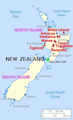
North Island
Taupō Volcanic Zone
| Name | Elevation | Location | Last eruption | |
|---|---|---|---|---|
| metres | feet | Coordinates | ||
| Hauhungatahi | 1521 | 4990 | 39°14′S 175°26′E / 39.23°S 175.44°E / -39.23; 175.44 (Hauhungatahi) | - |
| Kakaramea-Tihia Massif | 1300 | 4300 | 38°59′20″S 175°42′30″E / 38.98889°S 175.70833°E / -38.98889; 175.70833 (Kakaramea) | 20,000 years ago |
| Kawerau | - | - | - | - |
| Manawahe | 37°57′50″S 176°40′17″E / 37.9639°S 176.6713°E / -37.9639; 176.6713 (Manawahe) | ~ 400,000 years ago[13] | ||
| Mangakino Caldera | - | - | - | - |
| Maroa Caldera | 1156 | 3793 | 38°25′S 176°05′E / 38.42°S 176.08°E / -38.42; 176.08 (Maroa) | 180 |
| Maunga Kākaramea / Rainbow Mountain | 743 | 2438 | 38°19′08″S 176°23′17″E / 38.319°S 176.388°E / -38.319; 176.388 (Rainbow Mountain) | - |
| Mount Maunganui | 232 | - | 37°37′48″S 176°10′16″E / 37.630°S 176.171°E / -37.630; 176.171 (Mt Manganui) | - |
| Maungaongaonga | 825 | 2707 | 38°19′34″S 176°20′42″E / 38.326°S 176.345°E / -38.326; 176.345 (Maungaongaonga) | |
| Mayor Island / Tūhua | 338 | 1165 | 37°17′S 176°15′E / 37.283°S 176.250°E / -37.283; 176.250 (Mayor Island) | 4390 BC ± 200 years |
| Mokoia Island | - | - | 38°4′52.52″S 176°17′3.89″E / 38.0812556°S 176.2844139°E / -38.0812556; 176.2844139 (Mokoia Island) | - |
| Moutohora Island | 354 | 1161 | 37°51′29″S 176°58′48″E / 37.858°S 176.98°E / -37.858; 176.98 (Whale Island) | Pleistocene |
| Mount Ngauruhoe | 2291 | 7516 | 39°09′24.6″S 175°37′55.8″E / 39.156833°S 175.632167°E / -39.156833; 175.632167 (Ngauruhoe) | 1977 |
| Mount Ngongotahā | 487 | - | 39°7′5.59″S 176°11′51.20″E / 39.1182194°S 176.1975556°E / -39.1182194; 176.1975556 (Mount Ngongotahā) | - |
| Okataina Caldera | 1111 | 3645 | 38°07′S 176°30′E / 38.12°S 176.50°E / -38.12; 176.50 (Okataina) | 1973 |
| Pihanga | 1325 | 4347 | 39°02′28.75″S 175°46′7″E / 39.0413194°S 175.76861°E / -39.0413194; 175.76861 (Pihanga) | - |
| Putauaki (Mt Edgecumbe) | 867 | - | 38°06′S 176°48′E / 38.1°S 176.8°E / -38.1; 176.8 (Mount Edgecumbe) | ~ 300 BC[14] |
| Reporoa Caldera | 592 | 1942 | 38°25′S 176°20′E / 38.42°S 176.33°E / -38.42; 176.33 (Reporoa Caldera) | 1180 (hydrothermal) |
| Lake Rotorua | 757 | 2484 | 38°05′S 176°16′E / 38.08°S 176.27°E / -38.08; 176.27 (Lake Rotorua) | Pleistocene |
| Mount Ruapehu | 2797 | 9177 | 39°16′54.19″S 175°34′6.64″E / 39.2817194°S 175.5685111°E / -39.2817194; 175.5685111 (Mount Ruapehu) | 2007 |
| Rungapapa Knoll | - | - | 37°32′49″S 176°58′48″E / 37.547°S 176.98°E / -37.547; 176.98 | Pleistocene |
| Tama Lakes | - | - | - | - |
| Mount Tarawera (part of the Okataina caldera) | 1111 | 3644 | 38°13′S 176°30′E / 38.22°S 176.5°E / -38.22; 176.5 (Mount Tarawera) | 1886 |
| Mount Tauhara | 1087 | 3569 | 38°41′40″S 176°9′46″E / 38.69444°S 176.16278°E / -38.69444; 176.16278 (Mount Tauhara) | Pleistocene |
| Taupō Volcano | 760 | 2493 | 38°49′S 176°00′E / 38.82°S 176.00°E / -38.82; 176.00 (Lake Taupō) | 181 |
| Mount Tongariro | 1968 | 6456 | 39°8′S 175°39′E / 39.133°S 175.650°E / -39.133; 175.650 (Mount Tongariro) | 2012 |
| Waiotapu | 592 | 1942 | 38°25′S 176°20′E / 38.42°S 176.33°E / -38.42; 176.33 (Waiotapu) | 1180 |
| Whakaari / White Island | 321 | 1053 | 37°31′S 177°11′E / 37.52°S 177.18°E / -37.52; 177.18 (White Island) | 2024 |
| Whakatāne Seamount | -980 | -3200 | 36°48′S 177°30′E / 36.8°S 177.5°E / -36.8; 177.5 (Whakatāne Seamount) | - |
Elsewhere
| Name | Elevation | Location | Last eruption | |
|---|---|---|---|---|
| metres | feet | Coordinates | ||
| Auckland volcanic field | 260 | 853 | 36°54′S 174°52′E / 36.90°S 174.87°E / -36.90; 174.87 (Auckland volcanic field) | 1421 |
| Bombay Hills (part of the South Auckland volcanic field) | 379 | - | - | 550,000 years ago |
| Kārewa / Gannet Island | - | - | - | 500,000 years ago |
| Kaikohe-Bay of Islands volcanic field | 388 | 1273 | 35°18′S 173°54′E / 35.30°S 173.90°E / -35.30; 173.90 (Kaikohe) | 400 ± 300 years |
| Kaitake | - | - | - | 500,000 years ago |
| Kakepuku | 449 | 1473 | 38°04′06″S 175°15′07″E / 38.06833°S 175.25194°E / -38.06833; 175.25194 (Kakepuku) | 1.6 million years ago |
| Karioi | 756 | 2480 | 37°30′S 174°29′E / 37.50°S 174.49°E / -37.50; 174.49 (Karioi) | 2.4 million years ago |
| Little Barrier Island | 722 | 2360 | - | 1.5 million years ago |
| Manukau volcano | 474 | 1555 | 36°54′S 174°18′E / 36.9°S 174.3°E / -36.9; 174.3 (Waitākere volcano) | 16 million years ago[15] |
| Maungatautari | 797 | 2615 | 38°01′08″S 175°34′33″E / 38.01887°S 175.57579°E / -38.01887; 175.57579 (Maungatautari) | 1.8 million years ago[15] |
| Paritutu and the Sugar Loaf Islands | 153 | - | - | 1.7 million years ago[16] |
| Mount Pirongia | 962 | 3156 | 37°59′28″S 175°05′53″E / 37.99111°S 175.09806°E / -37.99111; 175.09806 (Pirongia) | 1.6 million years ago |
| Pureora | 1165 | 3822 | 38°33′07″S 175°37′40″E / 38.551872°S 175.627846°E / -38.551872; 175.627846 (Mount Pureora) | 1.6 million years ago[15] |
| Ngatutura volcanic field | 140 | - | 37°32′S 174°48′E / 37.54°S 174.80°E / -37.54; 174.80 (Ngatutura volcanic field) | 1.6 million years ago |
| Poor Knights Islands | - | - | - | 4 million years ago |
| Pouakai | - | - | - | 240,000 years ago |
| Rangitoto Island (part of the Auckland volcanic field) | 260 | 853 | 36°47′13″S 174°51′29″E / 36.78694°S 174.85806°E / -36.78694; 174.85806 (Rangitoto Island) | 1350 |
| South Auckland volcanic field | 379 | - | 37°11′44″S 175°01′05″E / 37.1955°S 175.0181°E / -37.1955; 175.0181 (South Auckland volcanic field) | 550,000 years ago |
| Mount Taranaki or Mount Egmont | 2518 | 8261 | 39°18′S 174°06′E / 39.3°S 174.1°E / -39.3; 174.1 (Mount Taranaki) | 1755 |
| Titiraupenga | 1042 | 3419 | 38°30′36″S 175°41′31″E / 38.509927°S 175.691857°E / -38.509927; 175.691857 (Mount Titiraupenga) | 1.89 million years ago[15] |
| Whangarei volcanic field | 397 | 1302 | 35°45′S 174°16′E / 35.75°S 174.27°E / -35.75; 174.27 (Whangarei) | - |
South Island
| Name | Elevation | Location | Last eruption | |
|---|---|---|---|---|
| meters | feet | Coordinates | ||
| Mount Somers | 1,688 | 5,538 | 43.70°S 171.40°E | 89 million years ago |
| Akaroa Volcano | - | - | 43°48′S 172°57′E / 43.800°S 172.950°E / -43.800; 172.950 (Akaroa) | Miocene |
| Dunedin Volcano | 680 | 2218 | 45°49′S 170°39′E / 45.817°S 170.650°E / -45.817; 170.650 (Otago Harbour) | c. 10 million years ago [17] |
| Mount Horrible (near Timaru) | - | - | 44°23′S 171°3′E / 44.383°S 171.050°E / -44.383; 171.050 (Mount Horrible) | 2 million years ago [18] |
| Lyttelton Volcano | 919 | 3010 | 43°36′S 172°43′E / 43.600°S 172.717°E / -43.600; 172.717 (Lyttelton Harbour) | Miocene |
Other
| Name | Elevation | Location | Last eruption | |
|---|---|---|---|---|
| meters | feet | Coordinates | ||
| Antipodes Islands | 402 | 1319 | 49°41′S 178°46′E / 49.68°S 178.77°E / -49.68; 178.77 (Antipodes Islands) | Holocene |
| Auckland Island | 650 | 1981 | 50°41′S 166°05′E / 50.69°S 166.08°E / -50.69; 166.08 (Auckland Island) | Miocene[19] |
| Mount Dick (Adams Island)[20] | 705 | 2313 | 50°52′28″S 166°4′55″E / 50.87444°S 166.08194°E / -50.87444; 166.08194 | - |
| Pitt Island | 241 | 791 | 44°11′S 176°08′W / 44.18°S 176.13°W / -44.18; -176.13 (Pitt Island) | Ancient[vague] |
| Solander Islands | 330 | 1080 | 46°34′S 166°53′E / 46.567°S 166.883°E / -46.567; 166.883 (Solander Islands) | Pleistocene |
Ross Dependency
New Zealand also has de facto administration over Ross Dependency in Antarctica, which contains the following volcanoes:
| Name | Elevation | Location | Last eruption | |
|---|---|---|---|---|
| meters | feet | Coordinates | ||
| Mount Bird (Ross Island) | 1765 | 5791 | 77°16′S 166°45′E / 77.267°S 166.750°E / -77.267; 166.750 (Mount Bird) | 3.8 million years ago[21] |
| Brown Peak (Sturge Island, Balleny Islands) | 1500 | 5000 | 67°24′S 164°50′E / 67.400°S 164.833°E / -67.400; 164.833 (Brown Peak) | 2001 |
| Buckle Island (Balleny Islands) | 1239 | 4065 | 66°48′S 163°15′E / 66.800°S 163.250°E / -66.800; 163.250 (Buckle Island) | 1899 |
| Mount Discovery (Scott Coast) | 2681 | 8796 | 78°22′S 166°01′E / 78.367°S 166.017°E / -78.367; 166.017 (Mount Bird) | 1.8 million years ago[22] |
| Mount Erebus (Ross Island) | 3794 | 12448 | 77°32′S 167°17′E / 77.533°S 167.283°E / -77.533; 167.283 (Mount Erebus) | 2008 (continuing) |
| Mount Terror (Ross Island) | 3230 | 10597 | 77°31′S 168°32′E / 77.517°S 168.533°E / -77.517; 168.533 (Mount Terror) | ~ 800,000 years ago |
| Young Island (Balleny Islands) | 1340 | 4396 | 66°25′S 162°27′E / 66.417°S 162.450°E / -66.417; 162.450 (Young Island) | - |
References
- ^ "Place name detail: 55517". New Zealand Gazetteer. New Zealand Geographic Board. Retrieved 7 April 2024.
- ^ "Place name detail: 55518". New Zealand Gazetteer. New Zealand Geographic Board. Retrieved 8 April 2024.
- ^ "Place name detail: 55522". New Zealand Gazetteer. New Zealand Geographic Board. Retrieved 7 April 2024.
- ^ "Place name detail: 55523". New Zealand Gazetteer. New Zealand Geographic Board. Retrieved 7 April 2024.
- ^ "Place name detail: 56548". New Zealand Gazetteer. New Zealand Geographic Board. Retrieved 7 April 2024.
- ^ "Place name detail: 55531". New Zealand Gazetteer. New Zealand Geographic Board. Retrieved 7 April 2024.
- ^ "Place name detail: 55542". New Zealand Gazetteer. New Zealand Geographic Board. Retrieved 7 April 2024.
- ^ "Place name detail: 55543". New Zealand Gazetteer. New Zealand Geographic Board. Retrieved 7 April 2024.
- ^ a b John H. Latter, Edwards F. Lloyd, Ian E.M. Smith, and Simon Nathan. () New Zealand's volcanoes: Kermadec Islands Archived 2010-05-22 at the Wayback Machine. Volcanic Hazards Working Group, Civil Defence Scientific Advisory Committee.
- ^ "Place name detail: 14795". New Zealand Gazetteer. New Zealand Geographic Board. Retrieved 7 April 2024.
- ^ "Place name detail: 55553". New Zealand Gazetteer. New Zealand Geographic Board. Retrieved 7 April 2024.
- ^ "Place name detail: 55560". New Zealand Gazetteer. New Zealand Geographic Board. Retrieved 8 April 2024.
- ^ Nairn, I.A.; Beanland, S. (1989). "Geological setting of the 1987 Edgecumbe earthquake, New Zealand". New Zealand Journal of Geology and Geophysics. 32: 1–13. doi:10.1080/00288306.1989.10421383. Retrieved 30 October 2011.
- ^ "Okataina: Eruptive History". Global Volcanism Program. Smithsonian Institution.
- ^ a b c d Pittari, Adrian; Prentice, Marlena L.; McLeod, Oliver E.; Zadeh, Elham Yousef; Kamp, Peter J. J.; Danišík, Martin; Vincent, Kirsty A. (2021). "Inception of the modern North Island (New Zealand) volcanic setting: spatio-temporal patterns of volcanism between 3.0 and 0.9 Ma" (PDF). New Zealand Journal of Geology and Geophysics. 64 (2–3): 250–272. doi:10.1080/00288306.2021.1915343. S2CID 235736318.
- ^ Price, R. C; R. B. Stewart; J. D. Woodhead; I. E. M. Smith (1999). "Petrogenesis of High-K Arc Magmas: Evidence from Egmont Volcano, North Island, New Zealand". Journal of Petrology. 40 (1): 167–197. doi:10.1093/petrology/40.1.167.
- ^ Bishop, D.G., and Turnbull, I.M. (compilers) (1996). Geology of the Dunedin Area. Lower Hutt, NZ: Institute of Geological & Nuclear Sciences. ISBN 0-478-09521-X.
- ^ Wilson, John (2009). "South Canterbury region – Landscape and geology". Te Ara – the Encyclopedia of New Zealand.
- ^ Adams, C.J (1983). "Age of the volcanoes and granite basements of the Auckland Islands, Southwest Pacific". New Zealand Journal of Geology and Geophysics. 26 (3): 227–237. doi:10.1080/00288306.1983.10422237.
- ^ Auckland Islands Archived 2009-03-20 at archive.today. Polar Conservation Organisation.
- ^ "Mount Bird, Ross Island, Antarctica," http://volcano.oregonstate.edu. Retrieved 10 June 2019.
- ^ "Mount Discovery, Antarctica," http://volcano.oregonstate.edu. Retrieved 10 June 2019.
External links
Map all coordinates using OpenStreetMap
Download coordinates as:
- KML
- GPX (all coordinates)
- GPX (primary coordinates)
- GPX (secondary coordinates)
- New Zealand's Volcanoes at GNS Science


