List of the highest islands of North America

The following sortable table comprises the 76 highest ocean islands of greater North America. Each of these islands rises at least 1000 meters (3281 feet) above the sea.
This article defines the ocean islands of greater North America to include the coastal islands of North America, the islands of the Caribbean Sea, the Lucayan Archipelago, the islands of Greenland (Kalaallit Nunaat), the islands of Canada, and the islands of Alaska. The Hawaiian Islands are not included because they are considered part of Oceania.
Highest islands
Map this section's coordinates using OpenStreetMap
Download coordinates as:
- KML
- GPX (all coordinates)
- GPX (primary coordinates)
- GPX (secondary coordinates)
Greenland and Hispaniola rise above 3000 meters (9843 feet). Eleven islands rise above 2000 meters (6562 feet), and the following 76 islands rise above 1000 meters (3281 feet).
| Rank | Island | Region | Summit | Elevation | Location |
|---|---|---|---|---|---|
| 1 | Island of Greenland[1] |  Greenland Greenland | Gunnbjørn Fjeld[2][3][a][b] | 3694 m 12,119 ft | 68°55′06″N 29°53′57″W / 68.9184°N 29.8991°W / 68.9184; -29.8991 (Gunnbjørn Fjeld) |
| 2 | Island of Hispaniola |  Dominican Republic Dominican Republic Haiti Haiti | Pico Duarte[4][c] | 3098 m 10,164 ft | 19°01′23″N 70°59′52″W / 19.0231°N 70.9977°W / 19.0231; -70.9977 (Pico Duarte) |
| 3 | Unimak Island | Shishaldin Volcano[5][6][d][e] | 2869 m 9,414 ft | 54°45′19″N 163°58′15″W / 54.7554°N 163.9709°W / 54.7554; -163.9709 (Shishaldin Volcano) | |
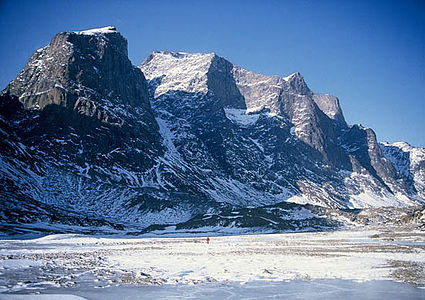
| 4 | Ellesmere Island |  Nunavut Nunavut | Barbeau Peak[7][8][f][g] | 2616 m 8,583 ft | 81°54′53″N 75°00′33″W / 81.9148°N 75.0093°W / 81.9148; -75.0093 (Barbeau Peak) |
| 5 | Island of Jamaica |  Jamaica Jamaica | Blue Mountain Peak[9][h][i] | 2256 m 7,402 ft | 18°02′47″N 76°34′44″W / 18.0465°N 76.5788°W / 18.0465; -76.5788 (Blue Mountain Peak) |
| 6 | Axel Heiberg Island | Nunavut | Outlook Peak[10][11][j] | 2210 m 7,251 ft | 79°44′23″N 91°24′22″W / 79.7397°N 91.4061°W / 79.7397; -91.4061 (Outlook Peak) |
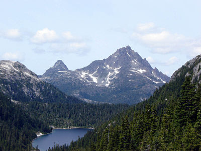
| 7 | Vancouver Island |  British Columbia British Columbia | Golden Hinde[12][13][k] | 2197 m 7,208 ft | 49°39′46″N 125°44′49″W / 49.6627°N 125.7470°W / 49.6627; -125.7470 (Golden Hinde) |
| 8 | Umnak Island | Mount Vsevidof[14][15][l][m] | 2149 m 7,051 ft | 53°07′32″N 168°41′38″W / 53.1256°N 168.6938°W / 53.1256; -168.6938 (Mount Vsevidof) | |
| 9 | Baffin Island[16] | Nunavut | Mount Odin[17][18][n][o] | 2143 m 7,031 ft | 66°32′48″N 65°25′44″W / 66.5468°N 65.4289°W / 66.5468; -65.4289 (Mount Odin) |
| 10 | Upernivik | Greenland | Palup Qaqa[19] | 2105 m 6,906 ft | 71°20′00″N 52°49′00″W / 71.3333°N 52.8167°W / 71.3333; -52.8167 (Palup Qaqa high point) |
| 11 | Island of Milne Land | Greenland | Milne Land high point[20] | 2050 m 6,726 ft | 70°49′10″N 26°35′44″W / 70.8194°N 26.5956°W / 70.8194; -26.5956 (Milne Land high point) |
| 12 | Island of Cuba[21] |  Cuba Cuba | Pico Turquino[22][p][q] | 1974 m 6,476 ft | 19°59′23″N 76°50′10″W / 19.9898°N 76.8360°W / 19.9898; -76.8360 (Pico Turquino) |
| 13 | Bylot Island | Nunavut | Angilaaq Mountain[23][24][r] | 1944 m 6,378 ft | 73°13′47″N 78°37′23″W / 73.2298°N 78.6230°W / 73.2298; -78.6230 (Angilaaq Mountain) |
| 14 | Devon Island | Nunavut | Devon Ice Cap high point[25][26][s] | 1920 m 6,300 ft | 75°20′34″N 82°37′07″W / 75.3429°N 82.6186°W / 75.3429; -82.6186 (Devon Ice Cap high point) |
| 15 | Disko Island | Greenland | Pyramiden[27][t][u] | 1904 m 6,247 ft | 70°07′10″N 53°23′20″W / 70.1195°N 53.3890°W / 70.1195; -53.3890 (Pyramiden) |
| 16 | Ymer Island | Greenland | Angelin Bjerg[28][v] | 1900 m 6,234 ft | 73°10′00″N 24°19′00″W / 73.1667°N 24.3167°W / 73.1667; -24.3167 (Angelin Bjerg) |
| 17 | Traill Island | Greenland | Traill Island high point[29] | 1884 m 6,181 ft | 72°43′00″N 24°04′00″W / 72.7167°N 24.0667°W / 72.7167; -24.0667 (Traill Island high point) |
| 18 | Tanaga Island | Tanaga Volcano[30][31][w][x] | 1806 m 5,925 ft | 51°53′02″N 178°08′34″W / 51.8838°N 178.1429°W / 51.8838; -178.1429 (Tanaga Volcano) | |
| 19 | Unalaska Island | Makushin Volcano[32][33][y] | 1800 m 5,905 ft | 53°52′42″N 166°55′48″W / 53.8782°N 166.9299°W / 53.8782; -166.9299 (Makushin Volcano) | |
| 20 | Island of Storo | Greenland | Storo high point[34] | 1770 m 5,807 ft | 70°50′00″N 27°29′00″W / 70.8333°N 27.4833°W / 70.8333; -27.4833 (Storo high point) |
| 21 | Qeqertaq Island | Greenland | Snehaetten[35][z] | 1765 m 5,791 ft | 71°39′15″N 53°09′51″W / 71.6542°N 53.1641°W / 71.6542; -53.1641 (Snehaetten) |
| 22 | Great Sitkin Island | Great Sitkin Volcano[36][37][aa] | 1740 m 5,710 ft | 52°04′35″N 176°06′39″W / 52.0763°N 176.1108°W / 52.0763; -176.1108 (Great Sitkin Volcano) | |
| 23 | Island of Skjoldungen | Greenland | Azimuthbjerg[38][ab] | 1738 m 5,702 ft | 63°27′19″N 41°51′03″W / 63.4552°N 41.8508°W / 63.4552; -41.8508 (Azimuthbjerg) |
| 24 | Geographical Society Island | Greenland | Svedenborg Bjerg[39][ac] | 1730 m 5,676 ft | 72°56′37″N 24°20′28″W / 72.9436°N 24.3412°W / 72.9436; -24.3412 (Svedenborg Bjerg) |
| 25 | Chuginadak Island | Mount Cleveland[40][41][42][ad] | 1730 m 5,675 ft | 52°49′23″N 169°56′47″W / 52.8230°N 169.9465°W / 52.8230; -169.9465 (Mount Cleveland) | |
| 26 | Agpat Island | Greenland | Appaalik[43][ae] | 1711 m 5,614 ft | 70°56′51″N 51°59′30″W / 70.9474°N 51.9918°W / 70.9474; -51.9918 (Appaalik) |
| 27 | King Island | British Columbia | Farquhar Peak[44][45][af] | 1679 m 5,509 ft | 52°19′18″N 127°18′23″W / 52.3216°N 127.3065°W / 52.3216; -127.3065 (Farquhar Peak) |
| 28 | Sillem Island | Nunavut | Sillem Peak[46][47][ag] | 1660 m 5,446 ft | 71°00′06″N 71°51′11″W / 71.0018°N 71.8531°W / 71.0018; -71.8531 (Sillem Peak) |
| 29 | Baranof Island | Veniaminof Peak[48][49][ah] | 1643 m 5,390 ft | 57°00′54″N 134°59′18″W / 57.0151°N 134.9882°W / 57.0151; -134.9882 (Veniaminof Peak) | |
| 30 | Carlisle Island | Carlisle Volcano[50][51][52][ai] | 1610 m 5,283 ft | 52°53′29″N 170°03′29″W / 52.8913°N 170.0580°W / 52.8913; -170.0580 (Carlisle Volcano) | |
| 31 | Salliaruseq Island | Greenland | Salliaruseq high point[53] | 1610 m 5,282 ft | 64°23′29″N 51°06′48″W / 64.3913°N 51.1134°W / 64.3913; -51.1134 (Salliaruseq high point) |
| 32 | Clavering Island | Greenland | Clavering Island high point[54] | 1604 m 5,262 ft | 74°22′00″N 21°11′00″W / 74.3667°N 21.1833°W / 74.3667; -21.1833 (Clavering Island high point) |
| 33 | East Redonda Island | British Columbia | Mount Addenbroke[55][56][aj] | 1591 m 5,220 ft | 50°13′54″N 124°41′10″W / 50.2316°N 124.6861°W / 50.2316; -124.6861 (Mount Addenbroke) |
| 34 | Gareloi Island | Gareloi Volcano[57][58][59][ak][al] | 1573 m 5,160 ft | 51°47′17″N 178°47′38″W / 51.7880°N 178.7940°W / 51.7880; -178.7940 (Gareloi Volcano) | |
| 35 | Island of Sangmissoq | Greenland | Sangmissoq high point[60][am] | 1549 m 5,082 ft | 60°03′01″N 43°54′59″W / 60.0502°N 43.9164°W / 60.0502; -43.9164 (Sangmissoq high point) |
| 36 | Atka Island | Korovin Volcano[61][62][an] | 1533 m 5,030 ft | 52°22′54″N 174°09′55″W / 52.3816°N 174.1653°W / 52.3816; -174.1653 (Korovin Volcano) | |
| 37 | Admiralty Island | Kootznoowoo Peak[63][ao] | 1478 m 4,850 ft | 57°47′21″N 134°27′17″W / 57.7891°N 134.4546°W / 57.7891; -134.4546 (Kootznoowoo Peak) | |
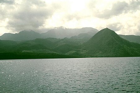
| 38 | île de Basse-Terre |  Guadeloupe Guadeloupe | La Grande Soufrière[64][ap][aq] | 1467 m 4,813 ft | 16°02′42″N 61°39′50″W / 16.0449°N 61.6638°W / 16.0449; -61.6638 (La Grande Soufrière) |
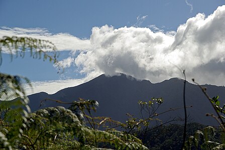
| 39 | Island of Dominica |  Dominica Dominica | Morne Diablotins[65][ar][as] | 1447 m 4,747 ft | 15°30′14″N 61°23′53″W / 15.5040°N 61.3981°W / 15.5040; -61.3981 (Morne Diablotins) |
| 40 | Revillagigedo Island | Mount Reid[66][at] | 1400 m 4,592 ft | 55°42′23″N 131°14′50″W / 55.7065°N 131.2472°W / 55.7065; -131.2472 (Mount Reid) | |
| 41 | Island of Martinique |  Martinique Martinique | Montagne Pelée[67][au][av] | 1395 m 4,577 ft | 14°48′33″N 61°09′55″W / 14.8092°N 61.1654°W / 14.8092; -61.1654 (Montagne Pelée) |
| 42 | Kodiak Island[68] | Koniag Peak[69][70][aw] | 1378 m 4,520 ft | 57°21′17″N 153°19′25″W / 57.3548°N 153.3235°W / 57.3548; -153.3235 (Koniag Peak) | |
| 43 | Island of Puerto Rico |  Puerto Rico Puerto Rico | Cerro de Punta[71][72][ax] | 1337.8 m 4,389 ft | 18°10′20″N 66°35′30″W / 18.1722°N 66.5917°W / 18.1722; -66.5917 (Cerro de Punta) |
| 44 | Ammassalik Island | Greenland | Ammassalik Island high point[73] | 1335 m 4,380 ft | 65°50′03″N 37°36′42″W / 65.8343°N 37.6118°W / 65.8343; -37.6118 (Ammassalik Island high point) |
| 45 | Herbert Island | Herbert Volcan[74][75][ay] | 1311 m 4,300 ft | 52°44′26″N 170°06′51″W / 52.7405°N 170.1142°W / 52.7405; -170.1142 (Herbert Volcano) | |
| 46 | Isla Guadalupe |  Baja California Baja California | Isla Guadalupe high point[76][az] | 1310 m 4,298 ft | 29°06′06″N 118°18′48″W / 29.1016°N 118.3132°W / 29.1016; -118.3132 (Isla Guadalupe high point) |
| 47 | Kanaga Island | Mount Kanaga[77][78][ba] | 1307 m 4,287 ft | 51°55′26″N 177°09′44″W / 51.9238°N 177.1623°W / 51.9238; -177.1623 (Mount Kanaga) | |
| 48 | Akutan Island | Mount Akutan[79][80][bb] | 1296 m 4,251 ft | 54°07′59″N 165°59′07″W / 54.1330°N 165.9854°W / 54.1330; -165.9854 (Mount Akutan) | |
| 49 | Island of Saint Vincent |  Saint Vincent and the Grenadines Saint Vincent and the Grenadines | La Soufrière[81][bc][bd] | 1234 m 4,049 ft | 13°20′52″N 61°10′34″W / 13.3477°N 61.1761°W / 13.3477; -61.1761 (La Soufrière) |
| 50 | Augustine Island | Augustine Volcano[82][83][be] | 1227 m 4,025 ft | 59°21′44″N 153°25′59″W / 59.3622°N 153.4330°W / 59.3622; -153.4330 (Augustine Volcano) | |
| 51 | Semisopochnoi Island | Anvil Peak[84][85][bf][bg] | 1221 m 4,007 ft | 51°59′09″N 179°36′08″E / 51.9859°N 179.6021°E / 51.9859; 179.6021 (Anvil Peak) | |
| 52 | Kiska Island | Kiska Volcano[86][87][bh][bi] | 1220 m 4,004 ft | 52°06′10″N 177°36′11″E / 52.1027°N 177.6030°E / 52.1027; 177.6030 (Kiska Volcano) | |
| 53 | Prince of Wales Island | Prince of Wales Island high point[88] | 1218 m 3,996 ft | 55°32′14″N 132°52′38″W / 55.5373°N 132.8773°W / 55.5373; -132.8773 (Prince of Wales Island high point) | |
| 54 | Etolin Island | Etolin Island high point[89] | 1207 m 3,960 ft | 56°07′11″N 132°19′31″W / 56.1196°N 132.3253°W / 56.1196; -132.3253 (Etolin Island high point) | |
| 55 | Kupreanof Island | Sherman Peak[90][bj] | 1204 m 3,950 ft | 56°53′49″N 133°02′51″W / 56.8969°N 133.0476°W / 56.8969; -133.0476 (Sherman Peak) | |
| 56 | Isla Cedros | Baja California | Isla Cedros high point[91] | 1200 m 3,937 ft | 28°07′48″N 115°13′14″W / 28.1301°N 115.2206°W / 28.1301; -115.2206 (Isla Cedros high point) |
| 57 | Adak Island | Mount Moffett[92][bk] | 1196 m 3,924 ft | 51°56′11″N 176°44′27″W / 51.9363°N 176.7409°W / 51.9363; -176.7409 (Mount Moffett) | |
| 58 | Chichagof Island | Chichagof Island high point[93][94] | 1191 m 3,909 ft | 57°48′54″N 135°10′48″W / 57.8149°N 135.1801°W / 57.8149; -135.1801 (Chichagof Island high point) | |
| 59 | Moresby Island | British Columbia | Mount Moresby[95][bl] | 1164 m 3,819 ft | 53°01′09″N 132°05′08″W / 53.0191°N 132.0856°W / 53.0191; -132.0856 (Mount Moresby) |
| 60 | Segula Island | Segula Peak[96][97][bm] | 1163 m 3,817 ft | 52°00′53″N 178°08′08″E / 52.0147°N 178.1356°E / 52.0147; 178.1356 (Segula Peak) | |
| 61 | Saint Christopher Island (Island of Saint Kitts) |  Saint Kitts and Nevis Saint Kitts and Nevis | Mount Liamuiga[98][bn] (Mount Misery) | 1156 m 3,793 ft | 17°22′07″N 62°48′10″W / 17.3685°N 62.8029°W / 17.3685; -62.8029 (Mount Liamuiga) |
| 62 | Chagulak Island | Chagulak Volcano[99][100][bo] | 1143 m 3,750 ft | 52°34′16″N 171°08′20″W / 52.5711°N 171.1388°W / 52.5711; -171.1388 (Chagulak Volcano) | |
| 63 | Graham Island | British Columbia | Mount La Pérouse[101][102][bp] | 1127 m 3,698 ft | 53°13′26″N 132°30′40″W / 53.2240°N 132.5110°W / 53.2240; -132.5110 (Mount La Pérouse) |
| 64 | Princess Royal Island | British Columbia | Canoona Peak[103][104][bq] | 1104 m 3,622 ft | 53°00′17″N 128°35′25″W / 53.0048°N 128.5904°W / 53.0048; -128.5904 (Canoona Peak) |
| 65 | Pitt Island | British Columbia | Heavenor Peak[105][br] | 1099 m 3,606 ft | 53°43′00″N 129°54′00″W / 53.7167°N 129.9000°W / 53.7167; -129.9000 (Heavenor Peak) |
| 66 | Annette Island | Tamgas Mountain[106][bs] | 1095 m 3,591 ft | 55°03′58″N 131°24′28″W / 55.0660°N 131.4077°W / 55.0660; -131.4077 (Tamgas Mountain) | |
| 67 | Louise Island | British Columbia | Mount Kermode[107][108][bt] | 1091 m 3,579 ft | 52°57′25″N 131°51′28″W / 52.9569°N 131.8577°W / 52.9569; -131.8577 (Mount Kermode) |
| 68 | Isla Ángel de la Guarda | Baja California | Isla Ángel de la Guarda high point[109] | 1090 m 3,576 ft | 29°27′26″N 113°30′59″W / 29.4571°N 113.5163°W / 29.4571; -113.5163 (Isla Angel de la Guarda high point) |
| 69 | Kuiu Island | Kuiu Island high point[110] | 1080 m 3,542 ft | 56°48′11″N 134°22′48″W / 56.8031°N 134.3800°W / 56.8031; -134.3800 (Kuiu Island high point) | |
| 70 | Gribbell Island | British Columbia | Gribbel Peak[111][112][bu] | 1077 m 3,533 ft | 53°23′00″N 128°58′00″W / 53.3833°N 128.9667°W / 53.3833; -128.9667 (Gribbel Peak) |
| 71 | Seguam Island | Pyre Peak[113][114][115][bv] | 1054 m 3,458 ft | 52°18′57″N 172°30′38″W / 52.3159°N 172.5106°W / 52.3159; -172.5106 (Pyre Peak) | |
| Douglas Island | Mount Meek[116][117][bw] | 1054 m 3,458 ft | 58°16′56″N 134°36′15″W / 58.2823°N 134.6043°W / 58.2823; -134.6043 (Mount Meek) | ||
| 73 | Isla Socorro |  Colima Colima | Volcán Everman[118][bx] | 1050 m 3,445 ft | 18°48′00″N 110°59′00″W / 18.8000°N 110.9833°W / 18.8000; -110.9833 (Volcán Everman) |
| 74 | West Redonda Island | British Columbia | Mount Perritt[119][120][by] | 1048 m 3,438 ft | 50°16′00″N 124°53′00″W / 50.2667°N 124.8833°W / 50.2667; -124.8833 (Mount Perritt) |
| 75 | Calvert Island | British Columbia | Mount Buxton[121][122][bz] | 1017 m 3,337 ft | 51°36′00″N 127°59′00″W / 51.6000°N 127.9833°W / 51.6000; -127.9833 (Mount Buxton) |
| 76 | Mitkof Island | Crystal Mountain[123][ca] | 1011 m 3,317 ft | 56°35′04″N 132°52′02″W / 56.5844°N 132.8672°W / 56.5844; -132.8672 (Crystal Mountain) |
Gallery
-
 1. Gunnbjørn Fjeld is the highest summit of the Island of Greenland, Kalaallit Nunaat, the Kingdom of Denmark, and the entire Arctic.
 -
 2. Pico Duarte is the highest summit in the Dominican Republic, the Island of Hispaniola, and the entire Caribbean.
 -

-

-
-
 8. Mount Vsevidof is the highest summit of Umnak Island and the Fox Islands in the Aleutian Islands of Alaska.
 -
-
 12. Pico Turquino is the highest summit of the island and Republic of Cuba.
 -
 18. Tanaga Volcano is the highest summit of Tanaga Island and the Andreanof Islands in the Aleutian Islands of Alaska.
 -

-
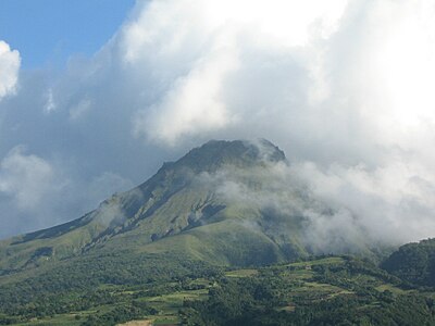
 39. The active volcano Morne Diablotins is the highest summit of the island and Commonwealth of Dominica.
 -
 41. Montagne Pelée is the highest summit on the Island of Martinique and the French Région Martinique.
 -
 43. Cerro de Punta is the highest summit of the island and Commonwealth of Puerto Rico.
 -


See also
 Geography portal
 Islands portal
 Mountains portal
 Volcanoes portal
 North America portal


- North America
- Geography of North America
- List of islands of North America
- List of the highest islands of North America
- List of islands of North America
- Geography of North America
- Islands
- Mountains
- Volcanoes
Notes
- ^ The summit of Gunnbjørn Fjeld is the highest point of the Island of Greenland, Kalaallit Nunaat, the Kingdom of Denmark, and the entire Arctic.
- ^ Gunnbjørn Fjeld is the easternmost summit of its elevation in greater North America.
- ^ The summit of Pico Duarte is the highest point of the Dominican Republic, the Island of Hispaniola, and all islands of the Caribbean Sea.
- ^ The summit of Shishaldin Volcano is the highest point of Unimak Island and the Aleutian Islands.
- ^ Shishaldin Volcano is the westernmost summit of its elevation in Alaska, the United States, and greater North America.
- ^ The summit of Barbeau Peak is the highest point of Ellesmere Island and Nunavut of Canada.
- ^ Barbeau Peak is the northernmost ultra-prominent summit of Canada and greater North America.
- ^ The summit of Blue Mountain Peak is the highest point of the island and the nation of Jamaica.
- ^ Blue Mountain Peak is the southernmost and westernmost 2000-meter (6562-foot) summit and ultra-prominent summit of the Caribbean.
- ^ The summit of Outlook Peak is the highest point of Axel Heiberg Island.
- ^ The summit of Golden Hinde is the highest point of Vancouver Island.
- ^ The summit of Mount Vsevidof is the highest point of Umnak Island and the Fox Islands.
- ^ Mount Vsevidof is the westernmost 2000-meter (6562-foot) summit of Alaska, the United States, and greater North America.
- ^ The summit of Mount Odin is the highest point of Baffin Island.
- ^ Mount Odin is the easternmost summit of its elevation in Canada.
- ^ The summit of Pico Turquino is the highest point of the island and Republic of Cuba.
- ^ Pico Turquino is the northernmost and westernmost ultra-prominent summit of the Caribbean.
- ^ The summit of Angilaaq Mountain is the highest point of Bylot Island.
- ^ The summit of Devon Ice Cap high point is the highest point of Devon Island.
- ^ The summit of Pyramiden is the highest point of Disko Island.
- ^ Pyramiden is the westernmost summit of its elevation in the Greenland.
- ^ The summit of Angelin Bjerg is the highest point of Ymer Island.
- ^ The summit of Tanaga Volcano is the highest point of Tanaga Island and the Andreanof Islands.
- ^ Tanaga Volcano is the westernmost summit of its elevation in Alaska, the United States, and greater North America.
- ^ The summit of Makushin Volcano is the highest point of Unalaska Island.
- ^ The summit of Snehaetten is the highest point of the Qeqertaq Island.
- ^ The summit of Great Sitkin Volcano is the highest point of Great Sitkin Island.
- ^ The summit of Azimuthbjerg is the highest point of the island of Skjoldungen.
- ^ The summit of Svedenborg Bjerg is the highest point of Geographical Society Island.
- ^ The summit of Mount Cleveland is the highest point of Chuginadak Island.
- ^ The summit of Appaalik is the highest point of Agpat Island.
- ^ The summit of Farquhar Peak is the highest point of King Island.
- ^ The summit of Sillem Peak is the highest point of Sillem Island.
- ^ The summit of Veniaminof Peak is the highest point of Baranof Island.
- ^ The summit of Carlisle Volcano is the highest point of Carlisle Island.
- ^ The summit of Mount Addenbroke is the highest point of East Redonda Island and the Inside Passage Islands.
- ^ The summit of Gareloi Volcano is the highest point of Gareloi Island.
- ^ Gareloi Volcano is the westernmost ultra-prominent summit of Alaska, the United States, and greater North America.
- ^ Sangmissoq high point is the southernmost 1000-meter (3281-foot) summit of Greenland.
- ^ The summit of Korovin Volcano is the highest point of Atka Island.
- ^ The summit of Kootznoowoo Peak is the highest point of Admiralty Island.
- ^ The summit of La Grande Soufrière is the highest point of île de Basse-Terre and the French Région Guadeloupe.
- ^ La Grande Soufrière is the southernmost and easternmost summit of its elevation in the Caribbean.
- ^ The summit of Morne Diablotins is the highest point of the island and Commonwealth of Dominica.
- ^ Morne Diablotins is the southernmost summit of its elevation in the Caribbean.
- ^ The summit of Mount Reid is the highest point of Revillagigedo Island.
- ^ The summit of Montagne Pelée is the highest point of the island and French insular region of Martinique.
- ^ Montagne Pelée is the southernmost and easternmost summit of its elevation in the Caribbean.
- ^ The summit of Koniag Peak is the highest point of Kodiak Island.
- ^ The summit of Cerro de Punta is the highest point of the island and Commonwealth of Puerto Rico.
- ^ The summit of Herbert Volcan is the highest point of Herbert Island.
- ^ The summit of Isla Guadalupe is the westernmost 1000-meter (3281-foot) summit of México.
- ^ The summit of Mount Kanaga is the highest point of Kanaga Island.
- ^ The summit of Mount Akutan is the highest point of Akutan Island.
- ^ The summit of La Soufrière is the highest point of the island of Saint Vincent and the nation of Saint Vincent and the Grenadines.
- ^ La Soufrière is the southernmost 1000-meter (3281-foot) summit of the Caribbean.
- ^ The summit of Augustine Volcano is the highest point of Augustine Island.
- ^ The summit of Anvil Peak is the highest point of Semisopochnoi Island and the Rat Islands.
- ^ Anvil Peak is the westernmost summit of its elevation in Alaska, the United States, and greater North America.
- ^ The summit of Kiska Volcano is the highest point of Kiska Island.
- ^ Kiska Volcano is the westernmost 1000-meter (3281-foot) summit of Alaska, the United States, and greater North America.
- ^ The summit of Sherman Peak is the highest point of Kupreanof Island.
- ^ The summit of Mount Moffett is the highest point of Adak Island.
- ^ The summit of Mount Moresby is the highest point of Moresby Island.
- ^ The summit of Segula Peak is the highest point of Segula Island.
- ^ The summit of Mount Liamuiga is the highest point of the island of Saint Kitts and the Federation of Saint Kitts and Nevis.
- ^ The summit of Chagulak Volcano is the highest point of Chagulak Island.
- ^ The summit of Mount La Pérouse is the highest point of Graham Island.
- ^ The summit of Canoona Peak is the highest point of Princess Royal Island.
- ^ The summit of Heavenor Peak is the highest point of Pitt Island.
- ^ The summit of Tamgas Mountain is the highest point of Annette Island.
- ^ The summit of Mount Kermode is the highest point of Louise Island.
- ^ The summit of Gribbel Peak is the highest point of Gribbell Island.
- ^ The summit of Pyre Peak is the highest point of Seguam Island.
- ^ The summit of Mount Meek is the highest point of Douglas Island.
- ^ The summit of Volcán Everman is the highest point of Isla Socorro.
- ^ The summit of Mount Perritt is the highest point of West Redonda Island.
- ^ The summit of Mount Buxton is the highest point of Calvert Island.
- ^ The summit of Crystal Mountain is the highest point of Mitkof Island.
References
- ^ Greenland is the most extensive island on Earth.
- ^ "Gunnbjørn Fjeld". Peakbagger.com.
- ^ "Gunnbjørn Fjeld". Bivouac.com.
- ^ "Pico Duarte". Peakbagger.com. Retrieved 4 May 2016.
- ^ "Shishaldin Volcano". Peakbagger.com. Retrieved 4 May 2016.
- ^ "Shishaldin Volcano". Bivouac.com. Retrieved 4 May 2016.
- ^ "Barbeau Peak". Peakbagger.com. Retrieved 4 May 2016.
- ^ "Barbeau Peak". Bivouac.com. Retrieved 4 May 2016.
- ^ "Blue Mountain Peak". Peakbagger.com. Retrieved 4 May 2016.
- ^ "Outlook Peak". Peakbagger.com. Retrieved 4 May 2016.
- ^ "Outlook Peak". Bivouac.com. Retrieved 4 May 2016.
- ^ "Golden Hinde". Peakbagger.com. Retrieved 4 May 2016.
- ^ "Golden Hinde". Bivouac.com. Retrieved 4 May 2016.
- ^ "Mount Vsevidof". Peakbagger.com. Retrieved 4 May 2016.
- ^ "Mount Vsevidof". Bivouac.com. Retrieved 4 May 2016.
- ^ Baffin Island is the most extensive island of Canada.
- ^ "Mount Odin". Peakbagger.com. Retrieved 4 May 2016.
- ^ "Mount Odin". Bivouac.com. Retrieved 4 May 2016.
- ^ "Palup Qaqa". Peakbagger.com. Retrieved 4 May 2016.
- ^ "Milne Land high point". Peakbagger.com. Retrieved 4 May 2016.
- ^ Cuba is the most extensive island of the Caribbean.
- ^ "Pico Turquino". Peakbagger.com. Retrieved 4 May 2016.
- ^ "Angilaaq Mountain". Peakbagger.com. Retrieved 4 May 2016.
- ^ "Angilaaq Mountain". Bivouac.com. Retrieved 4 May 2016.
- ^ "Devon Ice Cap high point". Peakbagger.com. Retrieved 4 May 2016.
- ^ "Devon Ice Cap high point". Bivouac.com. Retrieved 4 May 2016.
- ^ "Pyramiden". Peakbagger.com. Retrieved 4 May 2016.
- ^ "Angelin Bjerg". Peakbagger.com. Retrieved 4 May 2016.
- ^ "Traill Island high point". Peakbagger.com. Retrieved 4 May 2016.
- ^ "Tanaga Volcano". Peakbagger.com. Retrieved 4 May 2016.
- ^ "Tanaga Volcano". Bivouac.com. Retrieved 4 May 2016.
- ^ "Makushin Volcano". Peakbagger.com. Retrieved 4 May 2016.
- ^ "Makushin Volcano". Bivouac.com. Retrieved 4 May 2016.
- ^ "Storo high point". Peakbagger.com. Retrieved 4 May 2016.
- ^ "Snehaetten". Peakbagger.com. Retrieved 4 May 2016.
- ^ "Great Sitkin Volcano". Peakbagger.com. Retrieved 4 May 2016.
- ^ "Great Sitkin Volcano". Bivouac.com. Retrieved 4 May 2016.
- ^ "Azimuthbjerg". Peakbagger.com. Retrieved 4 May 2016.
- ^ "Svedenborg Bjerg". Peakbagger.com. Retrieved 4 May 2016.
- ^ "MOUNT CLEVELAND". Datasheet for NGS Station UV9122. U.S. National Geodetic Survey. Retrieved 4 May 2016.
- ^ "Mount Cleveland". Peakbagger.com. Retrieved 4 May 2016.
- ^ "Mount Cleveland". Bivouac.com. Retrieved 4 May 2016.
- ^ "Appaalik". Peakbagger.com. Retrieved 4 May 2016.
- ^ "Farquhar Peak". Peakbagger.com. Retrieved 4 May 2016.
- ^ "Farquhar Peak". Bivouac.com. Retrieved 4 May 2016.
- ^ "Sillem Peak". Peakbagger.com. Retrieved 4 May 2016.
- ^ "Sillem Peak". Bivouac.com. Retrieved 4 May 2016.
- ^ "Veniaminof Peak". Peakbagger.com. Retrieved 4 May 2016.
- ^ "Veniaminof Peak". Bivouac.com. Retrieved 4 May 2016.
- ^ "CARLISLE PEAK". Datasheet for NGS Station TT5510. U.S. National Geodetic Survey. Retrieved 4 May 2016.
- ^ "Carlisle Volcano". Peakbagger.com. Retrieved 4 May 2016.
- ^ "Carlisle Volcano". Bivouac.com. Retrieved 4 May 2016.
- ^ "Salliaruseq high point". Peakbagger.com. Retrieved 4 May 2016.
- ^ "Clavering Island high point". Peakbagger.com. Retrieved 4 May 2016.
- ^ "Mount Addenbroke". Peakbagger.com. Retrieved 4 May 2016.
- ^ "Mount Addenbroke". Bivouac.com. Retrieved 4 May 2016.
- ^ "GARELOI VOLCANO". Datasheet for NGS Station TT5136. U.S. National Geodetic Survey. Retrieved 4 May 2016.
- ^ "Gareloi Volcano". Peakbagger.com. Retrieved 4 May 2016.
- ^ "Gareloi Volcano". Bivouac.com. Retrieved 4 May 2016.
- ^ "Sangmissoq high point". Peakbagger.com. Retrieved 4 May 2016.
- ^ "Korovin Volcano". Peakbagger.com. Retrieved 4 May 2016.
- ^ "Korovin Volcano". Bivouac.com. Retrieved 4 May 2016.
- ^ "Kootznoowoo Peak". Peakbagger.com. Retrieved 4 May 2016.
- ^ "La Grande Soufrière". Peakbagger.com. Retrieved 4 May 2016.
- ^ "Morne Diablotins". Peakbagger.com. Retrieved 4 May 2016.
- ^ "Mount Reid". Peakbagger.com. Retrieved 4 May 2016.
- ^ "Montagne Pelée". Peakbagger.com. Retrieved 4 May 2016.
- ^ Kodiak Island is the most extensive island of Alaska.
- ^ "Koniag Peak". Peakbagger.com. Retrieved 4 May 2016.
- ^ "Koniag Peak". Bivouac.com. Retrieved 4 May 2016.
- ^ "PUNTA". Datasheet for NGS Station TV1204. U.S. National Geodetic Survey. Retrieved 4 May 2016.
- ^ "Cerro de Punta". Peakbagger.com. Retrieved 4 May 2016.
- ^ "Ammassalik Island high point". Peakbagger.com. Retrieved 4 May 2016.
- ^ "Herbert Volcan". Peakbagger.com. Retrieved 4 May 2016.
- ^ "Herbert Volcan". Bivouac.com. Retrieved 4 May 2016.
- ^ "Isla Guadalupe high point". Peakbagger.com. Retrieved 4 May 2016.
- ^ "Mount Kanaga". Peakbagger.com. Retrieved 4 May 2016.
- ^ "Mount Kanaga". Bivouac.com. Retrieved 4 May 2016.
- ^ "Mount Akutan". Peakbagger.com. Retrieved 4 May 2016.
- ^ "Mount Akutan". Bivouac.com. Retrieved 4 May 2016.
- ^ "La Soufrière". Peakbagger.com. Retrieved 4 May 2016.
- ^ "Augustine Volcano". Peakbagger.com. Retrieved 4 May 2016.
- ^ "Augustine Volcano". Bivouac.com. Retrieved 4 May 2016.
- ^ "Anvil Peak". Peakbagger.com. Retrieved 4 May 2016.
- ^ "Anvil Peak". Bivouac.com. Retrieved 4 May 2016.
- ^ "Kiska Volcano". Peakbagger.com. Retrieved 4 May 2016.
- ^ "Kiska Volcano". Bivouac.com. Retrieved 4 May 2016.
- ^ "Prince of Wales Island high point". Peakbagger.com. Retrieved 4 May 2016.
- ^ "Etolin Island high point". Peakbagger.com. Retrieved 4 May 2016.
- ^ "Sherman Peak". Peakbagger.com. Retrieved 4 May 2016.
- ^ "Isla Cedros high point". Peakbagger.com. Retrieved 4 May 2016.
- ^ "Mount Moffett". Peakbagger.com. Retrieved 4 May 2016.
- ^ "Chichagof Island high point". Peakbagger.com. Retrieved 4 May 2016.
- ^ "Chichagof Island high point". Bivouac.com. Retrieved 4 May 2016.
- ^ "Mount Moresby". Peakbagger.com. Retrieved 4 May 2016.
- ^ "Segula Peak". Peakbagger.com. Retrieved 4 May 2016.
- ^ "Segula Peak". Bivouac.com. Retrieved 4 May 2016.
- ^ "Mount Liamuiga". Peakbagger.com. Retrieved 4 May 2016.
- ^ "Chagulak Volcano". Peakbagger.com. Retrieved 4 May 2016.
- ^ "Chagulak Volcano". Bivouac.com. Retrieved 4 May 2016.
- ^ "Mount La Pérouse". Peakbagger.com. Retrieved 4 May 2016.
- ^ "Mount La Pérouse". Bivouac.com. Retrieved 4 May 2016.
- ^ "Canoona Peak". Peakbagger.com. Retrieved 4 May 2016.
- ^ "Canoona Peak". Bivouac.com. Retrieved 4 May 2016.
- ^ "Heavenor Peak". Peakbagger.com. Retrieved 4 May 2016.
- ^ "Tamgas Mountain". Peakbagger.com. Retrieved 4 May 2016.
- ^ "Mount Kermode". Peakbagger.com. Retrieved 4 May 2016.
- ^ "Mount Kermode". Bivouac.com. Retrieved 4 May 2016.
- ^ "Isla Ángel de la Guarda high point". Peakbagger.com. Retrieved 4 May 2016.
- ^ "Kuiu Island high point". Peakbagger.com. Retrieved 4 May 2016.
- ^ "Gribbel Peak". Peakbagger.com. Retrieved 4 May 2016.
- ^ "Gribbel Peak". Bivouac.com. Retrieved 4 May 2016.
- ^ "PYRE". Datasheet for NGS Station TT5609. U.S. National Geodetic Survey. Retrieved 4 May 2016.
- ^ "Pyre Peak". Peakbagger.com. Retrieved 4 May 2016.
- ^ "Pyre Peak". Bivouac.com. Retrieved 4 May 2016.
- ^ "Mount Meek". Peakbagger.com. Retrieved 4 May 2016.
- ^ "Mount Meek". Bivouac.com. Retrieved 4 May 2016.
- ^ "Volcán Everman". Peakbagger.com. Retrieved 4 May 2016.
- ^ "Mount Perritt". Peakbagger.com. Retrieved 4 May 2016.
- ^ "Mount Perritt". Bivouac.com. Retrieved 4 May 2016.
- ^ "Mount Buxton". Peakbagger.com. Retrieved 4 May 2016.
- ^ "Mount Buxton". Bivouac.com. Retrieved 4 May 2016.
- ^ "Crystal Mountain". Peakbagger.com. Retrieved 4 May 2016.
External links
Islands of North America at Wikipedia's sister projects
 Definitions from Wiktionary
 Media from Commons
 News from Wikinews
 Quotations from Wikiquote
 Texts from Wikisource
 Textbooks from Wikibooks
 Resources from Wikiversity
- Natural Resources Canada (NRC)
- Canadian Geographical Names @ NRC
- United States Geological Survey (USGS)
- Geographic Names Information System @ USGS
- United States National Geodetic Survey (NGS)
- Geodetic Glossary @ NGS
- NGVD 29 to NAVD 88 online elevation converter @ NGS
- Survey Marks and Datasheets @ NGS
- Instituto Nacional de Estadística, Geografía e Informática (INEGI)
- Sistemas Nacionales Estadístico y de Información Geográfica (SNEIG)
- Bivouac.com
- Peakbagger.com
- Peaklist.org
- Peakware.com
- Summitpost.org
- v
- t
- e
Dependencies and
other territories
other territories
68°55′06″N 29°53′57″W / 68.9184°N 29.8991°W / 68.9184; -29.8991 (Gunnbjørn Fjeld)


 List_of_the_highest_islands_of_North_America