Lake Hills, Bellevue

Lake Hills is a neighborhood in Bellevue, Washington. It lies to the south of the Crossroads and north of the Eastgate neighborhoods.[1]
In the early 1900s, Japanese immigrants farmed the part of Lake Hills between present day Larsen Lake and Phantom Lake.[2] This agricultural activity was abruptly curtailed following the Japanese American Internment in 1942, and was eventually replaced by suburban housing.[3][4] Lake Hills was annexed into Bellevue in 1969.[4]
Today the Lake Hills neighborhood contains Bellevue College,[5] the Lake Hills Greenbelt Urban Demonstration Garden (also known as the Bellevue Demonstration Garden), and Larsen Lake.[1]
-
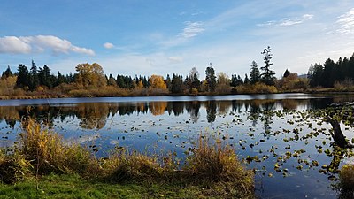 Larsen Lake in the Lake Hills neighborhood of Bellevue, Washington
 -
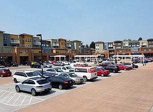 Bellevue's Lake Hills Village in 2018


References
- ^ a b "City of Bellevue: Neighborhood Areas" (PDF). Retrieved February 22, 2024.
- ^ "City of Bellevue Parks and Recreation: Lake Hills Greenbelt Trails". City of Bellevue. Retrieved 22 November 2017.
- ^ Marsha, Alia (19 February 2017). "How Bellevue businessmen who stoked fears benefited after Japanese American incarceration". The Seattle Globalist. Retrieved February 21, 2017.
- ^ a b Schein, Michael (September 27, 2016). "Lake Hills Library, King County Library System". HistoryLink.
- ^ "West Lake Hills (Official City of Bellevue Website)". Ci.bellevue.wa.us. Retrieved May 17, 2016.
Wikimedia Commons has media related to Lake Hills, Bellevue, Washington.
- v
- t
- e
Bellevue, Washington
Geography
- Bel-Red
- Bridle Trails
- Downtown Bellevue
- Crossroads
- Eastgate
- Factoria
- Lake Hills
- Lakemont
- Newport
- Overlake
- Somerset
- Spring District
- Wilburton
Education
- Bellevue School District
- Bellevue High School
- Interlake High School
- Newport High School
- Sammamish High School
- International School
- Issaquah School District
- Jewish Day School of Metropolitan Seattle
- Bellevue Christian School (in Clyde Hill)
Other
- 400 Building
- Bellevue Square
- Bellevue Towers
- City Center Bellevue
- Expedia Building
- Lincoln Square
- Paccar Tower
- Puget Power Building
- Seattle Washington Temple
- Washington Square
- Bellevue Airfield (closed)
This list is incomplete.
See also: List of tallest buildings
See also: List of tallest buildings
 | This King County, Washington state location article is a stub. You can help Wikipedia by expanding it. |
- v
- t
- e
47°36′12″N 122°07′51″W / 47.60333°N 122.13083°W / 47.60333; -122.13083


