Jampur District
Tehsils of Punjab in Pakistan
Jampur Tehsil تحصیل جام پُور | |
|---|---|
Tehsils of Punjab | |
 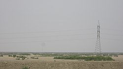 Top: Masjid Deen Muhammad Khan, Jampur View of desert region in the tehsil | |
| Country |  Pakistan Pakistan |
| Province |  Punjab Punjab |
| Division | Dera Ghazi Khan |
| Headquarters | Jampur |
| Government | |
| • Type | District Administration |
| • Assistant Commissioner | N/A |
| • SDPO | N/A Metric |
| Area [1]: 13 | |
| • Total | 12,318 km2 (4,756 sq mi) |
| Population (2017)[citation needed] | |
| • Total | 1,996,039 |
| • Density | 160/km2 (420/sq mi) |
| Time zone | UTC+5 (PST) |
| Number of Tehsils | 1 |
| Main language(s) | Saraiki, Balochi |
| Website | rajanpur |
Jampur (Urdu: جامپور) is a Tehsil in the province of Punjab, Pakistan with its administrative headquarters in the city of Jampur.[2] Lying west of the Indus River, its inhabitants are mostly Saraikis and Baloch while most of urban area is inhabited by Urdu speaking Muhajir families. According to the 1998 census, the district had a population of 1,100,000, and 14.27% of these were inhabitants of urban areas.[3]
Administration
References
- ^ 1998 District Census report of Rajanpur. Census publication. Vol. 27. Islamabad: Population Census Organization, Statistics Division, Government of Pakistan. 1999.
- ^ Correspondent, Our (31 December 2022). "Jampur gets district status". Tribune TODAY'S PAPER. p. 1. Retrieved 2 January 2023.
{{cite news}}:|last=has generic name (help) - ^ 1998 Census figures – Urban Resource Centre Archived 2006-05-13 at the Wayback Machine
- v
- t
- e
Provincial capital: Lahore


