Jahadi
Village development committee in Lumbini Zone, Nepal
Jahadi झाडी | |
|---|---|
Village development committee | |
 The main street in Jahadi village | |
| 27°35′N 83°07′E / 27.59°N 83.12°E / 27.59; 83.12 | |
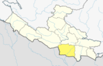
| Country |  Nepal Nepal |
| Zone | Lumbini Zone |
| District | Kapilvastu District |
| Population (1991) | |
| • Total | 4,324 |
| Time zone | UTC+5:45 (Nepal Time) |
Jahadi is a village development committee situated at the southwest corner of Jagdishpur Reservoir, within Kapilvastu District in the Lumbini Zone of southern Nepal. According to the 1991 Nepal census, it was home to a population of 4,324 individuals residing in 708 households.[1]
References
- ^ "Nepal Census 2001". Nepal's Village Development Committees. Digital Himalaya. Archived from the original on 12 October 2008. Retrieved 14 December 2008.
- v
- t
- e
Kapilvastu District
Headquarters: Kapilvastu Municipality
- Kapilvastu
- Banganga
- Buddhabhumi
- Shivaraj
- Krishnanagar
- Maharajganj
- Abhirawa
- Ajingara
- Bahadurganj
- Balarampur
- Baluhawa
- Bangai
- Baraipur
- Basantapur
- Baskhaur
- Bedauli
- Bhagawanpur Choti
- Bhalabari
- Bhrikuti Municipality
- Bijuwa
- Bithuwa
- Dhankauli
- Dharampaniya
- Dohani
- Dubiya
- Dumara
- Phulika
- Gajehada
- Ganeshpur
- Gauri
- Gotihawa
- Gugauli
- Haranampur
- Hardauna
- Hathausa
- Hathihawa
- Jahadi
- Jayanagar
- Kajarhawa
- Khurhuriya
- Kopawa
- Kushawa
- Labani
- Lalpur
- Mahendrakot
- Mahuwa
- Malwar
- Manpur
- Milmi
- Motipur
- Nanda Nagar
- Nigalihawa
- Pakadi
- Parsohiya
- Patariya
- Patna
- Patthardaihiya
- Pipari
- Purusottampur
- Ramghat
- Ramnagar
- Rangapur
- Sauraha
- Shivagadhi
- Shivapur Palta
- Shivaraj Municipality
- Singhkhor
- Sisawa
- Somdiha
- Thunhiya
- Tilaurakot
- Titirkhi
- Udayapur
- Vidhyanagar
List of municipalities and rural municipalities of Nepal
 | This article about a location in Kapilvastu District, Nepal is a stub. You can help Wikipedia by expanding it. |
- v
- t
- e


