Itabi
Municipality in Northeast, Brazil
Itabi Município de Itabi | |
|---|---|
Municipality | |
 Flag  Seal | |
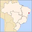
 Location of Itabi in Sergipe | |
| 10°07′33″S 37°06′10″W / 10.12583°S 37.10278°W / -10.12583; -37.10278 | |
| Country |  Brazil Brazil |
| Region | Northeast |
| State |  Sergipe Sergipe |
| Founded | November 25, 1953 |
| Government | |
| • Mayor | Rubens Feitosa Melo |
| Area | |
| • Total | 184.4 km2 (71.2 sq mi) |
| Elevation | 172 m (564 ft) |
| Population (2020 [1]) | |
| • Total | 4,886 |
| • Density | 26/km2 (69/sq mi) |
| Demonym | Itabiense |
| Time zone | UTC−3 (BRT) |
Itabi is a municipality located in the Brazilian state of Sergipe. In 2020, its population was 4,886. Its area is 184.4 km2 (71.2 sq mi) and has a population density of 27 inhabitants per square kilometer.[2][3]
References
- v
- t
- e
Capital: Aracaju
| Agreste de Itabaiana |
|
|---|---|
| Agreste de Lagarto | |
| Nossa Senhora das Dores | |
| Tobias Barreto |
| Aracaju | |
|---|---|
| Baixo Cotinguiba | |
| Boquim | |
| Cotinguiba | |
| Estancia | |
| Japaratuba | |
| Propria |
| Carira | |
|---|---|
| Sergipana do Sertao do Sao Francisco |
 | This Sergipe, Brazil location article is a stub. You can help Wikipedia by expanding it. |
- v
- t
- e


