Huejúcar
Municipality and town in Jalisco, Mexico

Seal
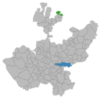
Location of the municipality in Jalisco
 Mexico
 Jalisco
MC
(2020 census)[1][2]

Huejúcar is a town and municipality, in Jalisco in central-western Mexico. The municipality covers an area of 309.2 km2.
As of 2020, the municipality had a total population of 5,920.
The name Huejúcar means "Place of Willows" in Nahuatl. It is about 240 km from the state capital, Guadalajara. It is next to Santa María de los Ángeles and Tepetongo. The municipality borders with the state of Zacatecas.
History
The city of Huejucar can trace its history back beyond the creation of Nueva Galicia in the Viceroyalty of New Spain. In 1530, Pedro Almíndez Chirinos passed through and conquered the area in the name of Spain during his voyage from Cuitzeo, Michoacan to Tepic, Nayarit.[3] On March 13, 1837, a decree is made that Huejucar would become part of the Colotlan Municipality. Later, on November 9, 1861, Huejucar would become its own municipality and twelve years later on September 24, 1873, would receive the title of Villa.
Geography
The town of Huejucar, although its average elevation is higher than that of the alpine city of Denver, Colorado in the United States, it is in a semiarid region with monsoonal weather in the summer months (July and August, mostly) with an average rainfall of 530.30 mm (20.878 in) of rainfall per year and an average temperature of 17.4C (63.3F). Summer months can reach highs on average of 38.3C (100.9F) while winter months reach lows on average of 0.8C (33.4F). Due to the Sierra Madre Occidental Mountains to the west, winds usually gust from the northeast. The town has average elevation of about 2,000 meters (6,600 feet) and the municipality's elevation varies drastically to as low as 1,750 meters (5,740 feet) in the valleys and as high as 2,600 meters (8,500 feet) in its mountainous areas on the western end of the municipality along the Sierra Madre Occidental Mountains. Hydrothermal streams and ponds dot the landscape to the west while the east and northeastern areas lead into the vast Mexican Plateau region in between the Sierra Madre Occidental and Oriental regions.[4]
Mexican Federal Highway 23 runs north–south which connects Huejucar on the southern terminus to the metropolitan area of Guadalajara, Jalisco and on its northern terminus to Fresnillo, Zacatecas.
Flora and fauna
Its vegetation is scarce in most of the territory. There are mainly drought-resistant plants such as: Vachellia farnesiana, Mesquite, Pitaya, Opuntia ficus-indica, Agave and some species of Populus, Pine and other trees in a small proportion.
Annual Festivities
Huejucar’s yearly fair, which normally lasts 7-10 days, begins in late September and runs until early October. This festival has been a tradition for decades. Entire families travel from neighboring towns like Colotlán, Jerez Zacatecas, and Santa María de los Ángeles to enjoy Huejucar and its traditional festival. The goal of this celebration is to honor San Francisco De Assis the municipality's patron saint, who is respected deeply by those who live in Huejucar, Jalisco.
The festival offers a wide range of enjoyable activities for people of all ages. Three female contestants will participate for the title of "queen of the fair" one month before the event. The queen will represent the festivities and locals in Huejucar will have the opportunity to vote for their desired candidate. Live music is one of the most visible forms of entertainment featured at the fair. Many well-known performers and bands have performed here, including Regulo Carro, Chuy Lizarraga, Aldo Trujillo, La Arrolladora Banda El Limón, and Ramon Ayala just to name a few. During the live performances you will see many people enjoying themselves and dancing to the rhythm of the music. Also, there are plenty of carnival games and rides to keep the younger generations entertained. Aside from live music and carnival games, Jaripeos (rodeos) are another major attraction that brings many charros enthusiasts to the Lienzo charro to witness the thrills of Charrería sportsmanship. Additionally, there is a wide range of restaurants and food stands that will be available for the enjoyment of the attendees.
Government
Municipal presidents
| Term | Municipal president | Political party | Notes |
|---|---|---|---|
| 01/01/1983-31/12/1985[5][6] | Francisco Campos Casas | PRI | |
| 01/01/1986-31/12/1988 | Juan Madera López | PRI | |
| 1989-1992 | Jorge Santacruz Flores | PRI | |
| 1992-1995 | J. Everardo Chávez Sotelo | PRI | |
| 1995-1997 | Francisco Santos Salas | PRI | |
| 01/01/1998-31/12/2000 | Miguel Ángel Martínez Bañuelos | PAN | |
| 01/01/2001-31/12/2003 | Bonifacio Rodrigo Silva de la Torre | PAN | |
| 01/01/2004-31/12/2006 | Miguel Ángel Martínez Bañuelos | PAN | |
| 01/01/2007-31/12/2009 | Édgar Humberto Villarreal Macías | PRI | |
| 01/01/2010-30/09/2012 | Bonifacio Rodrigo Silva de la Torre | PAN | |
| 01/10/2012-30/09/2015 | Francisco Santacruz Acuña | PRI | |
| 01/10/2015-30/09/2018 | Álvaro García Salazar | PRI | |
| 01/10/2018-28/02/2021 | Arcelia Díaz Márquez | MC | |
| 01/03/2021-30/09/2021 | Aaaa Bbbb Cccc | MC | Acting municipal president |
| 01/10/2021- | Arcelia Díaz Márquez | MC | She was reelected on 06/06/2021, to start a second triennium |
References
- ^ Citypopulation.de
- ^ "Huejúcar, Jalisco, Mexico Official Website". Archived from the original on 2011-11-11. Retrieved 2011-11-09.
- ^ Jalisco-Huejúcar
- ^ Free Maps - Mexican Topography
- ^ "Jalisco. Huejúcar. Cronología de los Presidentes Municipales" (in Spanish). Retrieved 15 June 2021.
- ^ "Enciclopedia de los Municipios y Delegaciones de México. Estado de Jalisco. Huejúcar" (in Spanish). Archived from the original on 18 May 2021. Retrieved 15 June 2021.
External links
- Official website
- v
- t
- e
State of JaliscoGuadalajara (capital)

- Guadalajara
- Ocotlán
- Puerto Vallarta
and
(municipal seats)
- Acatic
- Acatlán de Juárez
- Ahualulco de Mercado
- Amacueca
- Amatitán
- Ameca
- Arandas
- Atemajac de Brizuela
- Atengo
- Atenguillo
- Atotonilco El Alto
- Atoyac
- Autlán de Navarro
- Ayotlán
- Ayutla
- Bolaños
- Cabo Corrientes (El Tuito)
- Cañadas de Obregón
- Casimiro Castillo
- Chapala
- Chimaltitán
- Chiquilistlán
- Cihuatlán
- Cocula
- Colotlán
- Concepción de Buenos Aires
- Cuautitlán de García Barragán
- Cuautla
- Cuquío
- Degollado
- Ejutla
- El Arenal
- El Grullo
- El Limón
- El Salto
- Encarnación de Díaz
- Etzatlán
- Gómez Farías (San Sebastián del Sur)
- Guachinango
- Guadalajara
- Hostotipaquillo
- Huejúcar
- Huejuquilla El Alto
- Ixtlahuacán de los Membrillos
- Ixtlahuacán del Río
- Jalostotitlán
- Jamay
- Jesús María
- Jilotlán de los Dolores
- Jocotepec
- Juanacatlán
- Juchitlán
- La Barca
- La Huerta
- La Manzanilla de La Paz
- Lagos de Moreno
- Magdalena
- Mascota
- Mazamitla
- Mexticacan
- Mezquitic
- Mixtlán
- Ocotlán
- Ojuelos de Jalisco
- Pihuamo
- Poncitlán
- Puerto Vallarta
- Quitupan
- San Cristóbal de la Barranca
- San Diego de Alejandría
- San Gabriel
- San Ignacio Cerro Gordo
- San Juan de los Lagos
- San Juanito de Escobedo (Antonio Escobedo)
- San Julián
- San Marcos
- San Martín de Bolaños
- San Martín de Hidalgo
- San Miguel el Alto
- San Sebastián del Oeste
- Santa María del Oro
- Santa María de los Ángeles
- Sayula
- Tala
- Talpa de Allende
- Tamazula de Gordiano
- Tapalpa
- Tecalitlán
- Techaluta de Montenegro
- Tecolotlán
- Tenamaxtlán
- Teocaltiche
- Teocuitatlán de Corona
- Tepatitlán de Morelos
- Tequila
- Teuchitlán
- Tizapan El Alto
- Tlajomulco de Zúñiga
- Tlaquepaque
- Tolimán
- Tomatlán
- Tonalá
- Tonaya
- Tonila
- Totatiche
- Tototlán
- Tuxcacuesco
- Tuxcueca
- Tuxpan
- Unión de San Antonio
- Unión de Tula
- Valle de Guadalupe
- Valle de Juárez
- Villa Corona
- Villa Guerrero
- Villa Hidalgo
- Villa Purificación
- Yahualica de González Gallo
- Zacoalco de Torres
- Zapopan
- Zapotiltic
- Zapotitlán de Vadillo
- Zapotlán del Rey
- Zapotlán el Grande
- Zapotlanejo
- Agave Landscape and Ancient Industrial Facilities of Tequila
- Barranca de Oblatos
- Bosque Mesófilo Nevado de Colima
- Chamela-Cuixmala
- Cuenca Alimentadora del Distrito Nacional de Riego 043 Estado de Nayarit
- La Primavera
- Laguna de Sayula
- Sierra de Manantlán
- Sierra de Quila
- Vallarta Botanical Gardens
- Volcán Nevado de Colima


