Harsdorf
Municipality in Bavaria, Germany

Coat of arms
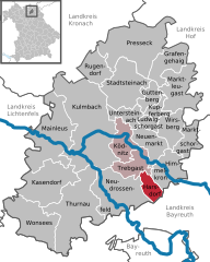
Location of Harsdorf within Kulmbach district
(2020–26) Günther Hübner[1] (CSU)
(2023-12-31)[2]
95499
Harsdorf is a municipality in the district of Kulmbach in Bavaria in Germany.
City arrangement
Harsdorf is arranged in the following boroughs:
- Altenreuth
- Brauneck
- Harsdorf
- Haselbach
- Hettersreuth
- Holzlucken
- Lettenhof
- Oberlaitsch /Seyerhaus
- Oberlohe
- Ritterleithen
- Sandreuth
- Unitz
- Unterlohe
- Zettmeisel
References
- ^ Liste der ersten Bürgermeister/Oberbürgermeister in kreisangehörigen Gemeinden, Bayerisches Landesamt für Statistik, 15 July 2021.
- ^ Genesis Online-Datenbank des Bayerischen Landesamtes für Statistik Tabelle 12411-003r Fortschreibung des Bevölkerungsstandes: Gemeinden, Stichtag (Einwohnerzahlen auf Grundlage des Zensus 2011).
- v
- t
- e
Towns and municipalities in Kulmbach (district)
- Grafengehaig
- Guttenberg
- Harsdorf
- Himmelkron
- Kasendorf
- Ködnitz
- Kulmbach
- Kupferberg
- Ludwigschorgast
- Mainleus
- Marktleugast
- Marktschorgast
- Neudrossenfeld
- Neuenmarkt
- Presseck
- Rugendorf
- Stadtsteinach
- Thurnau
- Trebgast
- Untersteinach
- Wirsberg
- Wonsees

Authority control databases | |
|---|---|
| International |
|
| National |
|
 | This Kulmbach district location article is a stub. You can help Wikipedia by expanding it. |
- v
- t
- e


