Habboûch
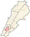
Place in Nabatieh Governorate, Lebanon
Habboûch حبّوش | |
|---|---|
 | |
| 33°24′N 35°29′E / 33.400°N 35.483°E / 33.400; 35.483 | |
| Grid position | 126/163 L |
| Country |  Lebanon Lebanon |
| Governorate | Nabatieh Governorate |
| District | Nabatieh District |
| Time zone | UTC+2 (EET) |
| • Summer (DST) | +3 |
Habboûch (Arabic: حبّوش) is a populated area in southern Lebanon.[1] The population is estimated to be approximately 15,000.It is located at latitude: 33.4072900 and longitude: 35.4816900
History
In 1875 Victor Guérin found the village to be inhabited by 200 Metualis.[2]
References
Bibliography
- Guérin, V. (1880). Description Géographique Historique et Archéologique de la Palestine (in French). Vol. 3: Galilee, pt. 2. Paris: L'Imprimerie Nationale.
External links
- Municipality of Habbouch (in Arabic)
- Habbouch, Localiban
- v
- t
- e
 Nabatieh District, Nabatieh Governorate
- Nabatieh
villages
- Ansar
- Adchit
- Ain Boswar
- Ain Qana
- Aldawair
- Arab Saleem
- Arnoun
- Braiqeaa
- Charkiyeh
- Choukine
- Deir Ez Zahrani
- Doueir
- Ebba
- Habboûch
- Harouf
- Houmeen
- Jbaa
- Jarjouh
- Jebchit
- Kaoutariyet Al Siyad
- Kfar Remen
- Kfar Tebnit
- Kfar Fila
- Kfarjouz
- Kfar Sir
- Kfour
- Marwania
- Mayfadoun
- Nabatiyeh El Faouqa
- Nmairiyeh
- Qaaqaiyeh Ej Jisr
- Qsaibeh
- Schhour
- Sharqia
- Sir el Gharbiyeh
- Toul
- Yohmor
- Zawtar El Charkiyeh
- Zefta
- Zibdine


