Hažín
Village and municipality in Slovakia
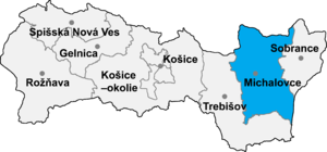
Hažín (Hungarian: Gezsény) is a village and municipality in Michalovce District in the Kosice Region of eastern Slovakia.
History
In historical records the village was first mentioned in 1336. Before the establishment of independent Czechoslovakia in 1918, it was part of Ung County within the Kingdom of Hungary.
Geography
The village lies at an altitude of 120 metres and covers an area of 16.31 km2 (6.30 sq mi) (2020-06-30/-07-01).[1]
Population
It has a population of 479 people (2020-12-31).[2]
Ethnicity
The population is about 100% Slovak in ethnicity.
Culture
The village has a small public library and food stores. It also has a car repair shop.
Sports
The village has a football pitch, fitness, tennis court and children's playground.
Transport
The nearest railway station is 12 kilometres away at Michalovce.
Genealogical resources
The records for genealogical research are available at the state archive "Statny Archiv in Presov, Slovakia"
- Roman Catholic church records (births/marriages/deaths): 1824-1912 (parish B)
- Greek Catholic church records (births/marriages/deaths): 1806-1913 (parish A)
- Reformated church records (births/marriages/deaths): 1747-1940 (parish B)
See also
References
External links
- http://www.statistics.sk/mosmis/eng/run.html Archived 2007-11-16 at the Wayback Machine
- Surnames of living people in Hazin
- v
- t
- e
Municipalities of Michalovce District
- Bajany
- Bánovce nad Ondavou
- Beša
- Bracovce
- Budince
- Budkovce
- Čečehov
- Čičarovce
- Čierne Pole
- Drahňov
- Dúbravka
- Falkušovce
- Hatalov
- Hažín
- Hnojné
- Horovce
- Iňačovce
- Ižkovce
- Jastrabie pri Michalovciach
- Jovsa
- Kačanov
- Kaluža
- Kapušianske Kľačany
- Klokočov
- Krásnovce
- Krišovská Liesková
- Kusín
- Lastomír
- Laškovce
- Lesné
- Ložín
- Lúčky
- Malčice
- Malé Raškovce
- Markovce
- Maťovské Vojkovce
- Moravany
- Nacina Ves
- Oborín
- Oreské
- Palín
- Pavlovce nad Uhom
- Petrikovce
- Petrovce nad Laborcom
- Poruba pod Vihorlatom
- Pozdišovce
- Ptrukša
- Pusté Čemerné
- Rakovec nad Ondavou
- Ruská
- Senné
- Slavkovce
- Sliepkovce
- Staré
- Stretava
- Stretavka
- Suché
- Šamudovce
- Trhovište
- Trnava pri Laborci
- Tušice
- Tušická Nová Ves
- Veľké Raškovce
- Veľké Slemence
- Vinné
- Vojany
- Voľa
- Vrbnica
- Vysoká nad Uhom
- Zalužice
- Závadka
- Zbudza
- Zemplínska Široká
- Zemplínske Kopčany
- Žbince

48°45′03″N 22°01′10″E / 48.7508°N 22.0194°E / 48.7508; 22.0194
 | This Michalovce District geography article is a stub. You can help Wikipedia by expanding it. |
- v
- t
- e


