Gold Town, California
Former settlement in California, United States
Goldtown[1] OarVille | |
|---|---|
Former settlement | |
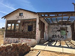 An abandoned house in Goldtown | |
| 35°00′06″N 118°10′08″W / 35.00167°N 118.16889°W / 35.00167; -118.16889 | |
| Country | United States |
| State | California |
| County | Kern County |
| Elevation [2] | 2,713 ft (827 m) |
Gold Town (on topographic maps) or OarVille[1]is a former settlement in Kern County, California.[2] It was located 9.5 miles (15 km) north of Rosamond,[3] at an elevation of 2,713 feet (827 m).[2]
Today, Goldtown exists only as a grid of dirt roads and a few abandoned buildings and mines in the desert off the California State Route 14.[citation needed] Silver Queen Road is the main paved road that connects Goldtown to the California State Route 14.[citation needed]
Fleta, California is 0.62 miles (1.00 km) northeast of Goldtown. Mojave, California is 1.44 miles (2.32 km) to the north. Gold mines exist within 2 miles (3.2 km) to the north and south of Goldtown.[4] These mines include the Golden Queen Mine and Elephant Eagle mine on Soledad Mountain south of Goldtown ,[5] and Whitmore Mine and Exposed Treasure mine[6] on Standard Hill north of Goldtown. KHXT-FM (Mojave) radio tower, at an elevation of 3,028 feet (923 meters) above sea level, is 1.56 miles (2.51 km) southeast of Goldtown.[7] The California Aqueduct Road is located about 5 miles (8.0 km) to the west of Goldtown.
Golden Queen Mine
From the early 1900s to 1980s, the Golden Queen Mine [8] was active on and off, using open pit, underground works, and heap leaching. About 100,000 short tons (91,000 t) of tailings were created over the years. Due to erosion since, some of these tailings reached the alluvial fan surface. The tailings contain elevated levels of arsenic. "Significant potential human health risks to the community and regional environmental impacts may have resulted from release of arsenic-bearing tailings into the waters of the state and airborne sources." according to the Bureau of Land Management.[9]
Construction has begun to re-open the Golden Queen Mine. Commissioning is planned for 2015. This is part of the Soledad Mountain Project. Open pit mining, cyanide heap leaching, and Merrill-Crowe processes will be used to recover gold and silver from crushed, agglomerated ore.[10] The heap leach pad for the mine will be located near Goldtown, according to Kern County Planning and Community Development Department. [11]
References
- ^ a b Daily News. April 8, 1923. p. 1.
{{cite news}}: Missing or empty|title=(help)[full citation needed]; "Goldtown Again on Mine Map of Kern". Los Angeles Times. May 20, 1935. p. 10.'"Near Mojave Old Town is Coming Back". Los Angeles Times. May 20, 1935. p. 5. - ^ a b c U.S. Geological Survey Geographic Names Information System: Gold Town, California
- ^ Durham, David L. (1998). California's Geographic Names: A Gazetteer of Historic and Modern Names of the State. Clovis, Calif.: Word Dancer Press. p. 1041. ISBN 1-884995-14-4.
- ^ http://www.placekeeper.com/California/Gold_Town-1703063.html [bare URL]
- ^ http://www.placekeeper.com/California/Golden_Queen_Mine-242824.html [bare URL]
- ^ Soledad Mountain Project, Golden Queen Mining Company, Mojave, Kern County, California. Vol. 1. May 1997. p. 262.[full citation needed]; "Alleged Auction of Exposed Treasure Mine". Los Angeles Times. November 1, 1906.
- ^ "KHXT-FM (Mojave) in Kern County, California". placekeeper.com. Archived from the original on February 22, 2014. Retrieved February 22, 2014.
- ^ Facebook https://web.archive.org/web/20231110011041/https://www.facebook.com/GoldenQueenMiningCo. Archived from the original on November 10, 2023.
{{cite web}}: Missing or empty|title=(help)[user-generated source] - ^ "Golden Queen Abandoned Mine Lands Project, U.S. Bureau of". Archived from the original on February 22, 2014.
- ^ "Golden Queen Mining Co. LTD. - Home Page - Fri Feb 7, 2014". Archived from the original on February 8, 2014.
- ^ Approved project bonduary. Archived from the original on August 14, 2014.
External links
- goldenqueen.com
- v
- t
- e
Municipalities and communities of Kern County, California, United States
County seat: Bakersfield

- Alta Sierra
- Bakersfield Country Club
- Bear Valley Springs
- Benton Park
- Bodfish
- Boron
- Buttonwillow
- Casa Loma
- Cherokee Strip
- China Lake Acres
- Choctaw Valley
- Cottonwood
- Derby Acres
- Di Giorgio
- Dustin Acres
- East Bakersfield
- East Niles
- Edison
- Edmundson Acres
- Edwards AFB
- El Adobe
- Fairfax
- Fellows
- Ford City
- Frazier Park
- Fuller Acres
- Glennville
- Goodmanville
- Golden Hills
- Greenacres
- Greenfield
- Hillcrest
- Inyokern
- Johannesburg
- Keene
- Kernville
- La Cresta
- Lake Isabella
- Lake of the Woods
- Lakeside
- Lamont
- Lebec
- Lost Hills
- McKittrick
- Mettler
- Mexican Colony
- Mojave
- Mountain Meadows
- Mountain Mesa
- North Edwards
- Oildale
- Old River
- Old Stine
- Olde Stockdale
- Onyx
- Pine Mountain Club
- Potomac Park
- Pumpkin Center
- Randsburg
- Rexland Acres
- Ridgecrest Heights
- Rivergrove
- Rosamond
- Rosedale
- Smith Corner
- South Taft
- Squirrel Mountain Valley
- Stallion Springs
- Stebbins
- Taft Heights
- Tarina
- Tupman
- Valley Acres
- Weedpatch
- Weldon
- Wofford Heights
- Woody
communities
- Actis
- Aerial Acres
- Bealville
- Bena
- Blackwells Corner
- Caliente
- Canebrake
- Cantil
- Cawelo
- China Lake
- Claraville
- Desert Lake
- Edwards
- Famoso
- Fruitvale
- Grapevine
- Gypsite
- Havilah
- Indian Wells
- Keyesville
- Lerdo
- Loraine
- Midoil
- Minter Village
- Miracle Hot Springs
- Missouri Triangle
- Monolith
- North Shafter
- Oil City
- Old Town
- Panama
- Pentland
- Pinon Pines Estates
- Pond
- Reward
- Rio Bravo
- Riverkern
- Saltdale
- Sand Canyon
- South Lake
- Spicer City
- Thomas Lane
- Twin Oaks
- Wheeler Ridge
- Willow Springs
settlements
- Asphalto
- Desert Spring
- Freeman Junction
- Garlock
- Gold Town
- Isabella
- Joe Walker Town
- Joyfull
- Kern River Slough
- Kernville
- Lavers' Crossing
- Leliter
- Martensdale
- Mountain House
- Muroc
- North Muroc
- Olig
- Petersburg
- Quartzburg
- Reefer City
- Rio Bravo
- Sageland
- San Miguel de los Noches
- Scovern Hot Springs
- Tehichipa
- California portal
- United States portal


