Fort Littleton, Pennsylvania
Unincorporated community in Pennsylvania, United States
40°3′46″N 77°57′49″W / 40.06278°N 77.96361°W / 40.06278; -77.9636117223
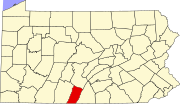
Fort Littleton is an unincorporated community in Dublin Township in Fulton County, Pennsylvania, United States. Fort Littleton is located at the junction of U.S. Route 522 and Plum Hollow Road, a short distance north of an interchange between US 522 and the Pennsylvania Turnpike (Interstate 76), which is called the Fort Littleton interchange.[2] The town was named for the 18th century Fort Lyttleton and was established near the fort's former location in 1767.[3]
References
- ^ "Fort Littleton". Geographic Names Information System. United States Geological Survey, United States Department of the Interior.
- ^ Fulton County, Pennsylvania Highway Map (PDF) (Map). PennDOT. 2014. Retrieved November 10, 2015.[permanent dead link]
- ^ "History of Dublin Township," in History of Bedford, Somerset, and Fulton Counties, Pennsylvania, Chicago: Waterman, Watkins & Co., 1884; pp. 594-601, 659-664
- v
- t
- e
Municipalities and communities of Fulton County, Pennsylvania, United States
County seat: McConnellsburg
communities
- Big Cove Tannery
- Crystal Spring
- Dott
- Fort Littleton
- Harrisonville
- Waterfall
‡This populated place also has portions in an adjacent county or counties
- Pennsylvania portal
- United States portal


