El Paso metropolitan area
Metropolitan statistical area in Texas, United States
El Paso Metropolitan Statistical Area | |
|---|---|
Metropolitan statistical area | |
| El Paso, MSA | |
 Downtown El Paso | |
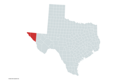 El Paso metropolitan area in red | |
| State |  Texas Texas |
| Area | |
| • Metropolitan statistical area | 5,587 sq mi (14,470 km2) |
| Population (2020)[1] | |
| • Urban | 854,584 (53rd) |
| • MSA | 868,859 (67th) |
| • CSA | 1,095,532 (56th) |
| GDP [2] | |
| • MSA | $43.3 billion (2022) |
The El Paso metropolitan area, officially the El Paso metropolitan statistical area, as defined by the United States Census Bureau, is an area consisting of two counties – El Paso and (since 2013) Hudspeth – in far West Texas, anchored by the city of El Paso. As of the 2020 United States Census, the MSA had a population of 868,859. The El Paso MSA forms part of the larger El Paso–Las Cruces combined statistical area, with a total population of 1,088,420[3] as of the 2020 United States Census.
Counties
- El Paso
- Hudspeth
Communities
| Census | Pop. | Note | %± |
|---|---|---|---|
| 1900 | 24,886 | — | |
| 1910 | 52,599 | 111.4% | |
| 1920 | 101,877 | 93.7% | |
| 1930 | 131,597 | 29.2% | |
| 1940 | 131,067 | −0.4% | |
| 1950 | 194,968 | 48.8% | |
| 1960 | 314,070 | 61.1% | |
| 1970 | 359,291 | 14.4% | |
| 1980 | 479,899 | 33.6% | |
| 1990 | 591,610 | 23.3% | |
| 2000 | 679,622 | 14.9% | |
| 2010 | 804,123 | 18.3% | |
| 2020 | 868,859 | 8.1% | |
| U.S. Decennial Census[4] | |||
Incorporated places
- Town of Anthony
- Town of Clint
- Dell City
- City of El Paso
- City of Horizon City
- City of Socorro
- Village of Vinton
Census-designated places
Note: All census-designated places are unincorporated.
Unincorporated places
See also
- El Paso–Juárez, the binational metropolitan area of which this area forms a part
- Texas census statistical areas
References
- ^ "U.S. Census website". United States Census Bureau. Retrieved April 18, 2019.
- ^ "Total Gross Domestic Product for El Paso, TX (MSA)". Federal Reserve Economic Data. Federal Reserve Bank of St. Louis.
- ^ "U.S. Census website". United States Census Bureau. Retrieved 2021-06-21.
- ^ "U.S. Decennial Census". United States Census Bureau. Archived from the original on May 7, 2015. Retrieved May 28, 2013.
- v
- t
- e
Austin (capital)
- Ark‑La‑Tex
- Big Bend
- Boca Chica
- Blackland Prairies
- Brazos Valley
- Central Texas
- Coastal Bend
- Concho Valley
- Cross Timbers
- East Texas
- Edwards Plateau
- Golden Triangle
- Hill Country
- Llano Estacado
- Northeast Texas
- North Texas
- Osage Plains
- Panhandle
- Permian Basin
- Piney Woods
- Rio Grande Valley
- Southeast Texas
- South Plains
- South Texas
- Texoma
- Trans-Pecos
- West Texas
areas
- Abilene
- Amarillo
- Austin–Round Rock (Greater Austin)
- Beaumont–Port Arthur
- Brownsville–Harlingen
- College Station–Bryan
- Corpus Christi
- Dallas–Fort Worth–Arlington (DFW)
- El Paso
- Houston–The Woodlands–Sugar Land (Greater Houston)
- Killeen–Temple
- Laredo
- Longview
- Lubbock
- McAllen–Edinburg–Mission
- Midland
- Odessa
- San Angelo
- San Antonio–New Braunfels
- Sherman–Denison
- Texarkana
- Tyler
- Victoria
- Waco
- Wagner Creek
- Wichita Falls
 Texas portal


