Djamandioké
Town and sub-prefecture in Ivory Coast
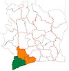
Town and sub-prefecture in Bas-Sassandra, Ivory Coast
Djamandioké Djamadjoké | |
|---|---|
Town and sub-prefecture | |
| 4°24′N 7°28′W / 4.400°N 7.467°W / 4.400; -7.467 | |
| Country |  Ivory Coast Ivory Coast |
| District | Bas-Sassandra |
| Region | San-Pédro |
| Department | Tabou |
| Population (2014)[1] | |
| • Total | 15,006 |
| Time zone | UTC+0 (GMT) |
Djamandioké (also spelled Djamadjoké) is a town in the south-western corner of Ivory Coast, near the border of Liberia. It is a sub-prefecture of Tabou Department in San-Pédro Region, Bas-Sassandra District. It is the southernmost sub-prefecture of the country.
Djamandioké was a commune until March 2012, when it became one of 1126 communes nationwide that were abolished.[2]
In 2014, the population of the sub-prefecture of Djamandioké was 15,006.[3]
Villages
The seventeen villages of the sub-prefecture of Djamandioké and their population in 2014 are:[3]
- Bliéron (336)
- Boubré (229)
- Djamandioké (1 337)
- Djoutou (774)
- Gnakanépo (112)
- Iroutou (518)
- Néro V1 (3 315)
- Néro V2 (1 952)
- Néro Village (692)
- Pata-Idié (1 386)
- Pimé (203)
- Prollo (959)
- Ranouinké/Georges-Town (1 351)
- Soublaké (677)
- Toupa (142)
- Wépo (231)
- Yeouli (792)
References
- ^ "Côte d'Ivoire". geohive.com. Retrieved 8 December 2015.
- ^ "Le gouvernement ivoirien supprime 1126 communes, et maintient 197 pour renforcer sa politique de décentralisation en cours", news.abidjan.net, 7 March 2012.
- ^ a b "RGPH 2014, Répertoire des localités, Région San-Pédro" (PDF). ins.ci. Retrieved 5 August 2019.
- v
- t
- e
Departments and sub-prefectures of San-Pédro Region, Bas-Sassandra DistrictRegional seat: San-Pédro
- Dapo-Iboké
- Djamandioké
- Djouroutou
- Grabo*
- Olodio
- Tabou*
* also a commune
 | This Bas-Sassandra District location article is a stub. You can help Wikipedia by expanding it. |
- v
- t
- e


