Dairut
27°34′00″N 30°49′00″E / 27.56667°N 30.81667°E / 27.56667; 30.81667
Place in Asyut, Egypt
Dairut ⲧⲉⲣⲱⲧ | |
|---|---|
 | |
  Dairut Location in Egypt | |
| Coordinates: 27°34′N 30°49′E / 27.567°N 30.817°E / 27.567; 30.817 | |
| Country |  Egypt Egypt |
| Governorate | Asyut |
| Area [1] | |
| • Total | 88.2 sq mi (228.4 km2) |
| Elevation | 144 ft (44 m) |
| Population (2021)[1] | |
| • Total | 653,847 |
| • Density | 7,400/sq mi (2,900/km2) |
| Time zone | UTC+2 (EST) |
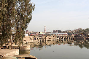
Dairut (Coptic: ⲧⲉⲣⲱⲧ terōt Coptic pronunciation: [dæˈroːt]) is a city in Egypt. It is located on the west bank of the Nile, in the Asyut Governorate. This is the point where the Nile divides, and a branch wanders off and eventually ends up in the Faiyum.
Climate
Köppen-Geiger climate classification system classifies its climate as hot desert (BWh).[2]
| Climate data for Dairut | |||||||||||||
|---|---|---|---|---|---|---|---|---|---|---|---|---|---|
| Month | Jan | Feb | Mar | Apr | May | Jun | Jul | Aug | Sep | Oct | Nov | Dec | Year |
| Mean daily maximum °C (°F) | 21.2 (70.2) | 23.3 (73.9) | 26.6 (79.9) | 31.6 (88.9) | 34.7 (94.5) | 35.6 (96.1) | 35.5 (95.9) | 35.1 (95.2) | 32.6 (90.7) | 31 (88) | 26.8 (80.2) | 22.3 (72.1) | 29.7 (85.5) |
| Daily mean °C (°F) | 12.4 (54.3) | 14.2 (57.6) | 17.2 (63.0) | 21.9 (71.4) | 25.6 (78.1) | 27.1 (80.8) | 27.5 (81.5) | 27.4 (81.3) | 25.3 (77.5) | 23.2 (73.8) | 18.6 (65.5) | 14.3 (57.7) | 21.2 (70.2) |
| Mean daily minimum °C (°F) | 3.6 (38.5) | 5.1 (41.2) | 7.8 (46.0) | 12.3 (54.1) | 16.6 (61.9) | 18.7 (65.7) | 19.6 (67.3) | 19.8 (67.6) | 18.1 (64.6) | 15.4 (59.7) | 10.5 (50.9) | 6.4 (43.5) | 12.8 (55.1) |
| Average precipitation mm (inches) | 0 (0) | 1 (0.0) | 1 (0.0) | 0 (0) | 0 (0) | 0 (0) | 0 (0) | 0 (0) | 0 (0) | 0 (0) | 0 (0) | 1 (0.0) | 3 (0) |
| Source: Climate-Data.org, altitude: 47m[2] | |||||||||||||
Notable people
- Hafez Ibrahim
- Mohamed Mustagab
- Farghali Abdel Hafiz [Wikidata]
References
 Egypt portal

- ^ a b "Dayrūṭ (Markaz, Egypt) - Population Statistics, Charts, Map and Location". citypopulation.de. Retrieved 17 March 2023.
- ^ a b "Climate: Dairut - Climate graph, Temperature graph, Climate table". Climate-Data.org. Retrieved 7 September 2013.
- v
- t
- e
Cairo
Giza, 6th of October City, Sheikh Zayed City, El Hawamdeya, El Badrashein, El Saff, Atfih, El Ayyat, Bawiti, Manshiyat al Qanater, Awsim, Kerdasa, Abu El Numrus
Damanhur, Kafr El Dawwar, Rosetta, Edku, Abu El Matamir, Abu Hummus, El Delengat, El Mahmoudiyah, El Rahmaniya, Itay El Barud, Hosh Issa, Shubra Khit, Koum Hamada, Badr, Wadi El Natrun, New Nubariya
Mansoura, Talkha, Mit Ghamr, Dekernes, Aga, Minyat An-Nasr, El Senbellawein, El Kurdi, Bani Ebaid, El Manzala, Temay El Amdeed, El Gammalia, Sherbin, El Matareya, Dakahlia, Belqas, Mit Salsil, Gamasa, Mahallat Damana, Nabaruh
Kafr El Sheikh, Desouk, Fuwwah, Metoubes, Baltim, El Hamool, Biyala, El Reyad, Sidi Salem, Qallin, Sidi Ghazi, Borg El Burulus
Shibin El Kom, Sadat (city), Menouf, Sirs Al-Layyan, Ashmoun, El Bagour, Quesna, Birket El Sab, Tala, Shuhada
Zagazig, 10th of Ramadan (city), Minya El Qamh, Bilbeis, Mashtool El Souk, Al-Qinayat, Abu Hammad, El Qurein, Hihya, Abu Kebir, Faqous, El Salheya El Gedida, El Ibrahimiya, Diyarb Negm, Kafr Saqr, Awlad Saqr, El Husseiniya, Tanis, Minshat Abu Omar, Qantir
Minya, New Minya, El Idwa, Maghagha, Beni Mazar, Matai, Samalut, Mallawi, Dir Mawas, Aba al-Waqf, Dir Mawas, Dalga, Bahnasa, Idmo, Tuna el-Gebel, Al Madinah Al Fikriyyah
Asyut, New Asyut, Dairut, Dayrut al-Sharif, Manfalut, El Quseyya, Abnub, Abu Tig, El Ghanayem, Sahel Selim, El Badari, Sidfa, Manqabad, Musha
Sohag, New Sohag, Akhmim, New Akhmim, El Balyana, El Maragha, Ptolemais Hermiou, Dar El Salam, Girga, West Juhayna, Saqultah, Tima, Tahta
Capital cities are in bold font.
 | This geography of Egypt article is a stub. You can help Wikipedia by expanding it. |
- v
- t
- e


