Cresson, Minnesota
Unincorporated community in Minnesota, United States
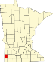
44°06′40″N 96°26′07″W / 44.11111°N 96.43528°W / 44.11111; -96.43528Cresson is an unincorporated community located in Pipestone County, Minnesota, United States. The elevation is 1,673 feet. Cresson appears on the Elkton SW U.S. Geological Survey Map.[2][1]
Close to the adjacent states of South Dakota to the west and Iowa to the south, Cresson lies in rural southwest Minnesota near the Pipestone National Monument, a National Park Service property established in 1937. The monument's 301 acres protect tallgrass prairie and quarries of red pipestone, or catlinite, traditionally used by Native Americans to make pipes.[3]
References
- ^ a b "Cresson". Geographic Names Information System. United States Geological Survey, United States Department of the Interior.
- ^ HomeTownLocator Data on Cresson, Minnesota
- ^ National Park Service: Pipestone National Monument
External links
- GNIS Map of Cresson, Minnesota
- v
- t
- e
Municipalities and communities of Pipestone County, Minnesota, United States
County seat: Pipestone
communities
- Airlie
- Cazenovia
- Cresson
- Diamond Corner
‡This populated place also has portions in an adjacent county or counties
- Minnesota portal
- United States portal
This article about a location in Pipestone County, Minnesota is a stub. You can help Wikipedia by expanding it. |
- v
- t
- e


 Cresson,_Minnesota