Bixiga
São Paulo neighborhood in Southeast, Brazil
23°33′24″S 46°38′41″W / 23.55667°S 46.64472°W / -23.55667; -46.64472 Brazil
 São Paulo
 São Paulo
Bixiga is a neighbourhood in the center of the city of São Paulo, Brazil.[1] It is located within the district of Bela Vista. Bixiga is known for having been a hub for Italian immigrants.[2][3]
History

The origins of the neighborhood can be traced to the foundation of the city. Nowadays, Bixiga is considered part of the official district of Bela Vista, but appeared on city maps with the Bixiga designation until 1943. It was incorporated into Bela Vista with the passing of Law 1242, in 1910. The area between the historic core, Paulista Avenue, 23 de Maio Avenue and 9 de Julho Avenue became, in 1878, the Chácara do Bexiga (Bexiga Farmstead), owned by Antônio José Leite Braga.[4]
In the middle of the 18th century, São Paulo saw an expansion of its population beneath the original boundaries of the city center. With the beginning of industrialization in the mid-19th century, São Paulo experienced accelerated population growth, in large part due to immigration to the city caused by the new jobs in the industrial sector. The many farmsteads that surrounded the city center found new purpose soon enough, becoming residential lots primarily for working-class immigrants.[5]
Purchasing the land from Thomaz Cruz in 1878, Leite Braga divided the farmstead into lots, which were then sold, thus beginning the urbanization process of Bixiga.[6]
The birth of the neighborhood began at Largo dos Piques, a convergence point where many roads met and from which they began, thus making the locale popular for inns and hostels, as well as prostitution and weekly slave auctions.[7][8] The streets of Santo Amaro and Santo Antonio connected São Paulo to neighboring cities, such as Jundiaí and the port city of Santos. The Largo dos Piques is currently known as Praça das Bandeiras or Largo do Riachuelo.[7] Largo dos Piques is identified as Bexiga's foundation site by the Department of Historical Heritage of the city of São Paulo. Some of the slaves who escaped the auctions formed the short-lived maroon state Quilombo do Saracura.[7]
In 1885 Rua Formosa was founded, thus connecting Bexiga to the Santa Ifigênia neighborhood to facilitate trade. The proximity of Anhangabaú, Largo dos Piques and Largo do Bexiga was instrumental to the development of the neighborhood.[7]
The first streets in Bexiga were Santo Antonio, Major Quedinho, 13 de Maio, and Abolição. Urbanization of the area began in 1880, and saw a surge of Italian residents in the late 19th-century, particularly those from Sicily, Calabria, and Apulia. With an extensive supply of land at low costs, immigrants settled in the neighborhood into terraced houses and sobrados, which were usually mixed-use. Houses were low and usually built without a blueprint. In addition to Italian immigrants, many freed slaves settled in Bexiga. They mostly lived in the lower floors of houses due to cheaper rent.[9]
By the 1920s Bexiga was the most densely-populated neighborhood in São Paulo. Tenements and basement residences began to appear at this time, damaging the neighborhood's reputation. The presence of both a black and immigrant populations made Bexiga a culturally diverse area, becoming known for such events as the Samba School Vai-Vai and the Our Lady of Achiropita Festival.[9]
Gallery
-
 Brigadeiro Luís Antônio Palace
 -
 The "Arcos do Bixiga" in 2015
 -
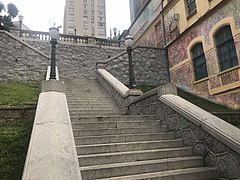 The Bixiga staircase, in front on Dom Orione Square
 -
 The Museu dos Óculos (Glasses Museum) in 2009
 -
 Bixiga
 -
 Streets of Bixiga


See also
References
- ^ Bixiga: os contornos atuais do bairro que começou com imigrantes calabreses
- ^ Museu expõe memória e sotaque do Bexiga, em São Paulo Archived February 15, 2011, at the Wayback Machine; O Estado de S. Paulo, 18 de março de 2009.
- ^ A Itália ao alcance dos pés Archived March 19, 2011, at the Wayback Machine
- ^ Scripillitti 28.
- ^ Scripillitti 32-34.
- ^ Scripillitti 36.
- ^ a b c d Scripillitti 38.
- ^ Sampaio de Castro 51.
- ^ a b Scripillitti 40.
Sources
- Scripillitti, Ana Carolina Nader (23 March 2017). "Verticalização e tombamento no bairro do Bexiga: materialização em tensão" (in Portuguese). São Paulo: Mackenzie Presbyterian University. Retrieved 16 January 2020.
{{cite journal}}: Cite journal requires|journal=(help) - Sampaio de Castro, Márcio (2008). Bexiga: um bairro afro-italiano (in Portuguese). Annablume. ISBN 978-8574198620.
External links
- Subprefecture of Sé
23°33′24″S 46°38′41″W / 23.55667°S 46.64472°W / -23.55667; -46.64472
- v
- t
- e
 Visitor attractions in São Paulo
landmarks
- Altino Arantes Building
- Brazil Stock Exchange
- Butantã's House
- Centro Comercial Aricanduva
- Centro Empresarial Nações Unidas
- Conjunto Nacional
- Copan Building
- Itália Building
- Iguatemi São Paulo
- Júlio Prestes Station
- Luz Station
- Mappin Building
- Martinelli Building
- Matarazzo Building
- Municipal Market
- Bandeirantes Palace
- São Pedro Theater
- Municipal Theater
- List of tallest buildings
religious sites
- Basilica of the Most Blessed Sacrament
- Imaculado Coração de Maria Church
- Nossa Senhora da Consolação Church
- Nossa Senhora do Brasil Church
- Ordem Terceira do Carmo Church
- Orthodox Metropolitan Cathedral
- Pátio do Colégio
- Santo Antônio Church
- São Bento Monastery
- São Cristóvão Church
- São Paulo Brazil Temple
- São Paulo Cathedral
- Temple of Solomon
cultural institutions
- CAIXA Cultural São Paulo
- Carmo Planetarium
- Casa das Rosas
- Bank of Brazil Cultural Center
- Centro Cultural da Penha
- Centro Cultural e de Estudos Superiores Aúthos Pagano
- Ema Gordon Klabin Cultural Foundation
- Football Museum
- Immigration Museum
- Butantan Institute
- Mário de Andrade Library
- Memória do Bixiga Museum
- Museu Afro Brasil
- Museu Lasar Segall
- Museu Paulista (Ipiranga)
- São Paulo Museum of Art
- Museum of Art of the Parliament
- Museum of Contemporary Art
- Museum of Fine Arts
- Museum of Image and Sound
- Museum of Modern Art
- Museum of Sacred Art
- Museum of the Portuguese Language
- Oca Pavilion
- Industries Palace
- Pinacoteca do Estado
- Professor Aristóteles Orsini Planetarium
- Sala São Paulo
- Allianz Parque
- Anhembi Convention Center
- Anhembi Sambadrome
- Arena Corinthians
- Canindé Stadium
- Morumbi Stadium
- Ícaro de Castro Melo Stadium
- Nicolau Alayon Stadium
- Parque São Jorge Stadium
- Rua Javari Stadium
- Estádio Universitário São Paulo
- Ibirapuera Auditorium
- Pacaembu Stadium
- Via Funchal
- Vibra São Paulo
and districts
- Aclimação
- Alto de Santana
- Bixiga
- Bom Retiro
- Brigadeiro Faria Lima Avenue
- Brooklin Novo
- Central Zone
- Japão
- Jardins
- Liberdade
- Paulista Avenue
- Rua 25 de Março
- Rua Augusta
- Rua Oscar Freire
- University of São Paulo (USP)
- Vila Madalena
- Vila Olímpia
public squares
- Albert Löfgren State Park
- Beco do Batman
- Botanical Garden
- Cantareira State Park
- Cemitério da Consolação
- Ibirapuera Park
- Independence Park
- Jardim da Luz
- Largo da Batata
- Largo da Memória
- Parque do Carmo
- Parque Trianon
- People's Park
- Pico do Jaraguá
- Praça da República
- Praça da Sé
- Praça Roosevelt
- São Paulo Zoo
- Vale do Anhangabaú
- Viaduto do Chá
- Villa-Lobos State Park
 | This geographical article relating to the state of São Paulo is a stub. You can help Wikipedia by expanding it. |
- v
- t
- e


 Bixiga