Ballyhuppahane
Townland in County Laois, Ireland
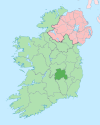
Townland in Leinster, Ireland
Ballyhuppahane Baile Shopacháin | |
|---|---|
Townland | |
| 53°05′29″N 7°27′03″W / 53.091428°N 7.450962°W / 53.091428; -7.450962 | |
| Country | Ireland |
| Province | Leinster |
| County | County Laois |
| Elevation | 205 m (673 ft) |
| Population (2001) | |
| • Urban | 54 |
| • Rural | 91 |
| Time zone | UTC+0 (WET) |
| • Summer (DST) | UTC-1 (IST (WEST)) |
| Irish Grid Reference | N3770105561 |
Ballyhuppahane, also spelt Ballyhuppahaun, (Irish: Baile Shopacháin)[1][2] is a townland in County Laois, Ireland.
Features
Ballyhuppahane is situated in the Slieve Bloom Mountains and there are a number of walks nearby.[citation needed] Most of the area is covered in forest. The trees were planted by local farmers on marginal land unsuitable for farming. The neighbourhood of Ballyhuppahane has some recreational areas such as the Cathole Falls.[3]
See also
References
External links
- Ordnance Survey of Ireland, maps of Ballyhuppahane
- v
- t
- e
Places in County Laois
Townlands
- Aghaboe
- Arless
- Ballacolla
- Ballaghmore
- Ballickmoyler
- Ballinakill
- Ballybrittas
- Ballybrophy
- Ballyfin
- Ballyhide
- Ballyhuppahane
- Ballyroan
- Barrowhouse
- Borris-in-Ossory
- Castletown
- Clonaghadoo
- Clonaslee
- Crettyard
- Cullohill
- Coolrain
- Donaghmore
- Durrow
- Emo
- Errill
- Jamestown
- Kilbricken
- Killenard
- Killeshin
- Middlemount
- New Inn
- Newtown
- Raheen
- Rathdowney
- Rosenallis
- Shanahoe
- Sletty
- Spink
- Stradbally
- The Swan
- Timahoe
- Vicarstown
- List of townlands in County Laois
- Category:Mountains and hills of County Laois
- Category:Rivers of County Laois
- Category:Geography of County Laois


