Arabsalim
Village in Nabatieh Governorate, Lebanon
Arabsalim عرب صاليم Aarab Salim | |
|---|---|
Village | |
 Arabsalim, 2008 | |
| 33°25′44″N 35°30′59″E / 33.42889°N 35.51639°E / 33.42889; 35.51639 | |
| Grid position | 129/165 L |
| Country |  Lebanon Lebanon |
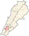
| Governorate | Nabatieh Governorate |
| District | Nabatieh District |
| Time zone | UTC+2 (EET) |
| • Summer (DST) | +3 |
Arabsalim (Arabic: عرب صاليم) is a populated area in Nabatiyeh District, in southern Lebanon.
Location
Arabsalim is located 87 km from Beirut, at an altitude of 700 meters above sea level[1]
History
The town’s name, which comes from the Phoenician language, also appears in Pharaonic records as Rab Salim or “the god of peace.” Found here is a shrine to the prophet Salim, which has important archeological significance.[2]
See also
- Mohamad Issa
References
External links
- Aarab Salim, Localiban
- v
- t
- e
 Nabatieh District, Nabatieh Governorate
- Nabatieh
villages
- Ansar
- Adchit
- Ain Boswar
- Ain Qana
- Aldawair
- Arab Saleem
- Arnoun
- Braiqeaa
- Charkiyeh
- Choukine
- Deir Ez Zahrani
- Doueir
- Ebba
- Habboûch
- Harouf
- Houmeen
- Jbaa
- Jarjouh
- Jebchit
- Kaoutariyet Al Siyad
- Kfar Remen
- Kfar Tebnit
- Kfar Fila
- Kfarjouz
- Kfar Sir
- Kfour
- Marwania
- Mayfadoun
- Nabatiyeh El Faouqa
- Nmairiyeh
- Qaaqaiyeh Ej Jisr
- Qsaibeh
- Schhour
- Sharqia
- Sir el Gharbiyeh
- Toul
- Yohmor
- Zawtar El Charkiyeh
- Zefta
- Zibdine


