Algerita, Texas
Unincorporated community in Texas, United States
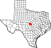
31°13′41″N 98°51′11″W / 31.22806°N 98.85306°W / 31.22806; -98.85306Algerita is an unincorporated community in San Saba County, in the U.S. state of Texas.[1] According to the Handbook of Texas, the community had a population of 48 in 2000.
History
Charles Cadwaleder Yarborough opened a general store and a post office near Richland Creek in 1885. It was located four miles north of the present location. It was named for the algerita shrubs in the area. The post office remained in operation until 1890. A railroad track was built by the Gulf, Colorado and Santa Fe Railway several miles from the town in 1907, thus Algerita moved to this area. Another post office was established here by Walter Thomas in 1914. The community began its decline when the railroad depot closed and was demolished since ranchers refused to open lanes for their cattle across their land. Its population was recorded as 20 in 1925 and increased to 60 in 1949. That year, it had a church and a combination store and gas station. The population dipped to 25 in 1952 then grew to 48 in 2000.[2]
Geography
Algerita stands on U.S. Route 190, 7.5 mi (12.1 km) west of San Saba in central San Saba County.[2]
Education
Algerita had its own school in 1949.[2] Today the community is served by the San Saba Independent School District.
References
- ^ a b U.S. Geological Survey Geographic Names Information System: Algerita, Texas
- ^ a b c Yancy, Karen. "Algerita, TX". tshaonline.org. Retrieved February 16, 2023.
- v
- t
- e
Municipalities and communities of San Saba County, Texas, United States
County seat: San Saba
communities
‡This populated place also has portions in an adjacent county or counties
- Texas portal
- United States portal


